Tucson Mountain Park was established April 1929. The Pima County Parks Commission, with C. B. Brown as its chairman, was established to oversee the park. At approximately 20,000 acres, the park is one of the largest natural resource areas owned and managed by a local government in the U.S.
The park has approximately 62 miles of non-motorized shared-use trials. The park’s trails are open to hikers, equestrians, and mountain bikers, and provide a wide range of outstanding experiences, including technical challenges, and breathtaking views.
Gates Pass overlook includes interpretive displays and historic structures. Picnicking and wildlife viewing opportunities are located throughout the park.Source: Pima County
During my two months as a member of the Tucson Hiking Meetup Group I led 15 hikes. In planning my last one I decided on another Beginner Hike in Tucson Mountain Park. While looking over the maps and adding up distances I settled on a "lollipop" hike on the east side of the Tucson Mountains near the opulent JW Marriott Starr Pass Resort & Spa
What is a "lollipop" hike? It is a hike which consists of a loop with an out-and-back spur. The loop is the sucker and the spur is the stick which is the handle. Get it?
The requirements for a beginner class hike with the Tucson Hiking Meetup Group requires it be under 5 miles in length and under 500' of elevation gain. In looking over the maps I could see if I combined the 36th street trail (the spur) along with the Starr Pass, Rock Wren and Yetman Trails (the sucker) I could stay within these guidelines.
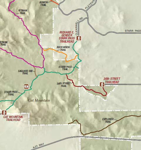
Detail from the Tucson Mountain Park map issued by the Pima County Parks and Recreation Department.
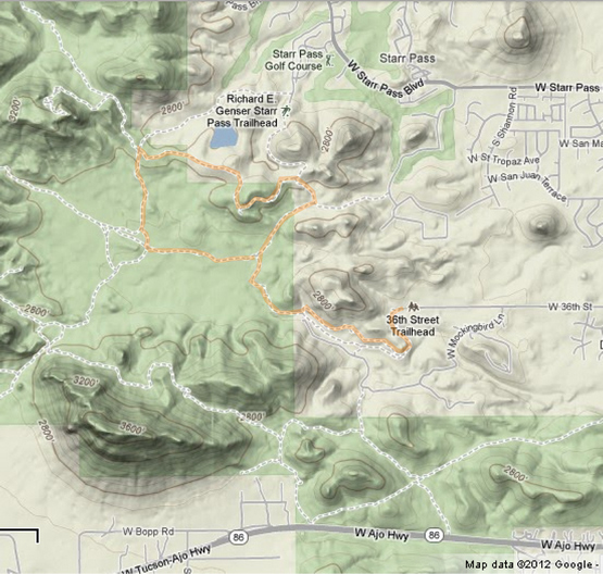
Google terrain map showing the route for the Lollipop Hike. Click for larger map.
Since I had not been on any of these trails before I though it prudent to scope them out before the hike. So, on Monday, January 28th I left Green Valley at around 7:00 in the morning and was on the trail by 8:00 or so.
The condition of the deserted 36th Street trail head made me a little nervous about just how safe this parking area would be. There was the bashed in remains of a formerly automated gate, broken beer bottles in the parking lot and surrounding area, missing and damaged signs as well as graffitti here and there. All I could do was hope for the best and so I donned my day pack and was on my way.
Click on the photos below for a larger image.
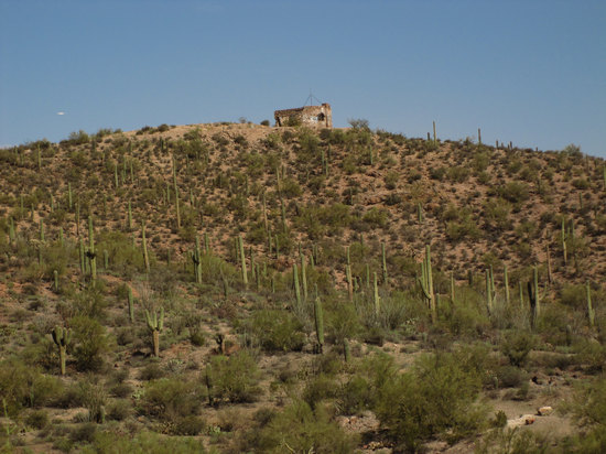
This old stone structure sits above the parking area. I meant to check it out but never got around to it.

Typical scenery in much of Tucson Mountain Park: Saguaro, Teddy Bear and Staghorn Cholla, Prickly Pear Cactus, Cat's Claw, Creosote Bush and Foothills Palo Verde. Gorgeous.
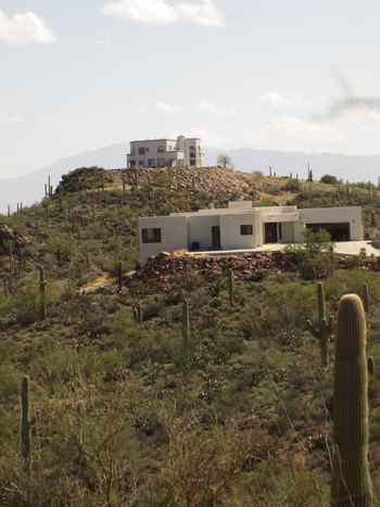
I passed several homes which were on the other side of the wash. The trail snaked along the wash about 75 feet above it.
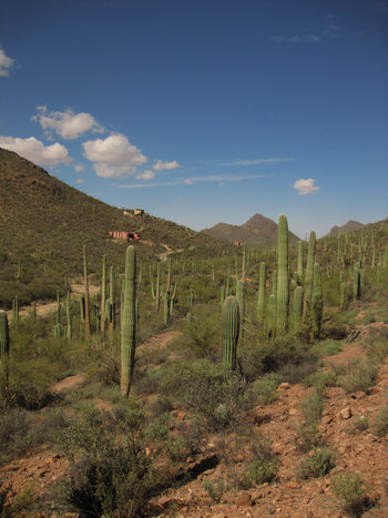
The trail made a turn to the right and the houses thinned out. These are the last two I would see on the hike. The white one at the top turned out to be a good landmark for navigating this hike.

Nice spot.
All was quiet except for the incessant barking of a dog from across the wash.

The gradually dropping trail followed the wash and it started to open up a bit.

Here the trail came right down to the wash and skirted it for a few feet before gently ascending back up the slope.

For about 300' feet the trail narrowed and tunnelled through some mesquite trees. It is at the point the trail right-of-way narrows as it passes through the tight corridor of Pima county property.

The trail continued it's ascent taking me through some closely spaced Saguaro which hugged the trail.
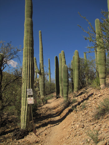
In several areas there was evidence of driven sections rail-road track with heavy cable run through them in an effort to prevent access by motorized vehicle. The problem seemed to have vaporized as I saw no sign of incursion and the posts and cables all had heavy vegetation growing around them.


Damn radicals!!
In the 1980s, an upsurge in public recognition of the recreational potential of BLM lands, especially in the Southwest, collided with a growing awareness that livestock were just about everywhere. Range management, which had been consistently ignored by the general public, began to be an issue of broader concern. Using rangelands for fun was a novel concept.
The BLM was not funded for recreation until 1965. But as hikers, bikers, and environmentalists penetrated the once-exclusive domain of ranchers, they didn't always like what they saw. Bare ground and cow pies inspired disgruntled comments on trailhead registers: "Get the cows out!" "Welcome to Cowpie National Monument!" and "I found some grass--put more cows in, quick!" Bumperstickers with slogans like " Stop Welfare Ranching" began to appear on out-of-state cars at BLM trailheads.
By the 1990s, contention was more abundant than forage on the western range. Droves of recreationists grew incensed that public lands were littered with feces and hoofprints. Environmentalists were fanning the flames of outrage at ecological abuse and economic subsidy. And ranchers circled their wagons in an understandably defensive stance.
Source: LAND HELD HOSTAGE: A History of Livestock and Politics by Thomas L. Fleischner, Ph.D.

Here, you must walk with care or you will find out first hand what hugging a Saguaro is like.

After climbing up and out of the wash the terrain opened up and flattened out.
That cholla on the right is about 10 feet tall. Fine specimen.

There were also a few barrel cactus scattered about. Unfortunately I did not get a photo of the "fattest" barrel cactus I have yet to see.

The trail then went back down into the wash and climbed back out. Here you can see the use of caged stones for trail stabilization.

Or, were they trying to prevent 4WD trucks and other ORV vehicle from climbing out of the wash?

I have seen several of these old weather beaten signs. And, thankfully, no trail litter.
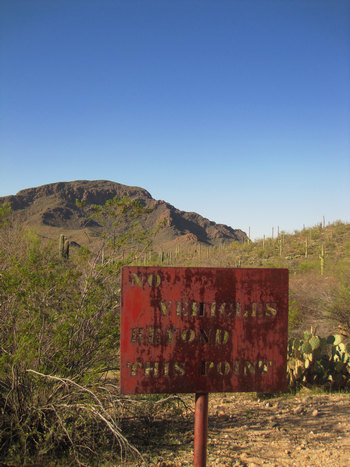
Nothing like a plate steel sign to foil the sign shooters.

Just past the bullet-proof sign was this torn down gate. Yet another attempt to keep cattle from wandering in. All of Arizona is free range so cattle are to be found everywhere.
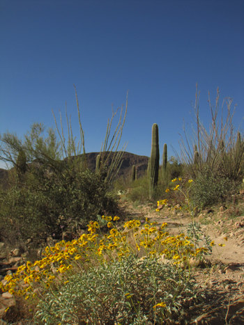
There were some nice displays of Brittle Bush (Encelia farinosa) in full bloom.
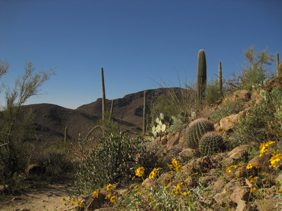
A lovely Sonoran garden.
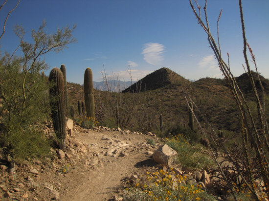
This is looking to the east, towards Tucson. Unfortunately from this vantage point I could hear the drone of the not to distant Interstate 10.
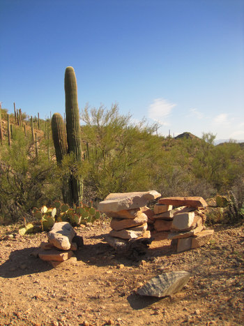
Surprise! Barney Rubble was here and built us a nice picnic table and seats.
It is
located about mid-way on the Rock Wren Trail.
Thanks, Barney!
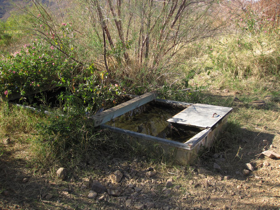
This wildlife watering tank made use of a spring. Why anyone would think the indigenous wildlife would need any help in finding water is beyond me. Foolish humans!
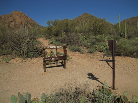
Here we are at the intersection of the Rock Wren and Yetman Trail. As you can seen the sign has been vandalized and is a little the worse for wear.
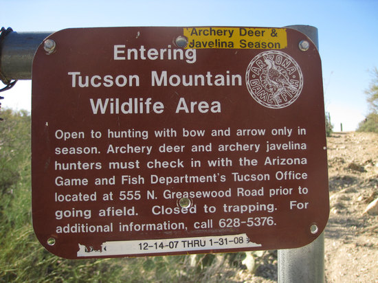
This sign was near the above mentioned trail intersection.
For those of you who many not be familiar with "Javelinas", here is the scoop.
A peccary (plural peccaries; also javelina and skunk pig; Portuguese javali and Spanish jabalí, sajino or pecarí) is a medium-sized mammal of the family Tayassuidae, or New World Pigs. Peccaries are members of the artiodactyl suborder Suina, as are the pig family (Suidae) and possibly the hippopotamus family (Hippopotamidae). They are found in the southwestern area of North America and throughout Central and South America. Peccaries usually measure between 90 and 130 centimetres (3.0 and 4.3 ft) in length, and a full-grown adult usually weighs between about 20 to 40 kilograms (44 to 88 lb).
People often confuse peccaries, which are found in the Americas, with the pig family that originated in Afro-Eurasia, especially since some domestic pigs brought by European settlers have escaped over the years and now run wild as razorback hogs in many parts of the United States.
Source: WikiPedia
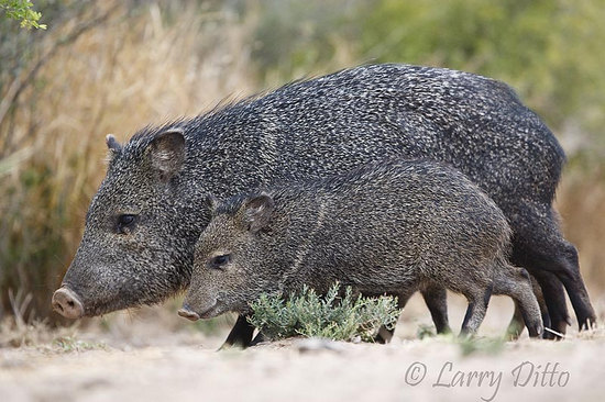
Above Collared Peccary photo © Larry Ditto. Used with permission
In the Southwest it is the Collared Peccary which has made the area it's home. Like the wily coyote the Javelina has adapted nicely to being around humans and it is not uncommon to see them in the urban areas of Tucson and Phoenix as well as out in the countryside.
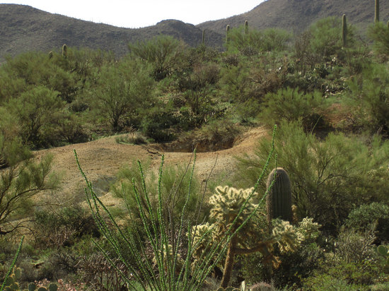
Tucson Mountain Park, like most of the surrounding area, is peppered with these exploratory diggings by mineral prospectors of days gone by..
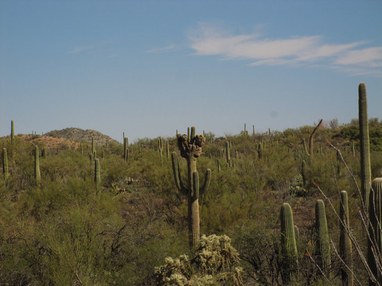
These weird, often bizarre crested forms of Saguaro can been seen just about everywhere - if you are lucky.
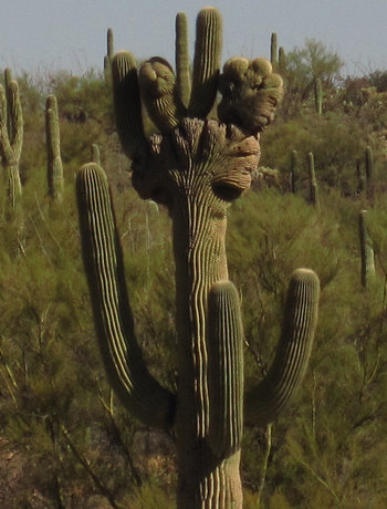
This was cropped from the above photo.
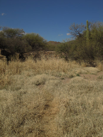
This old dam built by the CCC has long since been filled in.
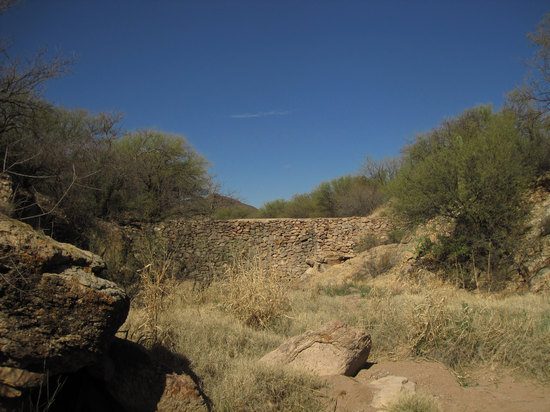
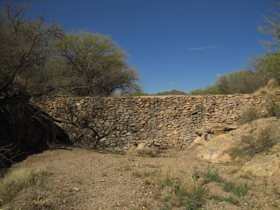
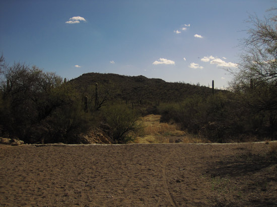
This is the view from the top of the dam. Now, it no longer holds back water but I'll bet it makes a nice waterfall during the Summer monsoons.
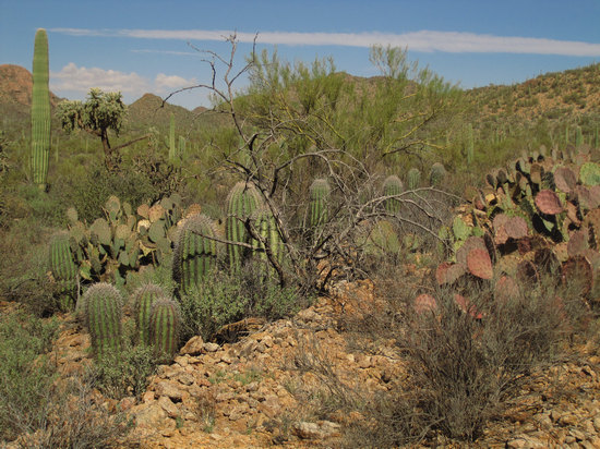
What a delightful little Saguaro nursery! I counted 16 just in this small area. Nice to see regeneration like this.
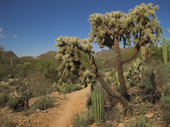
This little fella is getting what shade he can from this old Teddy Bear Cholla.
Okay, here comes the "X 2" part. Below are some photos I took two days later on the actual hike. This was to be my last hike for the Tucson Hiking Meetup Group. There was quite a crowd - 29 people showed up!
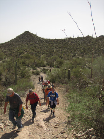
This is less than half the group making their way up one of the only two steep pitches on the hike.
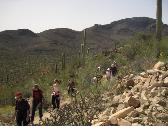
Looking down from the upper section of one of the switchbacks.
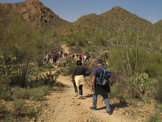
This is at the intersection of the Cactus Wren and Yetman Trail.
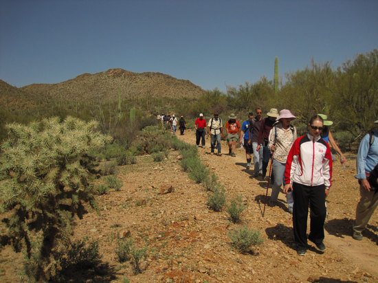
That's quite a train!
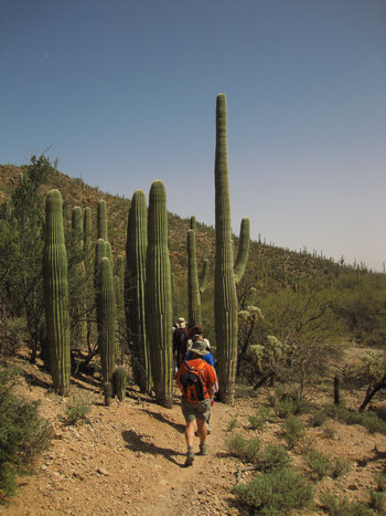
The Saguaro Squeeze Through.
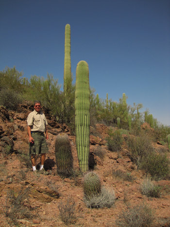
My buddy Roger from Minnesota. You can see Rogers photos of the hike here.
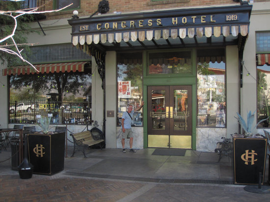
Afterwards the hike, Jim and I went to the Hotel Congress for a bite to eat.
Jim is a long time resident of Tucson and somewhat of a foodie. He had all kinds of suggestions for good places to eat.

We both felt we should order something healthy.
But our carnal desires got the best of us!


Short on the fish and heavy on the chips. But, both were well prepared, presented and TASTY!!
'Till next time...