Tucson Mountain Park was established April 1929. The Pima County Parks Commission, with C. B. Brown as its chairman, was established to oversee the park. At approximately 20,000 acres, the park is one of the largest natural resource areas owned and managed by a local government in the U.S.
The park has approximately 62 miles of non-motorized shared-use trials. The park’s trails are open to hikers, equestrians, and mountain bikers, and provide a wide range of outstanding experiences, including technical challenges, and breathtaking views.
Gates Pass overlook includes interpretive displays and historic structures. Picnicking and wildlife viewing opportunities are located throughout the park.Source: Pima County

View Larger Map Brown Mt: Lower Left
20,000 acres and 62 miles of non-motorized trails! That is one amazing county park. And for some icing on the cake it is directly adjacent to the Tucson Mountain District of Saguaro National Park which encompasses another 33,000 acres of land with another 50 + miles of trail. And all of this is just 15 miles from the Tucson city center.
What a groovy place to be a SnowBird!
I first became acquainted with Tucson Mountain Park on an exploratory hike in January of 2012. I was scouting Beginner hikes to lead for the Tucson Hiking MeetUp group. After looking over the Green Trails map for the Eastern and Western units of Saguaro National Park and Tucson Mountain County Park I spotted what looked like a loop which would fit the criteria for a beginner hike - under 5 miles and under 500' of elevation gain. To make this 4.8 mile loop I combined the Golden Gate, Prospector and Ironwood Trails.
I started this loop at the end of the Ironwood picnic area next to an ancient tree that could be 200 years old judging from its DBH.
The Ancient Ironwood Tree at Ironwood picnic area
Tucson Mt Park
The trail map for this area stated there were "many" trails in the area. They aren't kidding! I no sooner left the picnic area before I was "lost". There were numerous trail intersections which were not on the map and they went every which way. It would appear many years of equestrian and Mt Bike use have established what is a maze of criss-crossing social trails. So, before I knew it I was quite a ways off my chosen path and looking for the right way to go. Well, to make a long story short I was able to navigate my way using landmarks such as Golden Gate Mountain and Tower Peak and complete the 4.8 mile loop. And, in doing so I hiked through the most gorgeous desert I had yet seen or have seen since. The towering Saguaros, and an Enchanted Cholla Forest kept me spell bound and it is a place I have come back regularly during the past 3 months. Some with my Betsy and sometime with groups from the Tucson MeetUp - every time as enjoyable as the last.
But wait! This report in not about that hike at all! Indeed, it is in the same neck of the woods, but not the same trail. Instead, we will visit Brown Mountain, just down the road from the loop mentioned above.
Click on the photos below for a larger image.

After scoping out the maps and checking my figures several times, I posted the " Beginner Hike: Tucson Mt Prk - Brown Mountain Loop" on the Tucson Hiking MeetUp site. It was a short notice hike and the RSVP went up and down and settled out at the 3+me.
Those 3 were Jim, Krista and Dave. All 3 arrived at the appointed time and soon we were crossing the desert, dipping down, through and up a wash and then onto the trail which ascended to the summit of Brown Mt. Brown Mountain is named for the first administrator of Tucson Mountain Park, Cornelius Brown

My three companions (L-R) Dave, Krista and Jim. Dave had taken a long vacation from hiking and this was a trial run for him to get back into it. Way to go Dave!

I like this picture better 'cause Krista's face is obscured.

Like most all of the trails I have been on out here, this one was well layed out and constructed. The yellow flowering plant is Brittle Bush (Encelia farinosa). We saw lots of it.

This is looking east. The peak on the right is Golden Gate Mt. To its left is Gates Pass Road which, if followed east turns into Speedway Blvd which goes into Tucson proper. The stick-like shrub which frames the right side of this photo is Ocotillo (Fouquieria splendens). The leaves are just starting to emerge as are the terminal flower spikes.

Looking east towards the Tucson Mountains. In the center of the basin you can see a white spot which is our van, parked in the Brown Mountain Picnic area.

This is looking to the South East towards what mountain ranges? Maybe they are the Sierratas, Las Guijas, Santa Rita, Tumacacori, mountains. I am just not sure. Here is why.
Pima County Mountain Ranges
Agua Dulce Mountains
Ajo Range
Alvarez Mountains
Artesa Mountains
Baboquivari Mountains
Batamote Mountains
Bates Mountains
Brownell Mountains
Castle Mountains
Cerro Colorado Mountains
Cimarron Mountains
Coyote Mountains
Crooked Mountains
Diablo Mountains
Empire Mountains
Gakolik Mountains
Granite Mountains
Growler Mountains
John the Baptist Mountains
La Lesna Mountains
Las Guijas Mountains
Little Ajo Mountains
Mesquite Mountains
North Comobabi Mountains
Pozo Redondo Mountains
Pozo Verde Mountains
Puerto Blanco Mountains
Quijotoa Mountains
Quinlan Mountains
Rincon Mountains
Roskruge Mountains
San Luis Mountains
Santa Catalina Mountains
Santa Rosa Mountains
Sauceda Mountains
Sheridan Mountains
Sierra Blanca Mountains
Sierra de Santa Rosa
Sierrita Mountains
Sikort Chuapo Mountains
Silver Bell Mountains
Sonoyta Mountains
South Comobabi Mountains
Tucson Mountains
Waterman Mountains
West Silver Bell Mountains
Sierra de la Nariz
Casa Grande Mountains
Dripping Spring Mountains
Palo Verde Mountains
Picacho Mountains
Sacaton Mountains
Santan Mountains
Sawtooth Mountains
Silver Reef Mountains
Slate Mountains
Suizo Mountains
Superstition Mountains
Table Top Mountains
Tat Momoli Mountains
Tortilla Mountains
Tortolita Mountains
Vekol Mountains

Santa Cruz County Mountain Ranges
Santa Rita County
Atascosa Mountains
Mustang Mountains
Pajarito Mountains
Patagonia Mountains
San Cayetano Mountains
Santa Rita Mountains
Tumacacori Mountains
Now, of course many of the ranges listed above are way out of the area that I am in today, east-central Pima County. And, Pima County extends way out to the west to Ajo. And it covers 9,188.83 sq mi!
But it will give you some insight as to why I am not always sure what I am looking at. However, slowly but surely I am finding my way around.
OK! Back to the Trail

Continuing on up the south side of the mountain we passed all manner of interesting shaped Saguaros.

Just another shot to show off the Brittle Bush and mature Saguaros.

We are now on top - not on top of the summit, but close to it. This lesser peak gave us some flat walking and fabulous views.

From here we crossed a small saddle and started the climb up the main peak of Brown Mountain. The buildings which can be seen in the distance are those of the internationally famous Arizona-Sonora Desert Museum.

We saw lots of young Saguaros on our way across the saddle. Note that a 10' tall Saguaro may be 40 to 50 years old. So the term "young" is relative.

I love these winding paths!

Leaving the saddle we started to climb up the summit. Love these steps. Sure make the footing easier.

This was shot from the other side of a sharp switchback in the trail.

Looking east towards the Tucson Mountains
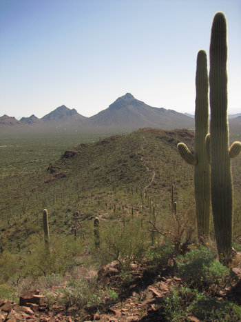
Looking back towards Golden Gate Mountain and the saddle we just crossed.
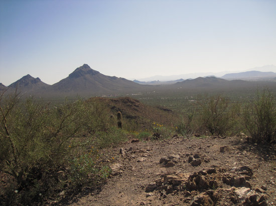
Golden Gate Mountain and Gates Pass to the west. Gilbert Ray Campground is barely discernible, center - right.
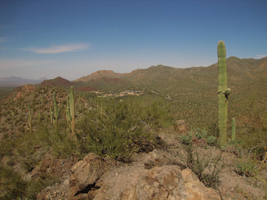
The view from the Summit:Arizona-Sonora Desert Museum and mountains, mountains and more mountains. Amazing.
The reddish rock which is left of center speaks of the volcanic origins of the Tucson Mountains. Apparently geologists have found this area so geologically complex it is referred to by the formal name "Tucson Mountains Chaos".
"Tucson Mountain Chaos is a formal geologic name, describing one of the more confusing, complex, and controversial areas in southern Arizona." So says the newsletter of theArizona Geological Society.
If you drive over Gates Pass and look closely at the road cuts, you will see a jumble of various-colored rocks. Within the beds of volcanic ash are big chunks of other volcanics, limestones, granites, and schists. The mountain range appears to be composed of a mega-breccia.
The origin of the Tucson Mountains is still subject to geologic debate. The following is what I think is the most probable chain of events. Like many stories in the very complex structural geology of the Western U.S., even the probable may seem fantastic.
Source:TucsonCitizen.com
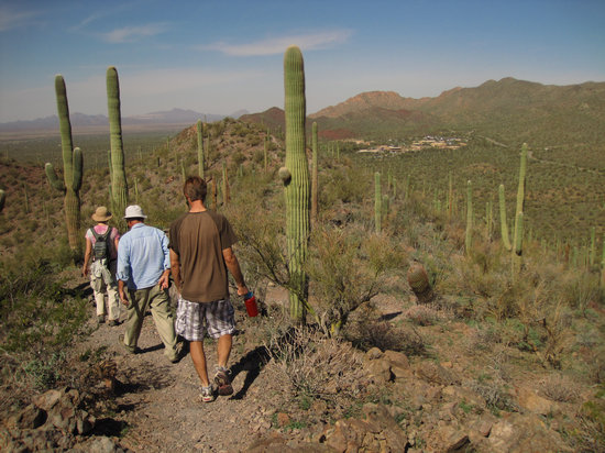
Here we go: down, down, down the mountain to our lunch spot.

The Teddy Bear Chollas are looking pretty nice all lit up by the sun.
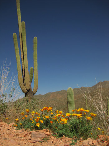
The early spring here is pushing up the poppies everywhere.


What intense color. These are Arizona Poppies (Kallstroemia grandiflora). When in season, after a warm, wet winter they bloom by the tens of millions.
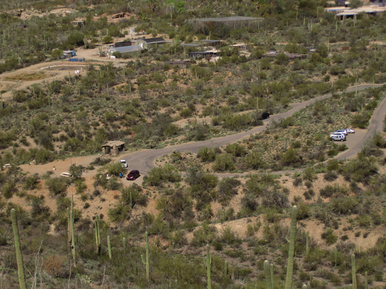
Birds-eye view of the aviary at the Arizona-Sonora Desert Museum and the Juan Santa Cruz picnic area.
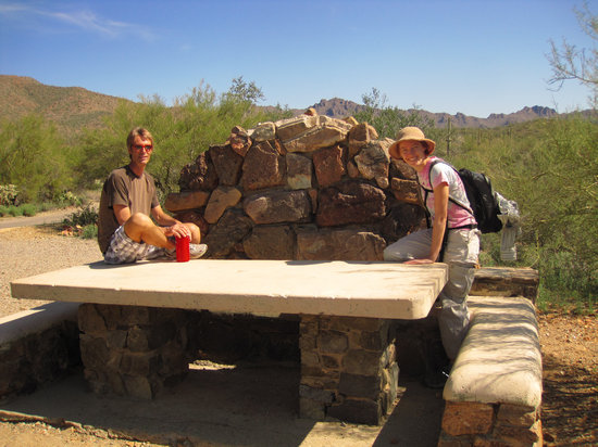
Heavy duty picnic table and a stone wind break - not bad!
After lunch we took the lower trail which wanders along the base of Brown Mount. This section is a mostly flat desert meander.

A look inside a Saguaro which lost one of it arms.

The skeleton of a Saguaro is comprised of strong, woody ribs which support the tons (as much as 6) of water and tissue. But sometimes a bloated saguaro's arm becomes too heavy after a rainstorm and the following high winds can rip the arm right off.
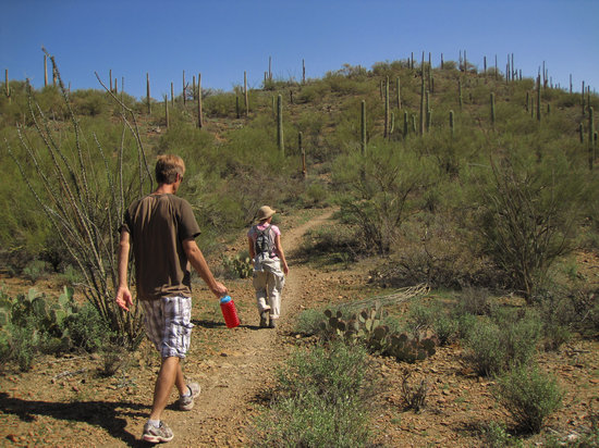
Thing are starting to green up now that spring is just around the corner.
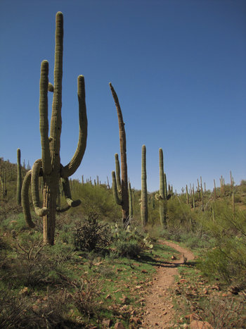
I have heard two explanations as to why a Saguaro may have sagging arms. One is the result of severe freeze which damages the supporting structure and surrounding tissue. If the damage is sever, decomposition spreads into the healthy tissue and destroys it, turning the rotten tissue into a black gelatinous mess that oozes out and runs down the exterior of the cactus. Saguaros can live from a few months to many years after the fatally damaging frost.
Another explanation I have heard is the weakening of the support structure which occurs when woodpecker cavities are excavated in the "armpits" for nesting sites.
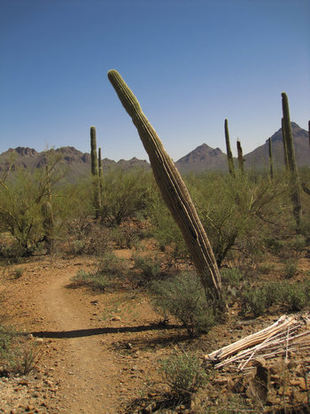
There are more and more "leaners" starting to show up. When this happens, they are goners. Also, I have seen many Saguaros with brown skin which looks like dead tissue. Supposedly this can be from disease and/or freezing. No one really seems to know for sure.
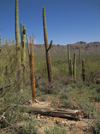
Saguaro skeletons in the foreground and a browned one on the left. This does not look good for the Saguaro.

A more recent, dead standing Saguaro on the right and a brown skinned on the left.
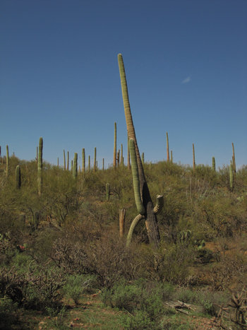
Another "leaner". Note the nearly black skin on the lower portion of the stem.
As you can see, Saguaros have lots of things that can cause problems.
Parasitic Diseases
Fungi
Phymatotrichopsis Root Rot
Phytophthora Diseases
Pythium Diseases
Rhizoctonia Diseases
Verticillium And Fusarium Wilts
Powdery Mildew
Rust Diseases
Cytospora Canker
Sooty Canker
Wood Rots And Decays
Ganoderma Root Rot

Bacteria
Crown Gall
Oleander Gall
Fire Blight
Bacterial Necrosis Of Saguaro
Wetwood Or Slime Flux
Nematodes
Root-Knot Nematodes
Mistletoes

Nonparasitic Diseases
Aleppo Pine Blight
Scorch
Arizona Ash Decline
Mulberry Tree Decline
Oleander Decline
Salt Problems
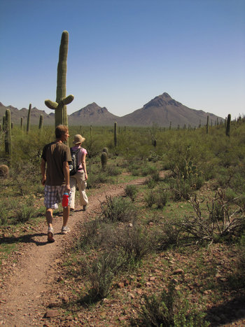
The terrain is nearly flat now.
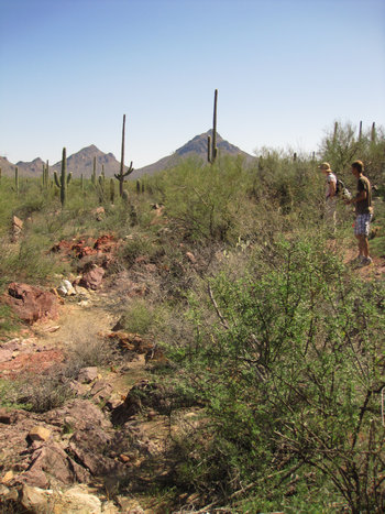
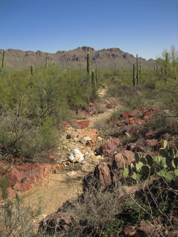
We came upon this small ravine cut into the rock. I am not used to seeing a cut like this in the rocks. Usually it is a wash with soil and gravel side walls.
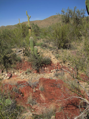
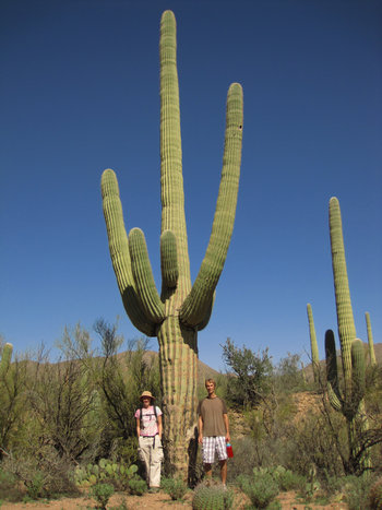
Now, that is a big Saguaro!
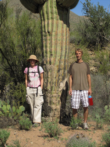
I wonder how many tons this baby weighs.
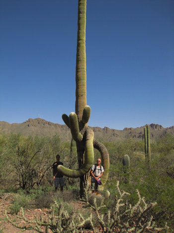
Another one with strangely twisted and drooping arms. These forms are great for being able to see the flowers which are born on the ends of the arms.

Confusion Junction!
It was interesting when we arrived at this point. None of us, of course, remembered exactly where we were. Then Jim and Krista decided we must have missed our spur to the picnic area and were now at the point where we started. They were right! And soon we were back at the picnic area and talking about a snack.
Great hike.
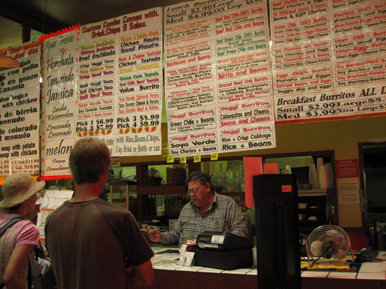
That's what I call a wide selection!
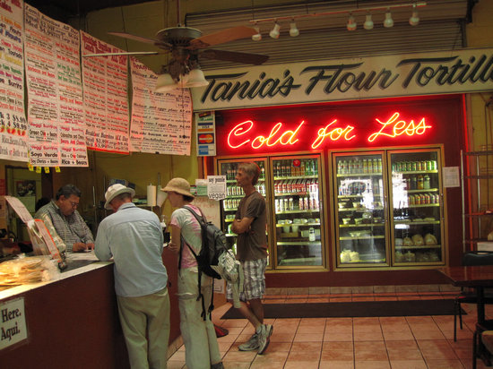
This is " Tanias 33" at 614 N Grande Ave between Speedway and St Marys. Dave and Jim had both been here before so we decided to try it out.
We each ordered a burrito and also a coupla cheese crisps. The latter was by accident - we only meant to order one. But, the second one did not go to waste, you can be sure of that.

I ordered the birria burrito with chopped cilantro, cabbage and onions. But I had them plate it rather than wrap it. Very tasty.
Birria(pronounced bírria, accented on the first syllable) is a spicy Mexican meat stew usually made with goat, lamb, or mutton, often served during festive periods, such as Christmas, New Year's Eve, Mother's Day, and weddings. Originally from Jalisco, it is a common dish in some Mexican food establishments. It is served with corn tortillas, onion, cilantro, and lime. There are variations using beef as well.
Birria is made using a base of dried roasted peppers. This gives birria both its characteristic savoriness as well as its variety, as different cooks choose different peppers to use for the broth base. Birria is served by combining a bowl of broth with freshly chopped roasted meat. One method of presentation for the diner to fill a corn tortilla with meat, onions and cilantro, seasoning with fresh squeezed lime juice, then dip it into the broth before eating it. The broth itself may be eaten with a spoon or by drinking from the bowl.
Source: WikiPedia

Chow time!

The 3 Amigos.
As we were walking back to our vehicles I said "Today was a good day" to my companions. They all concurred.
'Till next time...