Monday: January 17th and Tuesday: January 18th
In addition to the predictably warm and sunny weather during the winter months, the GV/Tucson area also has some of the most spectacular desert and canyon hiking in the West.
This is one more reason to leave the dreary East behind when December rolls around and there is day after day of oppressively dark and dismal weather.
For our first hike we decided on nearby Madera Canyon in the Coronado National Forest on the west side of the Santa Rita Mountains. I had been there at least once before and had hiked the Super Trail with my brother William.
Click on the photos below for a larger image.
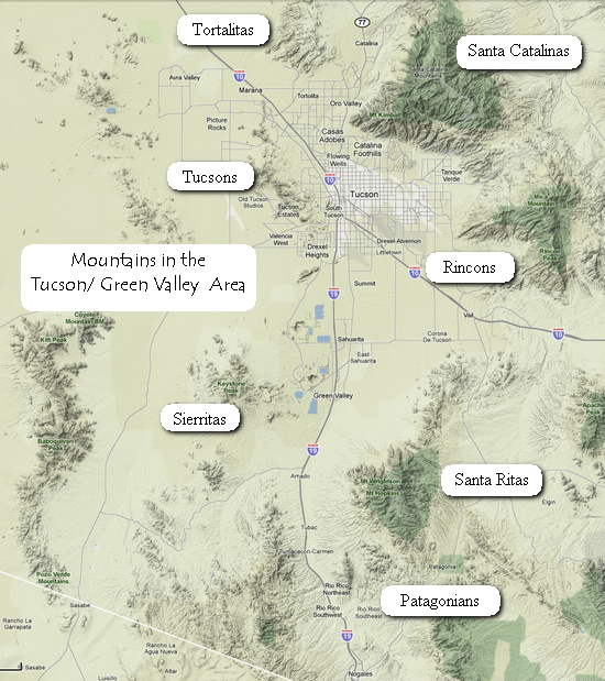
Source: © Google Maps
An overview of mountain ranges in the Tucson/Green Valley area.

When we arrived at the parking area for the trail heads, we were surprised to see so many vehicles on a Monday morning. Later we realized it was MLK day and a lot of people were out making good use of the holiday.
I barely recognized the place. Not only had it been at least 15 years since I was last here, there had been a lot of improvements made: new pavement, parking areas, signage, maps, rest rooms, etc.
Pursuant to its goal of milking money out of tax payers there is also a 5 dollar parking fee. ("F*CK you! I paid my taxes!!")
Just beyond the bear proof trash cans and the information board is the trail which leads to several popular hikes. The parking area is at an elevation of 5500' and yes, that is snow on the sides of the mountain.
Madera Canyon makes a large dent in the northwest face of the Santa Rita Mountains. Its higher elevation grants relief to desert dwellers during the hot months and allows access to snow during the winter.
A world-renowned location for bird watching, Madera Canyon is a major resting place for migrating species, while the extensive trail system of the Santa Rita Mountains is easily accessed from the Canyon's campground and picnic areas.
The Coronado National Forest covers 1,780,000 acres of southeastern Arizona and southwestern New Mexico. Elevations range from 3000 feet to 10,720 feet in twelve widely scattered mountain ranges or "sky islands" that rise dramatically from the desert floor, supporting plant communities as biologically diverse as those encountered on a trip from Mexico to Canada.
Views are spectacular from these mountains, and visitors may experience all four seasons during a single day's journey, wandering through the desert among giant saguaro cactus and colorful wild flowers in the morning, enjoying lunch beside a mountain stream, and playing in the snow later in the afternoon.
The sky islands of the Coronado National Forest are unique and surprising, offering year-round recreation opportunities.
Source: Coronado National Forest

This was taken about 5 minutes from the parking area. Green Valley is in the distance. Just past this point we came to a trail intersection and decided on the Vault Mine Trail.
There are three main ways to approach this scenic area, the most direct and most demanding of which is via the Very Steep/Vault Mine Trail out of Roundup Picnic Area at the end of Madera Canyon Road. This trail earned its descriptive name from the fact that it climbs 1,400 feet in a distance of a little over one half mile. This heart thumping climb leads from upper Madera Canyon to the vicinity of Agua Caliente Saddle, where that trail branches off toward Josephine Saddle and a number of other trails that crisscross the upper slopes of the Santa Ritas. USFS: Coronado National Forest

This is Alligator Juniper (Juniperus deppeana). I first remember seeing this tree on a hike to the summit of Guadalupe peak. The ones I saw in the 'Lupes were much smaller than this and I did not realize they grew to be such large trees.

The way cool bark reflects its common name.
The bark is usually very distinctive, unlike other junipers, hard, dark gray-brown, cracked into small square plates superficially resembling Alligator skin; it is however sometimes like other junipers, with stringy vertical fissuring. - WikiPedia

One of many nice views we had on our hike.

We finally ran into some snow. It was not much, but what was left seemed to always be on the steepest part of the trail. The footing was treacherous at times because many of these sections were snow on top of ice with loose rocks underneath that.

Another great view!

This Arizona Madrone (Arbutus arizonica) had branches hanging out over the trail. Note all the reddish/orange fruits.

This section of the trail was covered with Madrone fruits.
Note my foot gear. I have foot skins for cold weather but did not bring them on this hike. This made for some frosty feet when walking through the sloppy snow and ice.
We found the hiking very challenging. The combination of a 5500' elevation starting point, the very steep trail and the elevation gain of nearly 2000' made it slow going for us. We took many breaks to catch our breath as we huffed and puffed our way up the trail. We had hoped to make it to the end of the trail but instead had lunch at the Josephine Saddle juncture and then headed back down the trail.
Negotiating the snow covered sections of the trail on the way down proved a bit tricky and we had to be very careful not to slip, stumble or fall.

This is Mount Baldy which we saw on our way back down the trail.

These ferns (Woodsia sp?) were uncurled slightly as they took up moisture from the melting snow.
On Tuesday the 18th we decided to drive up to Tucson to run errands and go hiking in Ventana Canyon in the Santa Catalina Mountains.
We started out with a stop at Food City 719 E. Fort Lowell Rd in search of Betsy's favorite hot sauce - La Guacamaya with lime juice.
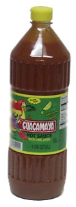
I first became acquainted with this hot sauce in 2005. I was staying with my brother William about 5 blocks away and bought the La Guacamaya along with several others to take home as souvenirs of my trip.
Betsy loved the "Guac" and declared it her favorite. Within 2 years (?) the 33 oz bottle was empty. Since then I have looked high and low for it. I have scoured countless Hispanic markets in San Francisco, Nashville and anywhere else I went, all to no avail. I finally found it on the web site of www.mexgrocer.com. They have offered it for years, but it has always been listed as "Out of Stock".
So, now we were at the source and I went directly to the salsa section. YIKES!! No La Guacamaya!!
But wait, what is that one lonely bottle on the bottom shelf? Eureka! We have found it - but only one bottle. We finally tracked down the store manager who looked several other places for it but then declared out bottle of La Guacamaya as the last one in the store. He said the next shipment would not be until Thursday, after we would be out of town.
Oh well, Betsy would just have to make this one precious bottle last until we could find more.
Bottle in hand we hopped back in the van and headed over to Bookman's, a Tucson institution for used books. Now, however they are billing themselves as "Bookman's Entertainment Exchange".
I was hoping to find some used Tucson area hiking guides for Bruce. But there was not one single volume to be found. Apparently the demand is bigger than the supply.
Then it was westward over to The Ventana Canyon hiking trail.
Using the Tucson city map I had marked up, Betsy helped me navigate our way to the trailhead parking area.

This is looking up the canyon from near the start of the trail. As you can see, it was another gorgeous, sunny day.

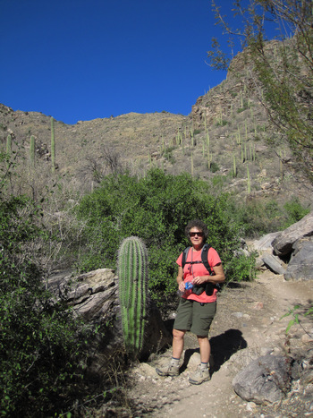
I remembered this big Saguaro well, as I had taken my own photo next to it in 2005.
I estimate this beauty to be about 25' tall which would make it over 100 years old.

This is a very popular trail with the destination for most hikers being the "Maiden Pools" which are 2.4 miles from the trailhead.

Here Betsy tries to get a bird in the glasses for an ID. But, that can be tricky when the field guide is sitting at home some 2000 miles away!

There are countless Saguaro all through the canyon, many growing out of cracks in the rocks.
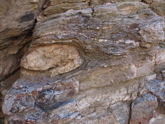
It would have been handy to have had a geologist with us as I had no clues as to how this boulder ended up like this. Bizarre!
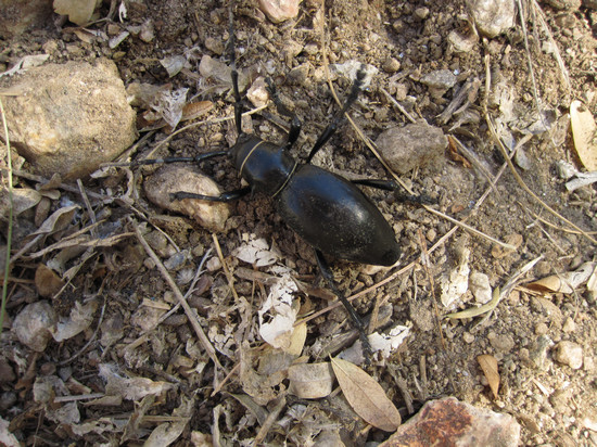
I spotted this critter crossing the trail. It was about the size of a quarter. I had no luck identifying it. If you know what it is, please let me know.
Unfortunately, we ran out of time and had to return after about 2 miles up the Canyon. So, we missed skinny dippin' in the pools. Next time we will not be on a schedule!
The baby Saguaro is probably around 25 years old. They grow slowly, but have long lives.
After we departed the canyon we drove east over to our next two stops - Trader Joes and AAA. We found both places without any problems.
On our way back over to I-10 via West Orange Grove road, we narrowly missed getting rear-ended at a stop light. Unfortunately the poor guy behind us got the full force of it.
Back on the interstate we headed back to Bruce and Mia'a for another nice dinner and relaxing evening.
Next installment: Heading west to Organ Pipe Cactus National Monument
'Till then... Adios!
~ Mike and Betsy