Day 6: Tuesday - October 12th
I rose at 6:00 with web work until 11:30 then hunger forced me out of the house in search of sustenance. I wanted only a snack and I thought I knew where to go. Just around the corner near 12th and Irving is " Peasant Pies". Ed had pointed out this place on my first weekend here and I had it in the back of my mind to go there since then.
Click on the photos below for a larger image.

Peasant Pies has three stores in San Fran and seems to have filled a niche here.

A couple of interior shots of the Peasant Pies location on Irving Street.


Wall art showing how to make a wholesome, cholesterol free pie.

The menu lists 10 types of savory pies and 6 types of sweet pies.

I ordered the Curried Potato. It was spicy good! I liked the whole wheat crust.

Very tasty considering they use no butter. And the Curried Potato is cholesterol free.

Fresh out of the oven.

The origin of Peasant Pies can be traced to Sète, an old port city in the South of France. Small savory pies are a specialty of the region, purchased as snacks by local fishermen who appreciate their low cost and eat-anywhere appeal.
Inspired by this regional favorite, Cordon Bleu-trained chef Gérard Buulong and partner Ali Keshavarz founded Peasant Pies, bringing the authentic flavors of Southern France to the Bay Area.
Source: PeasantPies.com

Nutritional info posted at the front door.
My hunger sated it was back to Ed's and finishing up my report then back out the door at 12:30 and into the bright warm sunshine.

I took the N Judah inbound to Cole and Carl street then headed up the hill with the idea of getting some good views of The City on this clear day.

The people watching is always interesting - both on and off MUNI.

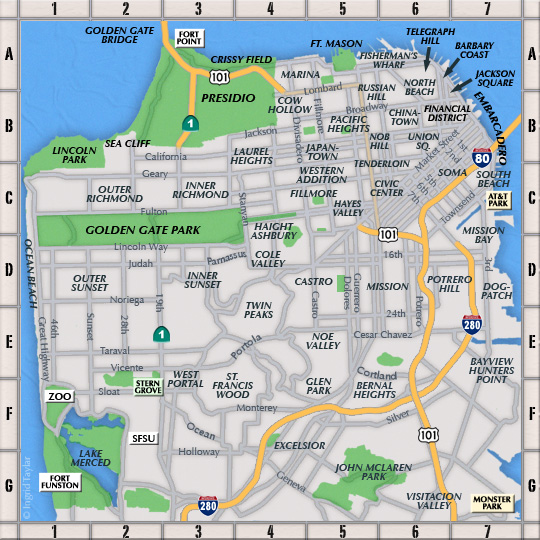
Google terrain map for the area of my walk.
I walked up Cole and then turned left on to Carmel then right on to Twin Peaks Blvd. Soon I saw the familiar steep timber steps which climb up to Tank Hill Park.

The view of downtown San Francisco from Tank Hill. On the left can be seen the TransAmerica Pyramid and on the far right the Rincon Tower at the end of the Bay Bridge sticks up like a high rise erection.
Why is it called "Tank Hill"?
When you get to the top of the steps there is a circular concrete pad which supported the Clarendon Heights water tank built in 1894. The tank was used to store drinking water pumped from Laguna Honda. The tank was removed in the late 50s and the site came close to being yet another precariously perched house with a million dollar view. But, the neighborhood lobbied City Hall and it was purchased in 1977 as part of the city's new Open Space Program.

Looking north towards Muir Beach and Bolinas Bay. The Harmon Tower of the de young Museum can be seen in the center of this photo.

This view looks off to the southeast. The bald knob in the foreground is Kite Hill Open Space which is accessed via Yukon near 19th Street.
In the distance can be seen Bernal Heights Park and to the far right is Bayview Park which is adjacent to Candlestick Park. Both these parks are on my "to do" list for this trip.

When I descended back down to Twin Peaks Blvd from Tank Hill I continued my ascent and was treated to spectacular and constantly changing views of The City. Shown here is Corona Heights Park, one of my favorite places to take in still more views.

Another look at Corona Heights and downtown SF and the Oakland Hills in the distance.

I climbed up to Twin Peaks and the views kept changing and expanding. The walker in the photo and I crossed paths again on the summit. Turns out he was from Portland, Maine. He was here with his wife who was at a conference. They were staying in a downtown motel and he was out for a walk. He had just come from exploring the Mission and had seen the summits of Twin Peaks. He said he had no idea how to get to them but just kept following streets which went up.
He asked me to take a picture of him from the summit and we talked for a while about some cool places to see while in the city.

On a clear day you can see a loooong ways from Twin Peaks. And although it was a bit hazy I still got some half decent shots. This one shows the waterfront and downtown area of Oakland with Mt. Diablo in the background.
Talk about views:
From the summit (of Mt Diablo) on a clear day the Sierra Nevada range is plainly visible; the southernmost mountain of the volcanic Cascade Range, Mount Lassen, might barely be visible 181 miles (291 km) away. Owing to the Earth's curvature it is not possible to see the larger Mount Shasta, although Half Dome in Yosemite National Park, about 125 miles (201 km) to the east, can be viewed with a telescope when the atmosphere is exceptionally clear. Historic claims that the mountain's view shed is the largest in the world—or second largest after Mount Kilimanjaro—are unfounded. It is however, one of the largest view sheds in the Western United States.
Source: WikiPedia

A hair-pin turn on Twin Peaks Blvd is contrasted with the straight-as-an-arrow section of Market Street seen here.

Just I was leaving the overlook area to walk to the south summit a tour bus arrived and suddenly there was a crowd.

Here is a good look at the eastern end of Golden Gate Park, the Panhandle and Buena Vista Park.

There are now regular coyote sightings at the hill parks.


Heading back down the hill towards the Castro I spotted this house. A Mountaineer fan perhaps?

At Corbett and 17th this plaque is set adjacent to a Coast Redwood tree.
Harvey Bernard Milk (May 22, 1930 – November 27, 1978) was an American politician who became the first openly gay man to be elected to public office in California, when he won a seat on the San Francisco Board of Supervisors.
Milk served 11 months in office and was responsible for passing a stringent gay rights ordinance for the city. On November 27, 1978, Milk and Mayor George Moscone were assassinated by Dan White, another city supervisor who had recently resigned but wanted his job back.
White's defense attorney, Doug Schmidt, argued that he was not responsible for his actions, using the legal defense known as diminished capacity: "Good people, fine people, with fine backgrounds, simply don't kill people in cold blood." Schmidt tried to prove that White's anguished mental state was a result of manipulation by the politicos in City Hall who had consistently disappointed and confounded him, finally promising to give his job back only to refuse him again. Schmidt said that White's mental deterioration was demonstrated and exacerbated by his junk food binge the night before the murders, since he was usually known to have been health-food conscious. Area newspapers quickly dubbed it the Twinkie defense.
Source: WikiPedia

Harvey's tree.

Just a short distance from Harvey's tree, at Market and 17th is the " Pink Triangle".
The pink triangle (German: Rosa Winkel) was one of the Nazi concentration camp badges, used to identify homosexual men, as well as those imprisoned for sexual offenses such as rape, bestiality, and pedophilia.[1] Originally intended as a badge of shame, the pink triangle (often inverted from its Nazi usage) has become an international symbol of gay pride and the gay rights movement, and is second in popularity only to the rainbow flag.

By the end of the 1970s, the pink triangle was adopted as a symbol for gay rights protest. Some academics have linked the reclamation of the symbol with the publication, in the early 1970s, of concentration camp survivor Heinz Heger's memoir, Men with the pink triangle.
Source: WikiPedia

In commemoration of the gay victims of the Holocaust and a reminder of the on-going inhumanity to repressed minorities going on now around the world. Source: http://www.thepinktriangle.com/
From here I walked down Market Street to Noe, took a left and walked up to Duboce Street and the East Portal of the N line. There, with lots of company I waited, and waited and waited for a train to arrive. After about a half-an-hour one resembling a bunch of connected sardine cans arrived.
A few passengers got off and the rest of us jammed ourselves into the various cars. As we were about to depart I could see another N, this one nearly empty, rolling up to the station. Is it any wonder there are " Fix MUNI" posters in so many windows?

I got off the train at 9th Ave and by now was ready for something to eat. I decided on " Social Brewery and Kitchen".

In the back you can see the brewery equipment on the second floor.

Looking over the menu I decided on the Beer Battered Sweet Potato Tempura appetizer and a Kölsch to wash it down with.

Yummy!

The were crunchy and flavorful, and, yes, a bit greasy. But, I could walk that off with no problem!
So ends day 6 of my San Fran Pilgrimage.