Day 4: Sunday - October 10th
I awoke around 4 to the sound of something familiar. I listened to the evenly spaced, deep, throaty vibrations. Then I realized it was a fog horn. It had been quite a few years since I heard this lonesome sound. I lay there and enjoyed it, drifting in and out.
Then ,up at 6:00 and my usual routine.
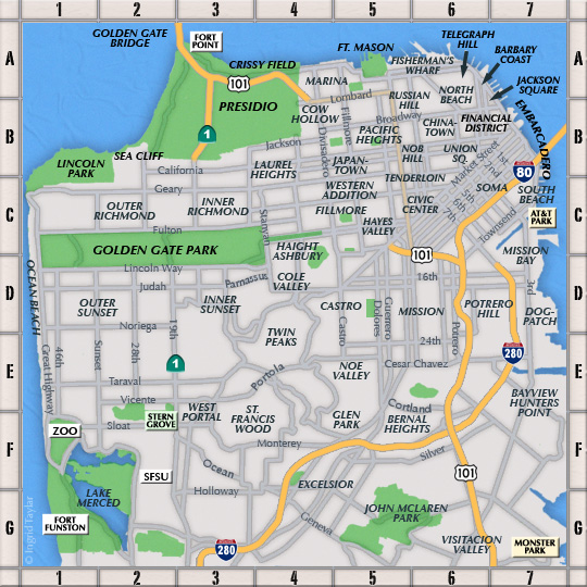
I was out the door by 9:00. Today I would be joining the "Urban Power Hikers" Meetup group for the "Telegraph+Russian Hill/North Beach from Levi Plaza" hike. We were to gather downtown at Levi Plaza at 10:30 and I needed to get some grub for lunch and then catch the N downtown to the Embacadaro Station, the same trolley Ed and I rode yesterday for the Farmer's Market.
I had queried Ed about a neighborhood place for a sandwich and he suggested Andronico's super market which was just around the corner.
Click on the photos below for a larger image.

My "Primo Italian Club" sandwich. 8 bucks. Ouch.
Although Andronico's makes sandwiches to order I opted for a pre-made one so I could grab it and run.
I walked back up to Judah and 12th, and while waiting on the train platform I unwrapped and started gnawing on my "lunch". I figgered it was big enough to have a bit for breakfast as well.

The N was pretty quiet on a Sunday morning.

It was 9:45 when the N rolled into the Embarcadero station. Since I had the time I decided to get a cup of coffee and a walnut-cinnamon streusel at Noah's. Knowing what was ahead of me I figgered the extra caffeine and sugar couldn't hurt.

I took my snack down to Sue Bierman Park and sat with a coupla homeless guys in the early morning sun.
This was the same location where I attended my first Critical Mass bike gathering.

Then I strolled up the Embarcadero taking in the various views of Coit Tower.

Here is a fascinating bit of San Francisco history.
During the Gold Rush of 1849 and 1850s there were no railroads, airplanes, or automobiles. The fastest mode of transportation to the first stop for the gold fields, San Francisco, was aboard a vessel. By the summer of 1850, over 500 vessels were recorded as being anchored in the vicinity of Yerba Buena Cove. After they had arrived, whole crews abandoned their ships, along with the passengers, to make their way up to the gold fields.
Many of the vessels were eventually left to rot, others were eventually used for such purposes as storeships, saloons, hotels, jails, and some were sunk purposefully to secure water lot titles (property that was originally underwater). As wood was scarce at the time, due to the many fires that swept the city and the increasing need for building material, many of the vessels were also broken up for their timber as well as other parts such as the metal plating.Source: Ron Filion. 20 April 2006.

This bronze map, imbedded in the sidewalk, shows the original shoreline and where buried ships have been found.


This was taken in Levi Park, adjacent to Levi Plaza.
The park is small, but quite a beautiful spot and this fella was the only one there at 10:15 on a Sunday morning. Nice spot to crash for the night.

Looking up towards Levi Plaza and Coit Tower atop Telegraph Hill.
By 10:30 there was a group of about 15 people assembled at Levi Plaza. Our leader, Kevin introduced himself to everyone as they arrived. It was a good mix of folks both gender and age wise.
The hike was to be a 6 mile roller coaster walk of hills and stairways. Below is the route info Kevin posted.

As you can see from this terrain model Kevin spared no expense to make sure we never set on foot on flat ground.

Has I walked this route by myself at my own pace I would have taken lots of photos. But, the nearly breakneck pace and no rest stops made it nearly impossible.


The San Francisco – Oakland Bay Bridge
I can identify most of what I shot. But from where? I am clue less...

The Golden Gate Bridge, Marin Headlands and Sausalito where shrouded in fog.

Alcatraz Island and Angel Island.

Some of the ship which were in for Fleet Week.
Fleet Week is a United States Navy, United States Marine Corps and United States Coast Guard tradition in which active military ships recently deployed in overseas operations dock in a variety of major cities for one week. Once the ships dock, the crews can enter the city and visit its tourist attractions. At certain hours, the public can take a guided tour of the ships. Often, Fleet Week is accompanied by military demonstrations and air shows such as provided by the Blue Angels.
Source: WikiPedia

On the right is Kevin, our fearless leader. To the left is An Gh.

We went up Telegraph and then made our way down to North Beach and past Pat's Cafe.

Another look at Alcatraz Island from who knows where.

The Pier at Fort Mason.
Fort Mason, also known as San Francisco Port of Embarkation, US Army, in San Francisco, California, is a former United States Army post located in the northern Marina District, alongside San Francisco Bay. Fort Mason served as an Army post for more than 100 years, initially as a coastal defence site and subsequently as a military port facility. During World War II, it handled most of the cargo for the Pacific campaign.
Today it is part of the Golden Gate National Recreation Area and the site of several cultural facilities. It is a National Historic Landmark District with over 49 buildings of historic significance, spread over 1,200 acres (490 ha).
Source: WikiPedia

After lunch the hill climbing continued.
Russian Hill is directly to the north (and slightly downhill) from the highly affluent Nob Hill, to the south (uphill) from Fisherman's Wharf, and to the west of the North Beach neighborhood. The Hill is bordered on its west side by parts of the neighborhoods of Pacific Heights, Cow Hollow, and the Marina District.
Downhill to the north is Ghirardelli Square, which sits on the waterfront of the San Francisco Bay, Aquatic Park, and Fisherman's Wharf, an extremely popular tourist area. Down the turns of Lombard Street and across Columbus Avenue to the east is the neighborhood of North Beach. Down the hill to the west, past Van Ness Avenue, are Cow Hollow and the Marina districts.
Source: WikiPedia

The Bay Bridge and the Transamerica Pyramid.

Then it was back through North Beach where the Columbus Day celebration was going full tilt.

Looking back down towards Levi Plaza - out starting point.

The last shot for the day: The San Francisco – Oakland Bay and the Ferry Building.

Post Trek photo by Stephen, one of the participants.
Whew !!! What a fun, interesting and grueling trek.
Afterwards I walked down to the BART/MUNI station with Carolyn and we caught our trains home. Great day!
« Previous