Excerpted from: The Tucson Hiking Guide by Betty Leavengood
Rincon means "corner" in Spanish*. It is not known for certain how the mountain range to the east of Tucson got its name. Topped by the 8,666-foot Mica Mountain, the Rincons have historically been the least accessible of the four ranges around Tucson.
Hohokam Indians camped and lived in the Rincons as in the Santa Catalina and the Tucson mountains. In Box Canyon five bed-rock mortars show where Indian women ground legumes. Petroglyphs adorn rocks and cliffs.
When the Hohokam left, the mountains were generally free of human habitation until the early 1800s, when the Apache wandered in the range. The mining that led to the development of the other ranges was almost nonexistent in the Rincons.
By the late 1800s, the lower areas of the Rincons saw extensive ranching. The main building of the Tanque Verde Guest Ranch today was once the ranch of Emilio Carrillo. Carrillo homesteaded the area in 1877, naming his ranch La Cebadilla for the wild barley that grew in profusion. Carrillo built the solid ranch house with small holes for rifles in case of Indian attack. Rumors persisted that Carrillo kept large sums of money hidden on the ranch. In 1904 a gang of bandits attacked La Cebadilla and demanded money. when Carrillo said he had no money, the robbers hung him from the rafters three times, lowering him each time long enough to ask where the money was hidden. Frightened by an arriving buggy, the bandits fled, leaving Carrillo alive but near death.
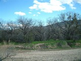
Carrillo and other ranchers ran so many cattle in the foothills of the Rincons that vegetation was destroyed for generations to come. Lime kilns, operating in the 1880s, also seriously deforested the area. The remains of these kilns can be seen along the Cactus forest Trail.
The foothills of the Rincons drew the attention of world-renowned ecologist and University of Arizona president Homer Shantz in the late 1920s. Shantz dreamed of preserving the magnificent stand of saguaros for use as a study area. Through his efforts the state did purchase the land, but when the depression hit, the state was unable to keep up the payments. Through a property transfer agreement, the federal government took over in 1933, establishing the Saguaro National Monument. Additional property was purchased from private individuals in the early 1970s. The monument became a national park in 1994.
In 1939, a few years after the establishment of the monument, great numbers of the giant saguaro began to rot and die. Coincidentally, in February of that year, the coldest temperatures ever recorded caused the mercury to fall to twenty-five degrees and remain there for several hours. At first plant scientists did not make any connection between the low temperature and the diseased plants. By 1941 so many saguaro were dying that the National Park Service removed diseased arms and buried whole plants that showed evidence of the rot. Plans were considered for transplanting young saguaro in the area. Before this was implemented, the policy of the National Park Service became more accepting of nature and did not interfere with the natural progression of plant life.
In the two decades that followed, extensive studies were conducted on the saguaro population. The studies led scientists to conclude that the freeze of 1939 had weakened the old giant saguaro by making them susceptible to the bacterial infection, and that the demise of the saguaro was part of the natural cycle in its long life. Younger, stronger plants are able to fight off infection by forming a "boot" or callus and sealing off the disease from the rest of the plant.
The Rincons were as cool and attractive as the Santa Catalinas, but few took advantage of their heights. One who did was Levi Manning, a mayor of Tucson and former surveyor general of the United States. He discovered a flat area at about eight thousand feet near Mica Mountain and decided to homestead the area. In preparation for this, he had Mexican laborers build a wagon road to the site. A well-constructed log cabin was built, and for a few years Manning Camp was the social center of Tucson in the summer. He even hauled a piano to the site. However, his homestead application had not been approved when the Rincon Mountains became part ofthe Coronado National Forest, and it was declared void. Manning abandoned the camp and never returned.
The United States Forest Service began using the cabin and the site in the early 1920s to set up a permanent fire control center.The camp was spruced up with modern conveniences and additional bunk houses over the years, eventually including a television set. The cost of maintaining the camp became too expensive,and in 1976 everything was dismantled but the original log cabinthat Manning built in the early 1900s. That cabin is used by the staffof the Saguaro National Park when working in the area.
In the mid-1950s, the Park Service drew up plans to develop the Rincon Mountains in a manner similar to the Mount Lemmon area. A nineteen-mile road called the Desert Mountain Highway would be constructed from the monument headquarters to Manning Camp. The thinking at the time was that such development would relieve the stress on the Mount Lemmon area, and that the rapid growth of the Tucson area demanded more recreational facilities. Fortunately for hikers who enjoy the wilderness, the Desert Mountain Highway never materialized.
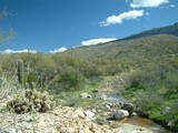
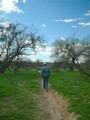
Today, reaching the highlands of the Rincons requires back-backing. Unlike the trails in the Santa Catalinas, which steeply and quickly ascend into the high country, many miles of foothills must be covered before reaching the ponderosa pine level.
"An inside corner or open-ended basin of a Mountain."
from: Spanish Terms of the Sonoran Desert Borderlands by Bill Hoy
Click on the images below for a larger picture. Images best viewed at a screen resolution of 1024x768