|
Welcome
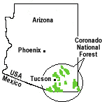 |
The Coronado National Forest covers 1,780,000 acres of southeastern Arizona and southwestern New Mexico. Elevations range from 3000 feet to 10,720 feet in twelve widely scattered mountain ranges or "sky islands" that rise dramatically from the desert floor, supporting plant communities as biologically diverse as those encountered on a trip from Mexico to Canada.
Views are spectacular from these mountains, and visitors may experience all four seasons during a single day's journey, wandering through the desert among giant saguaro cactus and colorful wildflowers in the morning, enjoying lunch beside a mountain stream, and playing in the snow later in the afternoon.
The sky islands of the Coronado National Forest are unique and surprising, offering year-round recreation opportunities.
|
Spotlight
Off-Highway Vehicles (OHVs)
 According to a June 2005 report by the Forest Service's Southern Research Station, OHV ownership — motorcycles, ATVs, and four-wheel drive vehicles — has increased 174% since 1993. Now, 51 million Americans aged 16 or over participate in OHV recreation. According to a June 2005 report by the Forest Service's Southern Research Station, OHV ownership — motorcycles, ATVs, and four-wheel drive vehicles — has increased 174% since 1993. Now, 51 million Americans aged 16 or over participate in OHV recreation.
In TV commercials, OHVs speed across roadless landscapes and plunge through pristine streams at highway speeds. Driving that way on public lands, however, endangers other forest visitors and damages fragile wildlife habitat. Forest Service Chief Dale Bosworth has identified such unmanaged recreation as one of four key threats to forests and grasslands.
Here on the Coronado National Forest, we recommend that OHV users take time to read our brochure, Guide to Backcountry Touring on the Coronado National Forest (pdf, 223 kb).
In addition, we ask that you adhere to the Tread Lightly Pledge:
Travel & recreate with minimum impact-
Respect the environment and the rights of others
Educate yourself, plan and prepare before you go
Allow for future use of the outdoors by leaving it better than you found it
Discover the rewards of responsible recreation
For more detailed information, please visit our OHV site. |
Madera Canyon
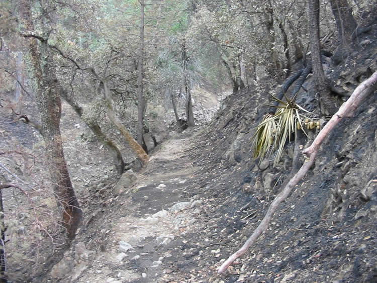
Despite some lingering effects of the Florida Fire, most Madera Canyon recreation facilities are open. However, entering the burned area is prohibited by a Closure Order signed July 25th. This closure will remain in effect until further notice. Recent rains and wind in the area have increased the hazard of falling limbs and trees. "Trespass" hikers in the burned area will be cited.
All campgrounds and picnic areas in Madera Canyon are open:
However, trails in the burned area remain closed, including the following:
The following trails outside the burned area are open:
- Vault Mine/Carrie Nation Trails
- Dutch John Trail (from Bog Springs Campground to the Dutch John Spring)
- The Madera Nature Trail (from the Proctor Parking Area to the Mt. Wrightson trailhead)
|
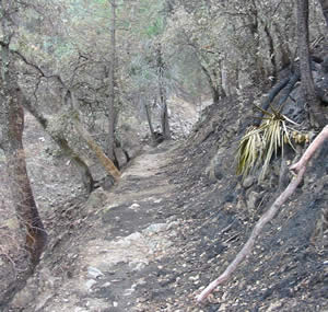 Photo: Old Baldy Trail after fire. Photo: Old Baldy Trail after fire.
Click photo to enlarge.
|
Kentucky Camp

For Rent: Rustic adobe cabin in historic Kentucky Camp, in the Santa Rita Mountains. As part of the Forest Service’s Rooms With A View program, a small cabin at Kentucky Camp is available for overnight stays, for up to 4 people.
Americans are fascinated with the history of the West, with its stories of adventure, hardship, perseverance, failure and the occasional spectacular success. Mining is part of that story. These pages tell of one mining venture in the Santa Rita Mountains of the Coronado National Forest, and what the Forest and dedicated volunteers are doing to preserve its history. MORE |
|
|


|


 Mountain Lions