Mike Breiding's Epic Road Trips ~2016~
Wheeling to Tucson
Bozeman Montana Area
Hiking to Sacagawea Peak
Wheeling to Tucson - Saturday October the 1st
Hiking to Sacagawea Peak
Saturday morning broke with a partly cloudy start to the day.
We had a nice view of the sunrise and mountains from the hotel room window.
When discussing our plans for the only two days we would be in Bozeman - Saturday and Sunday, we based our activities on the weather forecast. Since a hike would keep us outside most of the day, the decision was made to hike to Sacagawea Peak on Saturday.
This turned out to be the right decision to be sure!
Before we get started on the hike I think it worth taking the time to include a little background information.
As I mentioned previously, Sacagawea Peak is in the Bridger Mountains.
The Bridger Range (highest point: Sacagawea Peak 9,665 feet (2,946 m)) is a subrange of the Rocky Mountains, in southwestern Montana in the United States.
The range runs mostly in a north - south direction between Bozeman and Maudlow and is separated from the Gallatin Range to the south by Bozeman Pass, the Horseshoe Hills to the west by Dry Creek, the Crazy Mountains to the east by the Shields River valley and the Big Belt Mountains to the north by Sixteen Mile Creek. Bozeman Pass, el. 5,712 feet (1,741 m), is a narrow pass that lies between Bozeman and Livingston.Sacagawea Peak is a prominent peak visible to the northeast from Bozeman. The entire range is within Gallatin National Forest. Although the range is for the most part in Gallatin County a small portion of the range extends into Park County, Montana.
Source: WikiPedia
The Bridger Range was named for Jim Bridger who was born in 1804 in Richmond, Virginia. I first "met" James Felix Bridger in the early 60s'. This was in the day of LPs and sitting around the "record player" listening to music.
My dad had neither the time nor the interest for such an activity. However my mom, who was more or less trapped at home all day with 6 kids, did indeed have the time and interest.
Along with crooners Perry Como, and her Heart Throb Andy Williams she had two other fellows she loved to listen to: Marty Robbins and Johnny Horton.
In our household Marty and Johnny were represented by just two albums - "Gun Fighter Ballads and Trails Songs" and "Johnny Horton's Greatest Hits".


I think that my 3 brothers, 2 sisters, my mom and I must have listened to these two albums 100s of times. Amongst all the famous songs on these two albums, one of my favorites was a tribute song entitled "Jim Bridger" by Johnny Horton. I still listen to this song today when I spin Johnny's CD. You can listen to it also via good old YouTube and also read the lyrics. I like the part where Mr. Bridger gives Mr. Custer some advise.
James Felix Bridger (March 17, 1804 – July 17, 1881) was among the foremost mountain men, trappers, scouts and guides who explored and trapped the Western United States during the decades of 1820–1850, as well as mediating between native tribes and encroaching whites. He was of English ancestry, and his family had been in North America since the early colonial period.
Jim Bridger had a strong constitution that allowed him to survive the extreme conditions he encountered walking the Rocky Mountains from what would become southern Colorado to the Canada–US border. He had conversational knowledge of French, Spanish and several native languages.
Source: WikiPedia
OK. Now we know how the Bridger Range got its name. What about Sacagawea Peak?
As I am sure many of you know, Sacagawea was an Indian woman who helped out the Lewis and Clark Expedition.
While Sacagawea has been depicted as a guide for the expedition, she is recorded as providing direction in only a few instances. Her work as an interpreter certainly helped the party to negotiate with the Shoshone, however, her greatest value to the mission may have been simply her presence during the arduous journey, which demonstrated the peaceful intent of the expedition.
While traveling through what is now Franklin County, Washington, Clark noted, "The Indian woman confirmed those people of our friendly intentions, as no woman ever accompanies a war party of Indians in this quarter," and, "the wife of Shabono our interpeter we find reconsiles all the Indians, as to our friendly intentions a woman with a party of men is a token of peace."Sacagawea is an important part of the Lewis and Clark legend in the American public imagination. The National American Woman Suffrage Association of the early twentieth century adopted her as a symbol of women's worth and independence, erecting several statues and plaques in her memory, and doing much to spread the story of her accomplishments.
Source: WikiPedia
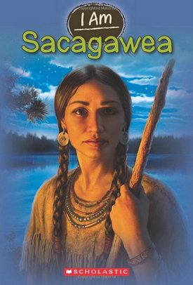
The above stylized and idealized image of Sacagawea probably has nothing to do with reality but it seems to have become the stereotype for the "Indian Maiden" in the American mythos.
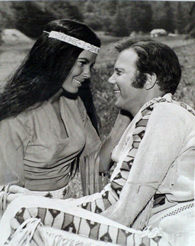
Another not quite so famous stereotypical Indian Maiden was Miramanee who was featured in the Star Trek episode "The Paradise Syndrome".
Predictably when Captain Kirk saw her it was love at first sight.
As is sometimes said:
"But, I digress...". On with the hike!
We had prearranged to meet Ryan at 9:30 at his place after Betsy and I had breakfast at the Western Cafe which Ryan recommended. The place was busy when we arrived at 8:30 but not full. We ordered and were served in good time to meet Ryan at the crack of 9:30.
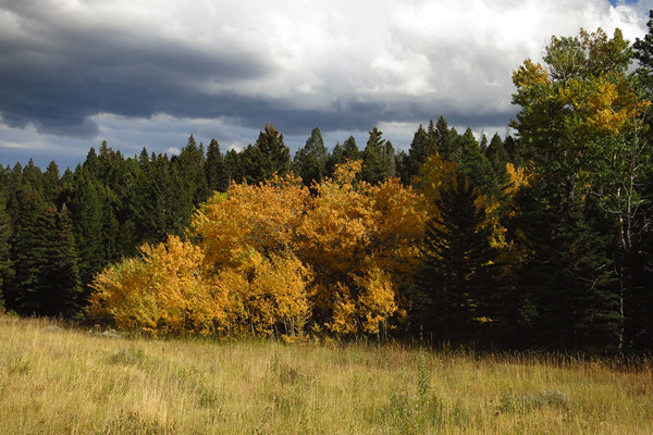
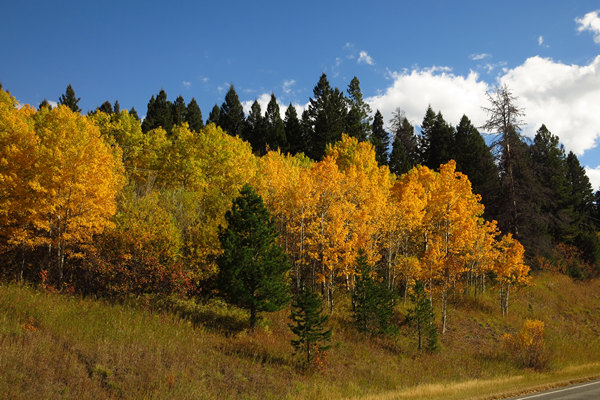
After loading our day packs et cetera into Ryan's CRV we headed out to the north side of Bozeman via Bridger Canyon Drive (Rt 86). The scenery was gorgeous! Wide open meadows, mountain views and lots of fall color from the Trembling Aspen, Willow, Cottonwood and Ash trees.
After about 20 miles we turned left on to Fairy Lake Road and traveled about 5 miles up the windy, sometimes steep and very rough road to the trailhead.
The trailhead is at about 7900' and the summit is about 9,800' for an elevation gain of 1900'. This elevation would be gained by hiking about 2.2 miles up, up, up to Sacagawea Peak the highest point in the Bridger Range.
This is a very popular hike and there were already about 20 vehicles there. I could tell by the number of off leash dogs and piles of dog shit here and there this was favorite place for people to take their fur babies for a stroll.
The first series of switch backs which took us through a dense forest of White Spruce (Picea glauca) occasionally opened up to some gorgeous views of the surrounding mountain sides.
The many short rest stops we took allowed ample opportunity to enjoy the views like this one of the distant Crazy Mountains.
Ryan had mentioned we might see Mountain Goats. Here he scans an adjacent talus/scree slope in the hopes of spotting one.
And indeed he did spot a mountain goat! This is the best I could do with my little digi snap set on maximum optical and digital zoom.
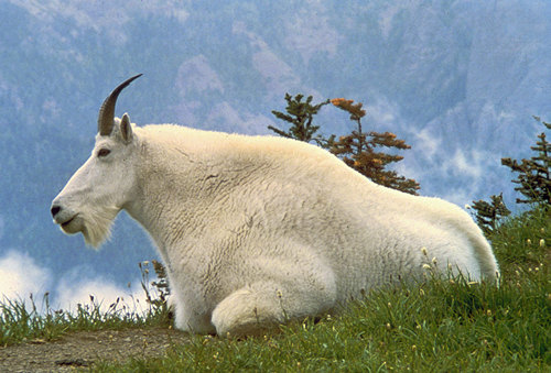
Fortunately good old WikiPedia had a little bit better photo.
The mountain goat (Oreamnos americanus), also known as the Rocky Mountain goat, is a large hoofed mammal endemic to North America. A subalpine to alpine species, it is a sure-footed climber commonly seen on cliffs and ice.
Despite its vernacular name, it is not a member of Capra, the genus that includes all other goats, such as the wild goat, Capra aegagrus, from which the domestic goat is derived.Source: WikiPedia
We don't often go on hikes which take us above tree line into the alpine zone and it was a real treat. Based on the vegetation we saw, the area must be carpeted with flowers in the summer time.
The geology was quite dramatic. Check out the wavy rocks above Betsy and Ryan.
At about 1.7 miles, the trail reached the saddle. We now have .7 miles to go to reach the summit.
In the distance are the Crazy Mountains. Betsy and I had driven past this range on our route between Billings and Bozeman.
The name Crazy Mountains is said to be a shortened form of the name "Crazy Woman Mountains" given them, in compliment to their original Crow name, after a woman who went insane and lived in them after her family was killed in the westward settlement movement.
Spanning a distance of 40 miles (64 km), the Crazy Mountains are located between the Musselshell and Yellowstone rivers. The highest peak is Crazy Peak at 11,214 feet (3,418 m). Rising over 7,000 feet (2,130 m) above the Great plains to the east, the Crazies dominate their surroundings and are plainly visible just north of Interstate 90.
The Crazy Mountains form an isolated island range east of the Continental Divide. Other isolated ranges in Montana include the Castle Mountains, Little Belt Mountains, Big Snowy Mountains, Little Snowy Mountains, Highwood Mountains, Sweet Grass Hills, Bull Mountains and, in the southeastern corner of the state near Ekalaka, the Long Pines and Short Pines.
Source: WikiPedia
Here we are at the summit - Sacagawea Peak.
Yours truly.
Why no picture of Betsy at the summit? The last 100' feet or so had just enough exposure she felt very nervous about being able to down climb that section. I know how this feels having had two failed attempts to summit Picacho Peak.
I took this picture of Betsy at the saddle on the way back down. The Crazies are the mountains in the distance.
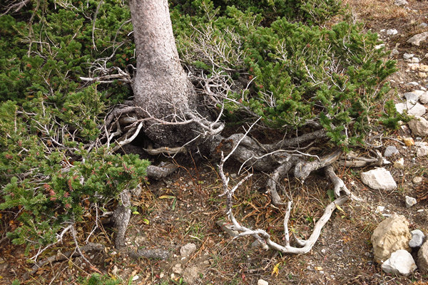
On the way up I had noticed numerous clumps of dwarfed White Spruce, the bases of which were surrounded by miniature trees - or so it seemed.
Dwarfed White Spruce.
Closer inspection showed the "miniature trees" turned out to be the lower branches of the parent trees. This brought to mind the so called "Flag Spruce" that occur in West Virginia in places such as Dolly Sods and Spruce Knob.
One difference between the trees above and the Flag Spruce is the "flags" have greatly reduced branch length on the prevailing wind side in addition to having elongated lower branches which are sheltered from the constant wind and to some extent the cold. Additionally the lowest branches would be covered under deep snow providing additional protection against the elements in the winter. Pretty cool.
Flag Spruce on Dolly Sods: Photo by Suburban Adventure Guy
Here you can clearly see the weather beaten side of the these White Spruce.
For some reason dead or dying trees always seem compelling and picturesque.
As we approached the end of our hike, we walked though the dense forest of White Spruce again. The trees which were down at around 7000' feet and on a sheltered slope were 60 to 70' tall, not 6 to 7' feet like the ones up near the tree line.
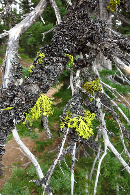
Many of the lower branches had these beautiful lichens growing on them.
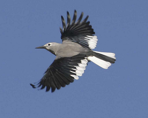
It was amongst these trees we saw several beautiful and very active Clark's Nutcrackers.
Clark's Nutcracker: Photo by National Audubon Society
On the drive back to Bozeman we again passed sme nice stands of Trembling Aspen, Willow and Ash trees which were providing some beautiful "autumn splendor".
On the way back to Ryan's we stopped for some dinner groceries and when we got back, Ryan grilled us up a feast of Antelope, Elk, Mule deer and White-tailed deer. All marinated in beer of course!
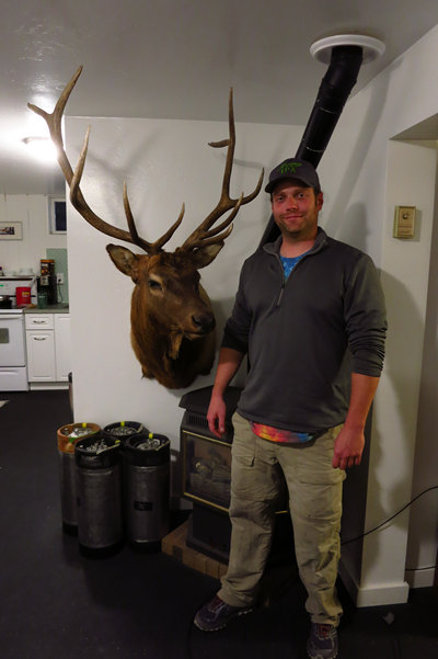
Elk! It's what's for dinner.
Thanks, Ryan for a wonderful hike and dinner.
Next stop: Yellowstone National Park.

