Saturday, January 23rd
After finishing up my webwork for Day 9 I walked up to town in search of a book on local hikes.
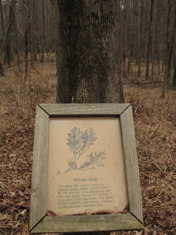
I went first to On Square books. They had nothing. I then went to Off Square Books. They had copies of "Hiking Mississippi: A Guide to Trails and Natural Areas" by Helen McGinnis. I paged through the section for Holly Springs NF near Oxford, by I saw nothing listed.
I went back to the motel, had some lunch - a cheese sandwich on baguette from Trader Joes, with celery and carrot sticks, then packed up. I stopped first at an Autozone just down the road to see if they could check the code for the Engine Trouble light.
The gal came out with the reader and I wrote down the code. She would not reset the code, but let me do it. She then offered to print out a more inclusive diagnostic for the code (PO441), which she did. When we read it indicated it could be, amongst other things: EVAP canister or hose cracked, not connected; Vacuum leak at Engine; Defective or loose fuel cap, etc. When she saw the "fuel cap" listed she seemed to think that was the cause. I hope so.
I drove down University Ave to the interchange for SR 7 North and then, 2 miles later, exited at Rt 30 West. I made a stop for gas and noticed a National Forest check in station with maps if the WMA there. The station was for hunters do the maps has no hiking trails on them.
Click on the photos below for a larger image.
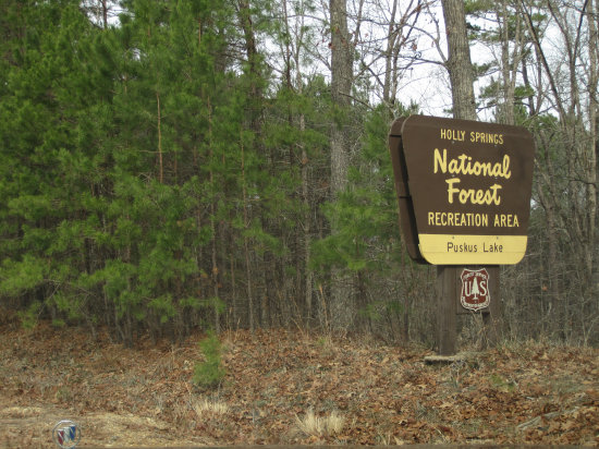
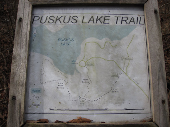
I continued west for about 10 miles and then saw a National Forest sign for Puskus Lake including an icon for camping. I made the left hand turn off of Rt30 and then drove the 3 miles down to the lake. When I got to the rather large parking lot there was not a soul to be seen.
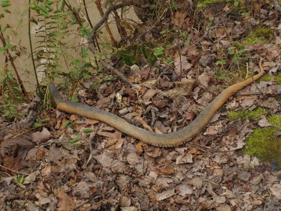
I walked over to the dam and then down to the outflow where i spotted this snake. It was about 24-30" long. I moved in for a closer look but it immediately slipped over the bank and in to the water. I have checked the web but I cannot make an ID based on the photos I saw.
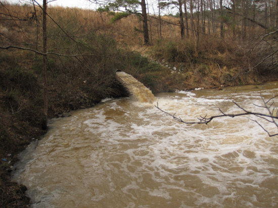
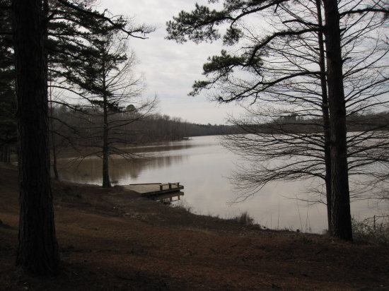
The outflow to from the lake was really roaring. There had been a lot of rain recently and most of the lakes and streams were running high and muddy!
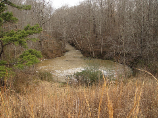
View of the outflow from the crest of the dam.
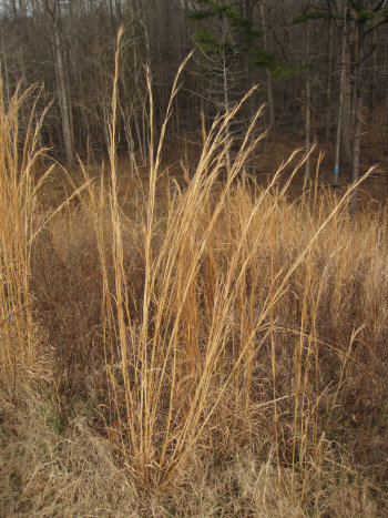
The damn was almost entirely covered with Broom Sedge (Andropogon virginicus). This is the first plant I can remember learning from my dad when I got reacquainted with him as an adult.
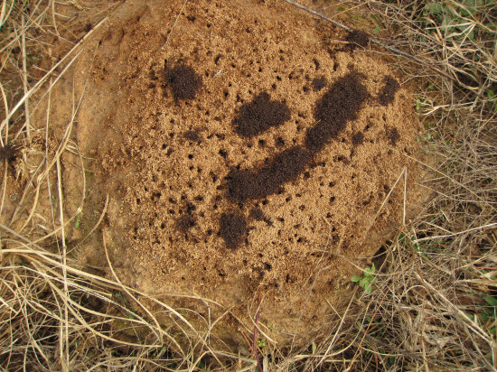
One of several small ant hills I saw on top of the dam.
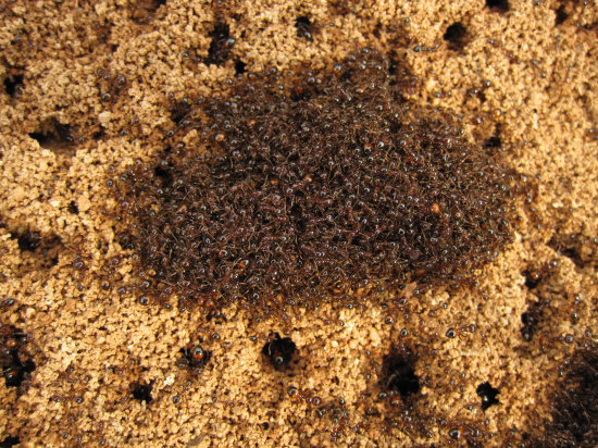
I am not sure what this clumping behavior was all about.
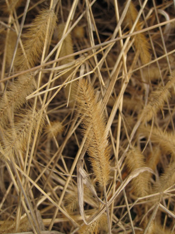
A seed head from one of the grasses on the damn.
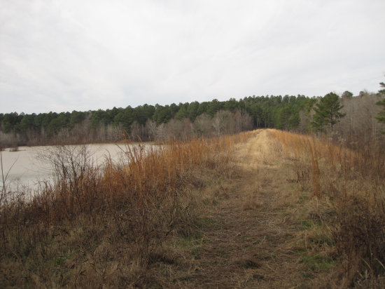
A look down the dam. I had hope the tack would lead to hiking trail but I saw nothing but a muddy ATV tail on the other end.
It was very quite and the only sound to be hear was the wind in the tall pines.
I headed back up the hill, giving up on any hiking, at least here. It was then I saw hiking icon which was invisible from the direction I had come from. I got my pack together and headed down the trail for a short 2 mile, 1 hour hike.
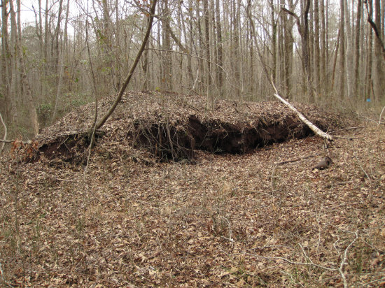
This mound rally stood out in the middle of the woods. Closer inspection showed it was an old sawdust pile. I would say 40-50 years old judging by the rate of decomposition. There were scattered pieces of metal which may have been remnants of the old mill.
There were a couple of dozen makers like this, all of the then marked specific species of trees.
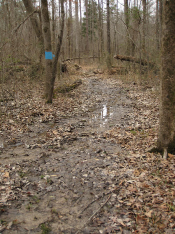
More evidence of the recent rains.
I enjoyed the hike. It was good to get out the confines of my hotel room and leave the cars and people behind.
I drove back out to Rt 30 and continued west to the intersection of 178 and 78. 78 and looked like a 4 lane and 178 went the same direction - north to Holly Spring. I opted to take 178 and I am glad I did. I caught a glimpse of 78 to the eat and it was very busy with lots of truck traffic.
I am not sure where I was on 178 but at some point I cam around a bent there were police cruises with light on and all traffic was stopped. I pulled up behind the car in front of me. An officer was talking to the driver and another one was heading my way. I rolled down the window and he looked at me expectantly. He then said "Just doing a licence check". He then went to the back of the Barge to check the plate and came back up to examine my operators permit. He wanted to know what brought me down this way and I told him I was headed to Texas and was taking "the long way" and today I was out enjoying the country side. He smile and told me to drive carefully and waved me on. I noticed there were several vehicle pulled off the road with other officers talking to the drivers.
Shortly after this I was in Holly Springs.
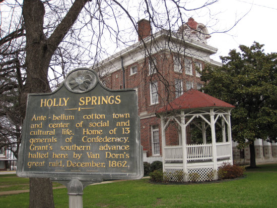
After reading this I realized I was in deed in the Deep South.
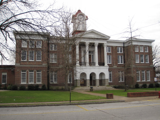
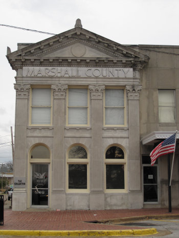
That is the Marshall County courthouse in the background.
Holly Springs is defined by a rich and varied history. Events through the centuries have left an indelible imprint on the face of this town. In the early days, at a place known only to a brave and civilized tribe of Chickasaw Indians, natural springs flowed through hills of holly trees. It became a gathering place for traders and explorers. They called it Holly Springs.
Treaties with the government sent the Chickasaws away from their land on the trail of tears to reservations in Oklahoma. There�s not much left to indicate their presence except honorary names of streets like Chulahoma or names of houses like Latoka or Tallalossa.
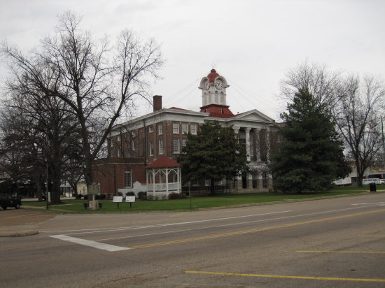
Two more views of the court house.
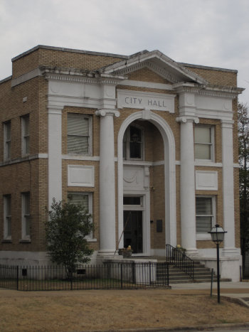
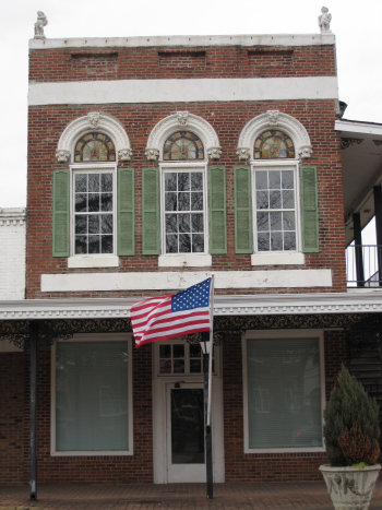
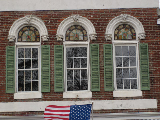
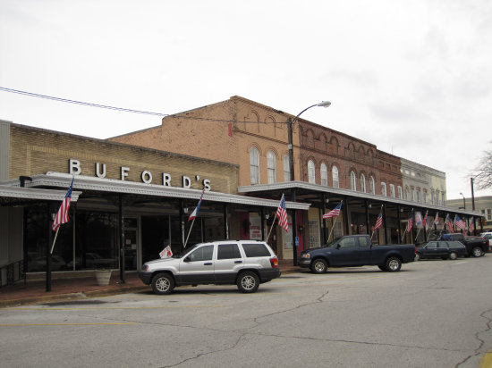
I wandered around for about an hour taking photos. Holly Spring had many fine old buildings.
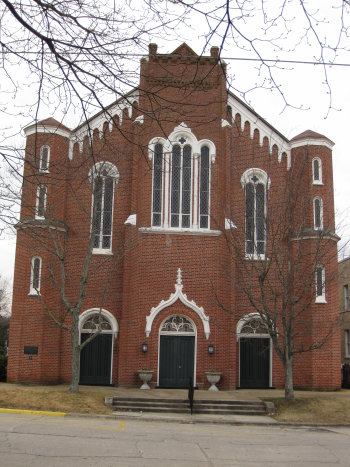
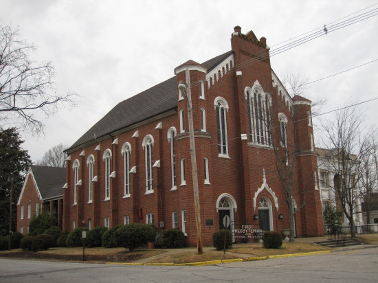
The first Presbyterian Church built in 1835.
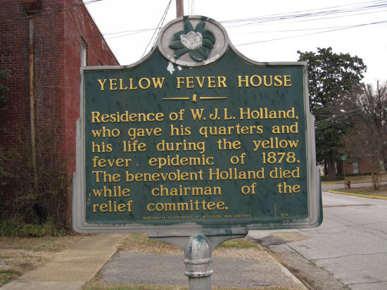
Mayor Goodrich was the first person to die of the epidemic. He died on August 31st, 1878. You may visit the The Yellow Fever Martyrs Church and Museum (circa 1841) East College Ave., Holly Springs, MS 38635, 662-252-3669, Museum dedicated to preserving the legacy of seven Catholic martyrs who gave their lives during the Yellow Fever epidemic of 1840. Open by appointment only.
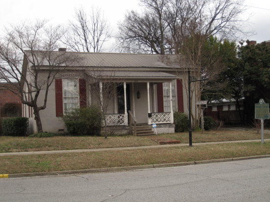
Yellow Fever House.
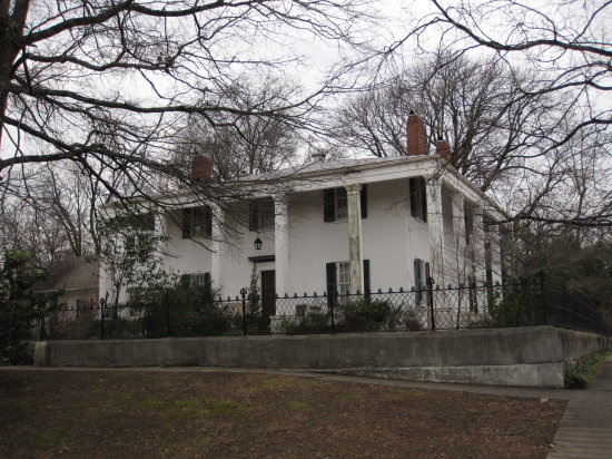
Hugh Craft House- 1851- Greek Revival
The home was built by Hugh Craft, an early land commissioner. His descendants lived in the house for 146 years until it was sold in 1997. The house is an example of the southern interpretation of Greek Revival architecture similar to George Washington�s Mt. Vernon which is a southern colonial.The Jones McIllwain Foundry, who made the first arms for the Confederacy, manufactured the original fence still around the house. It was the first insulated house in town. Two brick walls were built and charcoal was placed between them. During the war it was the headquarters for Federal Colonel Murphy at the time of Van Dorn�s Raid in 1862. On one of the columns of the house Murphy inscribed the dates of all 62 sub sequential raids. The original detached kitchen and slave quarters are still standing. The walls are still stained with the writing of its Pre-Civil War tenants.
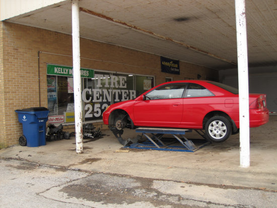
When I was in Florida several years ago I had to have some muffler work done. The shop where I took it had only outside lifts like this one. At the time, I had never seen them before.
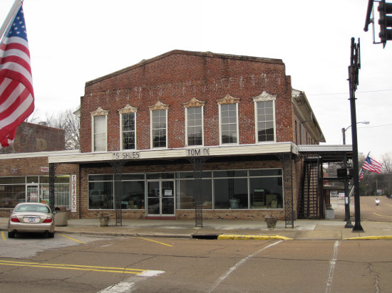
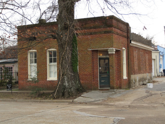
Many of the buildings downtown had business at street level, but the second stories of most of them appeared empty.
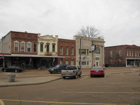
The streets around the court house square must have been 100 feet wide with a median down the middle and diagonal parking on both sides.

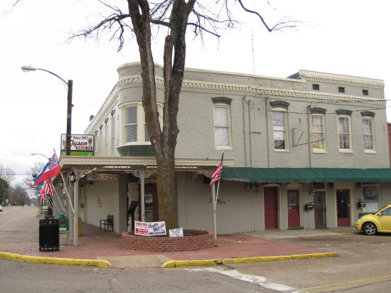
There was rotting beauty everywhere.
Th humble office of the Tax Collector.
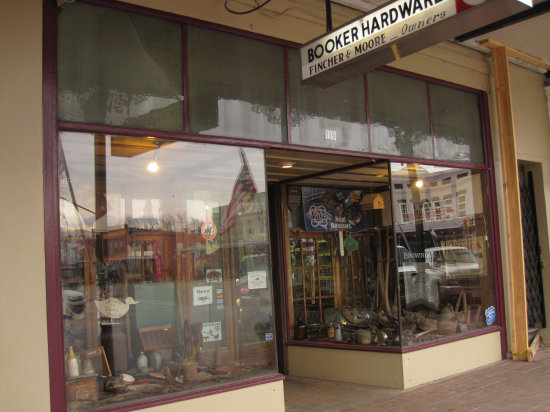
Only the middle brick section of this block was occupied - with a hardware and sundries store.
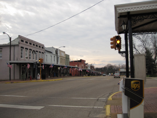
A look down the main street. I had never seen traffic signals mounted on the sides of building before.
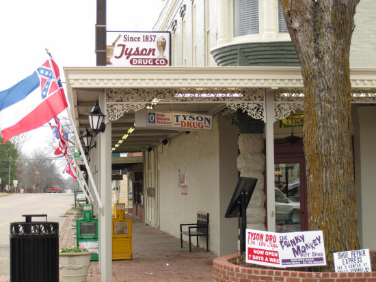
The old, but still busy pharmacy.
This old building is now a lawyers office.
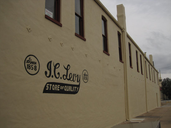
It is no more...
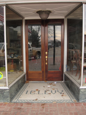
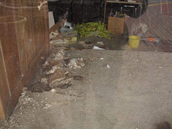
A look inside the old I.C. Levy Building.
This place had a sign in the window for "deep fried peanuts". I couldn't resist!

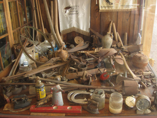
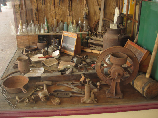
This, and the photo below are the window displays in the hardware store.
From here I headed back Oxford and arrived there at about 5 o'clock.Tomorrow is on to Clarksdale.