Day 12: Tuesday, June 22nd
Slept in and awoke to Robins calling at 6AM. Through the night we heard the on and off clanging of the bell buoys and the muffled and distant sounds of a fog horn. The day was starting out nice - sunny and cool with a good breeze blowing. For breakfast I had a bowl of my usual Great Grains and Kashi with skim milk. But, this morning I would enjoy it while sitting in one of the Adirondack chairs which were placed along the edge of the beach - not my usual breakfast nook. As I sat there enjoying the silence, a Loon called. What is it about that call that evokes such a feeling of hearing something unearthly, something unreal?
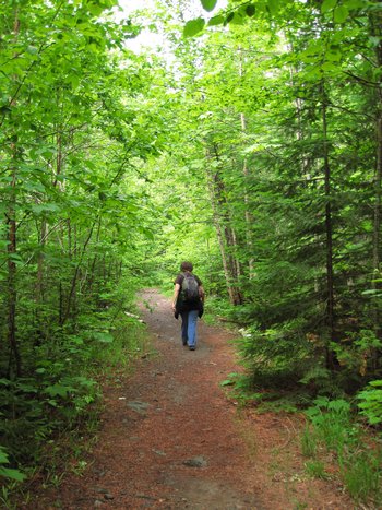
Our plans for the day had yet to fully gel but there was one item on the agenda - a trip to Estevant Pines to be amongst the virgin White Pine which had been spared from the loggers saw. I first read about Estevant Pines in what was now our Yooper hiking bible - "Hiking Michigan's Upper Peninsula" by Eric Hansen. Additionally, the proprietor at Carla's Motel also mentioned Estevant Pines as a must see. So, with those two recommendations it went to the top of our list for this, our first excursion in the tip of the Keweenaw and at 9:30 we headed out.
Click on the photos below for a larger image.
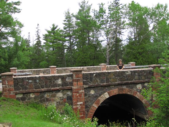
The previous day we had passed the falls at Silver River on our way up to Copper Harbor, but did not stop. This time we did.
I had hoped to get a snap or two of the falls but the weather had now turned cloudy and my shot of the falls would have been into the sun and not worth the effort. So, I contented myself with taking few pics of the nice stone arch bridge which spans the Silver River just above the falls.
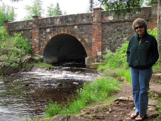
What a nicely gift wrapped culvert!
Located 4.5 miles east of Eagle Harbor along M-26 near the western base of Brockway Mountain Drive.
The Silver River Falls, about 15 feet wide, begins a short walk downstream from M-26 with a series of rapids that rush towards the falls. The stream divides at the falls to drop about seven feet over a rock outcropping then continues as rapids to another drop into a small pool. Here the river narrows to about 7 feet and continues on through the forest to Lake Superior. A small roadside park with picnic tables and grills is located just across M-26.
We then drove on up to Copper Harbor. It was not quite 10:30 in the morning. The town was much less busy than our mid-afternoon visit the previous day. Since we did not think to bring along Eric Hansen's hiking guide, we stopped in at the Gas Light General Store for directions and post cards. The proprietor was friendly and helpful and put us on the right path to the Pines.
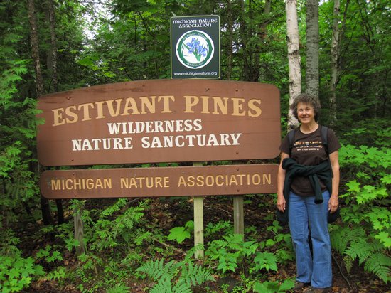
After a rather circuitous route on several sand roads, we arrived at the parking area for Estivant Pines which was a wide shoulder along the road. There was a sign there stating: "No Parking on Road - Log Trucks." Hmmm...
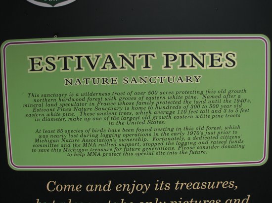
In the early 1970s logging began just south of what is now the sanctuary. The Michigan Nature Association purchased the land and vowing to protect the 508 acres (2.06 km2) of precious woods. Some of the trees are as many as 600 years old and have been called a living museum. They are among the very last old-growth white pines in Michigan.
Also in March 1971, Charles Eshbach took pictures of loggers cutting these pines. These were published in the Milwaukee Journal. An order came down to halt any cutting. These two acts started the "Save the Pines" movement. After long negotiations, on August 17, 1973 the MNA received a copy of the deed and the Estivant Pines were saved.
Source: WikiPedia
We entered the preserve through a tunnel of small birches and maples and soon realized we would see (and hear) much more than big White Pine.

The biggest Paper Birch this Hillbilly has ever seen.

Earlier on we had seen a coupla guys hauling rough sawn boards down the trail. They were putting them to good use in the low spots.
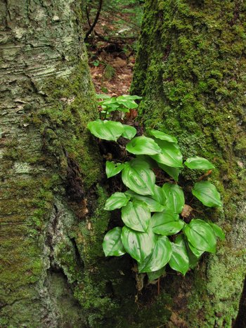
A plant we saw just about everywhere was in the YooperCanada Mayflower (Maianthemum canadense) I know this little beauty from places like Terra Alta and Dolly Sods in West Virginia.
Here it has made a home for itself in the fork of a Yellow Birch (Betula alleghaniensis).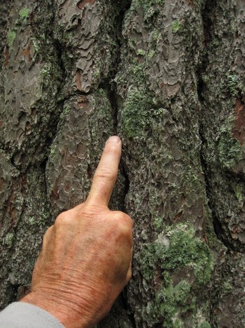
Hey Fern!! Yes, you - Fern the Tree Man!! Check out the deep fissures in this White Pine!
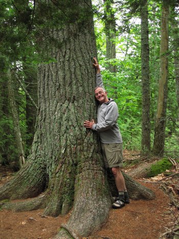
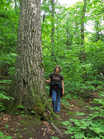
One happy tree tourist!
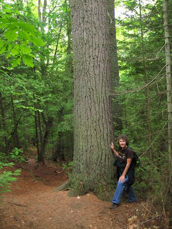
Betsy likes 'em BIG!
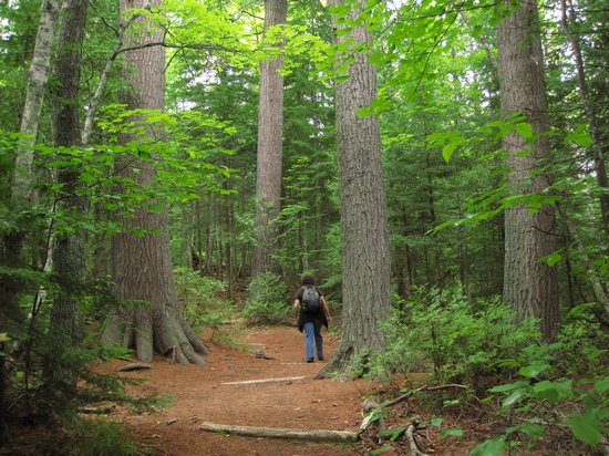
The next best thing to strolling through a Redwood Grove. Amazing. Remember, at one time there were square miles of forest like this. No more. And never again until we have assured our self extinction.
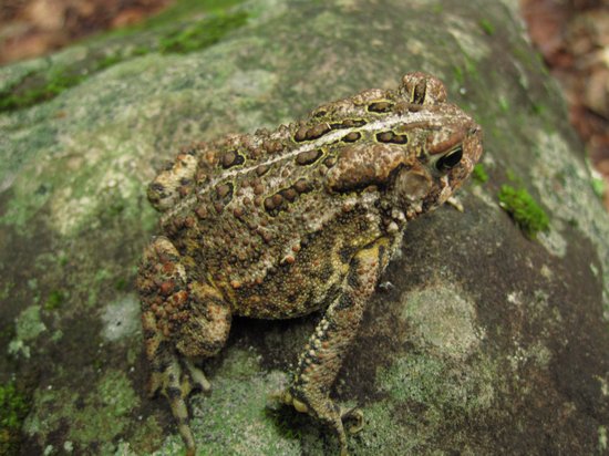
BONUS! Found this little feller trying to make his escape.
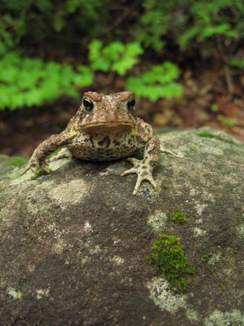
Not being a toadie I will guess this as being an Eastern American Toad (Bufo americanus). I can never resist picking them up when I come across them.
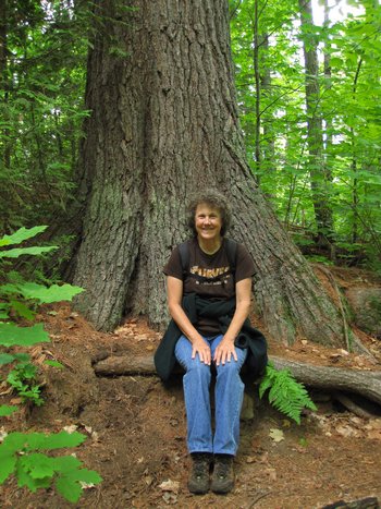
Here Betsy stands next to a right nice Red Oak (Quercus rubra).
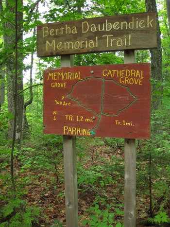
As you can see from the map, the trail consist of a loop which is bisected more or less in the middle. These locator maps were placed at each intersection.
Bertha Daubendiek was the founder of the Michigan Nature Association.
Two more nice specimens.
Not long after this, when we were almost back to the parking area we came across an older gentleman repairing some of the water bars on the trail.
We spoke to him at length and he was a wealth of information. I wish I had been able to record our conversation. I not only forgot his name, but most of what he told us. But, I did remember the info about the rubble walls made from Jacobsville sandstone. He also mentioned another Michigan Nature Association area near where were staying - a trail up to "Baldy Knob".
We said our farewells and when we got back to the car Betsy said she wanted to see "Keweenaw Mountain Lodge" a resort style vacation spot built in the 1930s by the WPA.
On our way to The Pines, Betsy and I had both noticed directional signs for Keweenaw Mountain Lodge as well as Estevant Pines. So, rather than back track to Copper Harbor we decided to follow the sand road and see if we could get there the "back way".
"Back way" turned out to be an understatement. The road got rougher and more narrow the farther we went. At one intersection I almost turned back but I was able to pick my way through the ruts and high spots. At one point we rounded a bend and both saw a black spot on the road. I eased forward and the black spot turned into a bear cub eye-balling us. Cool! He quickly bolted into the brush and that was the last of him.
We then saw another sign in a sharp bend warning us about a "Narrow Bridge Ahead". Great.
I slowly pressed on, rounded the corner and there saw the remains of a hand made bridge constructed of White Birch logs, half of which were missing. As I stared stupidly through the windshield wondering what to do next I had a revelation. We were on a snowmobile trail, not a road intended for cars! "Me big dummy!".
Since there was no place to turn around, I now had the hairy experience of backing the car up the rutted and high crowned "road" to the crest of the hill and hope for a place where I could get us turned around. Fortunately I found a wide spot, we got turned around and slowly backtracked to the Pines parking area and then headed back to Keweenaw Mountain Lodge just outside of Copper Harbor.
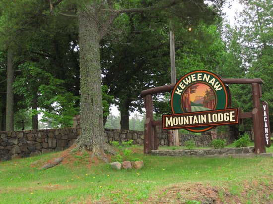
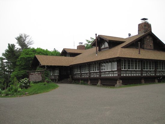
Anyone who has seen WPA and CCC projects would certainly end up hungry for more. Betsy and I are no exception.
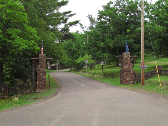
The nice sign, stone wall and the entry gate were a preview of what was to come.
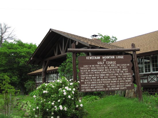
Yep, that's right - Golf Course!
The one man mostly responsible for the undertaking was Ocha Potter, and to most people in the area the building of a golf course in the wilds of Keweenaw was a little absurd. Even the city newspaper picked it up later and called it “Potter’s Folly.” However, it could put a lot of people to work, and in the fall and winter of 1933-34 the timber was cut from the fairway that would make the golf course.
The golf course was originally planned as an 18 hole course, and during the winter of 1933 and 1934 was actually cleared with that in mind to include all 18 fairways, but that was as far as it actually got, because after the first nine holes were built and it was found out the amount of maintenance required, the second nine holes were tabled for a future date, but to this day they have never been completed.
Source: www.copperharbor.org
By now it was past lunch time and the lodge had a nice dining room with a windowed porch area.
So, we checked out the
menu which looked adequate. Betsy had "The Par - A classic grilled chicken Caesar salad" $9.00.
I had the "On the Green - Black bean veggie burger." $8.
The food was good and the service by our very young waitress was pleasant, but forgetful. Betsy had ordered a beer menu - it never arrived. Her salad arrived and she assumed it was dressed in spite of asking for dressing on the side. Wrong. No dressing and our waitress was nowhere to be found. Oh well...
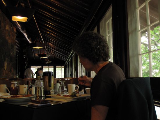
A dark look at the timbered ceiling and stone wall of the dining porch.
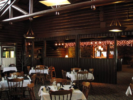
A look through the main dining area and in the lounge and lobby area. The main dining area had a high vaulted ceiling made from huge log timbers.
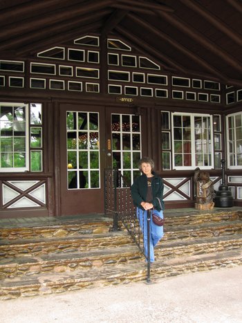
We paid up and headed to the car where I took this overview shot of the Lodge. Just then a car whipped up along side us. It was Pam. Did I mention Pam? We met Pam the previous day at the hotel. She was the only other person staying there and had the best room in the house - the corner room with two windows one of which faced the bay. After Betsy and I had settled in at the Shoreline Resort (what makes it a resort and not just a hotel?) we plopped ourselves in a coupla Adirondack chairs and sipped on our beers. Pam came out of her room and over to us to introduce herself. Turns out she was a friend of the Nidia Schmidt - the proprietress and was there to give her aid and comfort from the recent loss of here sister.
Anyway, we talked to Pam for a bit and she has some interesting ideas and advise about health matters. Some of the things she told us about were the benefits of Goji berry juice and how water from certain sources was beneficial in a number of ways. Frankly, it all sounded like hocus-pocus popular science to me but it was interesting talking to her. Pam also told us about the Eagle Harbor Inn which was within walking distance of the motel.
Ok, so there was Pam and before we knew it we were involved in a 20 minute conversation with her about fish dinners, hiking opportunities and god knows what all. Turns out she had driven up to the Lodge for a Trout Lake lunch but we talked her out of it after relating to her our experience in the dining room and price for lunch portion of Trout.
Pam took off back to Eagle Harbor and she would pop in and out of our vacation several more times while we were in the area. Interesting lady and fun to be around.
Ok, where was I? Right, the photos of the Mountain Lodge.
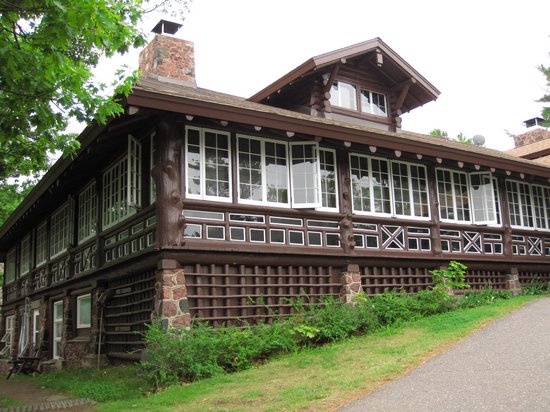
This shot shows the porching dining area on the left and main dining area in the front. The low windows were frosted so as to allow light in and prevent "sneak peaks" of legs.
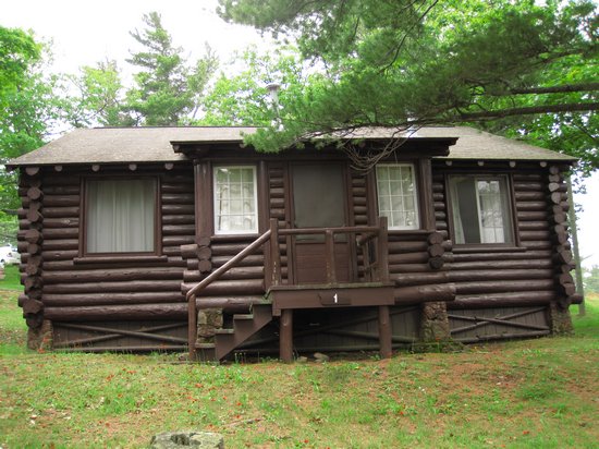
There are 34 one, two and three bedroom cabins in addition to the lodge. After Pam left we strolled around looking at them and getting a few snaps.
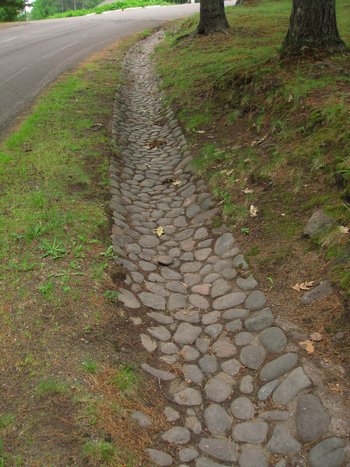
The is the stone line ditch below the cabin area. Nice.
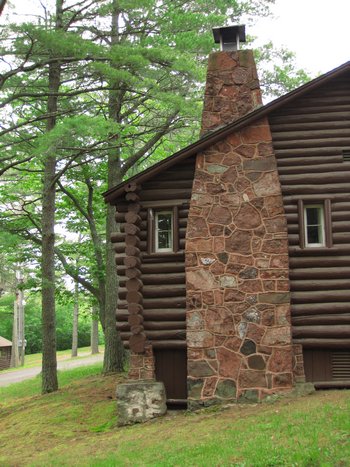
The masonary chimneys were gorgeous! I am sure they have been repaired and cleaned up over the years but there was no obvious sign of this.
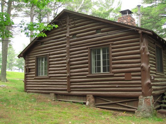
I loved how the structural logs had the branch collars left on them. Nice touch.
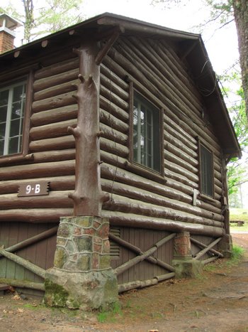
Great fit and finish on all the cabins.
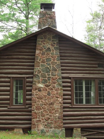
Maybe Betsy and I will be on the other side of this chimney some day.
A final shot of the Lodge Entrance before we went into Copper Harbor for some light shopping.
Earlier in the day when we were on our postcard hunt we saw two shops: The Laughing Loon and Patchword Books. We went into both. I bought Betsy a leather ditty bag at the Loon for her birthday, we bought more postcards and then headed back to our nest at Eagle Harbor.
We got back to the motel aournd 4:00 and both took naps and wrote postcards. Around 6:00, usually our supper time, I talked Betsy into trying to find the trail to Baldy Knob. After a little bit of waking up we got our packs and water bottles together and started the hunt for the trail head.
It was not long before we realized we would not find it with just the sketchy info we had so I stopped and asked a group of "old folks" who were all chatting together in the driveway of one of the houses. I stood there and watched the timeless scene for a few minutes. The women folk were talking about family and personal matters while the men were all examining the engine of one of the cars and making various comments about things motorized. There was finally a break in the conversation so I explained where we wanted to go and got easy-to-follow directions form one the ladies. Just like we had been told previously, it was right around the corner.
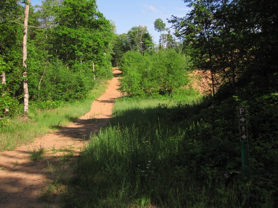
This is a shot looking up the trail from the parking are. We went through some interesting habitats on the way to the summit: dunes, White Birch thickets so dense they could not be penetrated, scrubby oaks forest, alpine areas. Quite amazing.
Betsy and I had no real idea of how long the trail was to the summit so we just kept walking, taking in the silence and enjoying the weather.
For most of it's length the trail appears to be an old road bed which is now a double track hiking path. As Betsy and I walked side by side up the mountain the silence was broken by an obviously alarmed Betsy who said, quietly, but earnestly: "Mike, stop. Back up. Come over here!" I did as directed and followed Betsy's gaze up the trail right into the eyes of a large black bear who was slowly ambling down the trail toward us.
I could tell Betsy was freaked out and I was not far behind her. I raised my arms and started shouting incoherently. Bruno stopped, continued to look at us, then turned and sauntered up the trail, around a bend and out of sight. Wow. Talk about a close encounter!
After we settled back down there was some discussion about whether to continue on up the tail or not. I was convince now that Bruno had seen us, that would be the last of him, Betsy - not so much so. In the end we continued on and Betsy talked loudly and whistled on occasion to give the bear a heads up incase he was near-by.
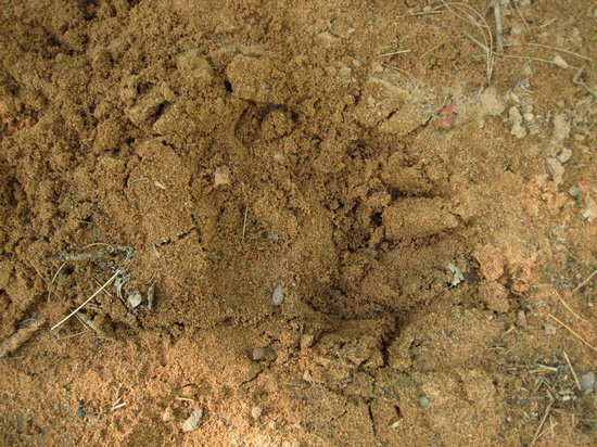
The bear had left a number of calling cards in the form of large, but poorly defined tracks in the sand which, thankfully, disappeared.
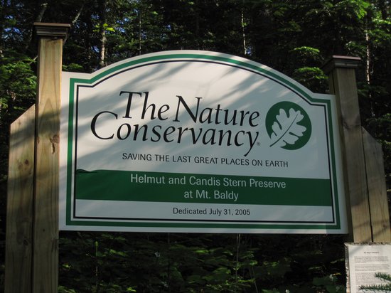
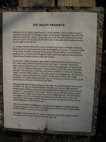
We continued our ascent and finally the double track became a narrow trail and this large sign was place at a left hand turn in the trail.
Although also known as Lookout Mountain, Mt. Baldy earned its name because high winds shaped the vegetation at its highest elevations. Towering 730 feet above Lake Superior in northern Keweenaw County near Eagle Harbor and Lake Bailey, the mountain offers spectacular panoramic views of Lake Superior and the Keweenaw Peninsula.
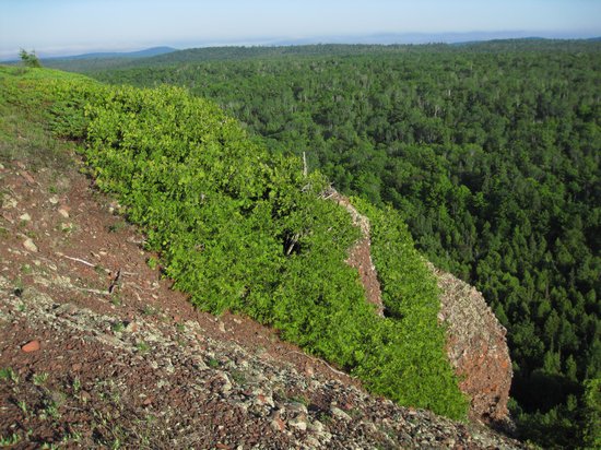
The preserve features a craggy, mile long ridge top that harbors a “northern bald” community containing several nearly treeless openings. These openings harbor several disjunct northern (“alpine”) and western ("prairie") plant species scattered amongst wind-contorted white cedar and ground juniper. This ridge-line drops in a precipitous 230 ft. cliff along the south face, and more gently, in forested slopes northward to the shores of Lake Bailey.
Down slope and along the ridge stunted oak forest dominate the preserve and further down the vegetation is dominated by a mix of conifer and northern hardwood forest. Local inhabitants include the black bear, snowshoe hare, peregrine falcon, ruffed grouse, golden-crowned kinglet, black-throated green warbler and yellow-rumped warbler.
Click on the photo to read more.
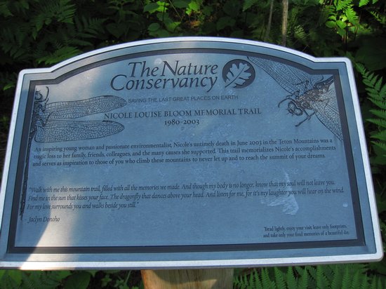
23 years old. I have seen more than one memorial like this during my travels and it always evokes the same feelings and memories of bygone friends and family.
We continued on and I could tell Betsy was flagging and I was getting tired myself. It was hot, muggy and still and we were now at a time in the day when we were usually heading off to bed. So ,I kept saying: "We are almost there, I can see the summit". Of course what I was seeing was not the summit and at one point I thought Betsy was going to turn back. But, with just a little encouragement she rallied and before we knew it we had reached the summit.
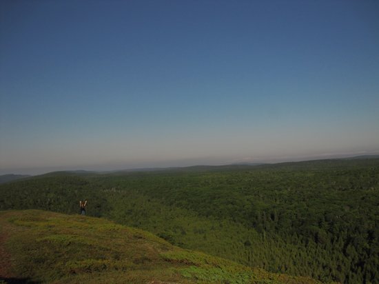
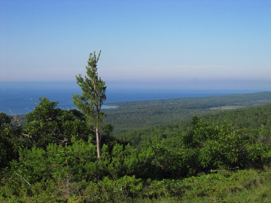
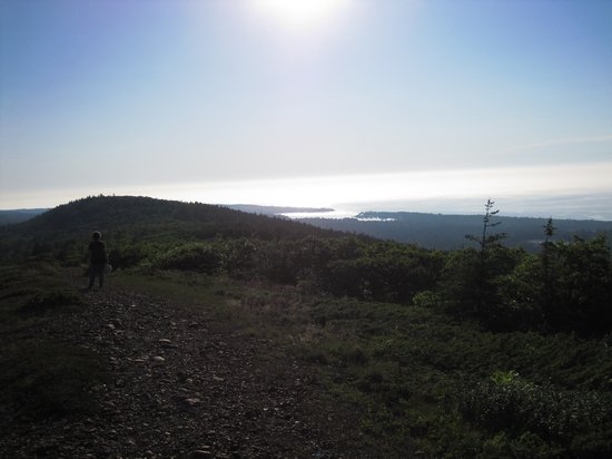
With a cool breeze blowing we both rallied. What a view!
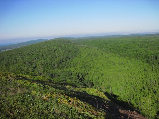
Although hard to discern, the light green swath was a big Thuja swamp surrounded by Balsam Fir and White Birch.
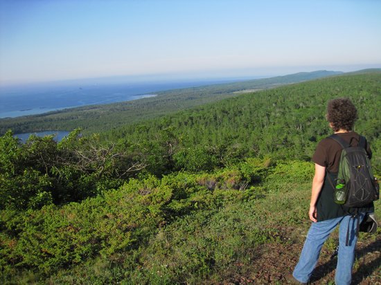
Here Betsy looks west towards Lakes Baily and Superior.

Google terrain map showing the Old Baldy area.
These spare and wind beaten pines reminded me of the Dolly Sods
Much of the summit was covered with these dwarfed oaks that were who knows how old. I tried to imagine this place in the dead of winter and thought about the sub zero temps and the howling wind. I wondered if this place even held snow in the winter or whether it was all just blown off leaving everything up here completely exposed. Whew! Rough life...
Much of the rock face was covered with dwarf Thuja and Bearberry.
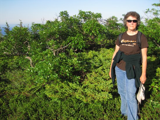
A last shot as we reluctantly headed back down the trail.
Betsy and I were both very glad the trail before us was now all down hill. Still skittish, Betsy occasionally made loud comments like "I wonder if the bear is still around?" We did not see Bruno again so maybe her bear alarm worked.
2.5 hours and 6 miles later we got back to the car and were both shocked to find it was 9:00! What a day! Now, what about dinner? Hoping the Inn was still open I dropped Betsy at the hotel where she met a couple from Seattle who were on a genealogy trip which involved a grand mother who had been married in the lighthouse there. I then drove the two blocks where I ordered The World's Most Expensive Pizza - 14" for 18 bucks. OUCH!
I had a beer at the bar while I waited for the pizza and was finally engaged in conversations by one of the half dozen locals sitting there as well. I entertained them with my bear stories and dazzled them with my sharp wit and deep knowledge of bird and plant lore - NOT!
I shuttled the pizza back to the hotel where Betsy and I assumed our places at the beach and had our sun filled 10pm dinner.
What a great day.