Mike Breiding's Epic Road Trips ~2017~
Three Weeks in Michigan
Pictured Rocks National Lake Shore
Hiking the Shore of Lake Superior to Au Sable Light Station
Friday - 21 July 2017: Pictured Rocks National Lakeshore
Hike from the Au Sable Log Slide to the Au Sable Lighthouse Station
This was our last morning at the Superior Shores Resort near Ontonagon in the western Upper Peninsula of Michigan. I got out early to try for some sunrise pics over Lake Superior.
Click on the photos below for a larger image.
These were taken from the shoreline at Superior Shores Resort. Notice I did not say "from the beach".
After this shot the clouds thickened and the sun was completely obscured.
Here is the "beach" at Superior Shores Resort.
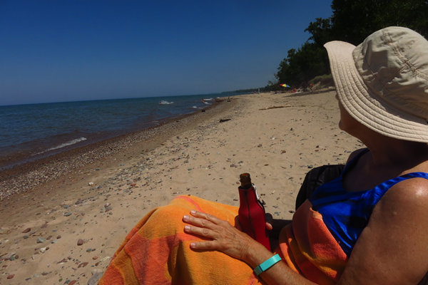
Here is where we had our last Happy Hour while staying at the Superior Shores Resort. It was only minutes away at Green Park. Nice beach but like most other beaches there were lots of Stable flies, thus the towel over the legs. For some reason they seem to prefer the legs and ankles. We have heard them referred to as "Stinger Flies" which is an apt description considering how the bite feels.
In the same family as houseflies, stable flies look like small houseflies, but both males and females bite. Hard.
It packs a "hot bite," Russell said.
On the beach where no horses or cows are available, their preferred target is the ankles and lower legs of humans.Source: © 2017 MLive Media Group
This is the only safe access to the water from Superior Shores Resort.
These folks spent a bunch of money for their little patch of "beach"
This is the end room of our unit at Superior Shores Resort. It had a sleeper sofa, table, fridge, coffee pot and microwave.
Here Betsy proudly displays her beverage can collection.
This is on SR 64 6 miles west of Ontonagon.
Looking back to Lake Superior from the entrance. When we arrived much of the parking area was under water due to the recent heavy downpour.
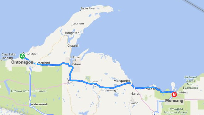
We left the Ontonagon area about 8:30 and drove to our next destination: Munising, the western gate way to Pictured Rocks National Lakeshore.
Munising is located on the southern edge of Munising Bay also known as the South Bay of Grand Island Harbor, across from Grand Island around the mouth of the Anna River. It is the primary embarkation point for cruises to Pictured Rocks National Lakeshore and Grand Island National Recreation Area.
The name Munising is derived from the Ojibway language. 'Munissi' means island. 'Munising' means near the island. Grand Island is located one half mile north in Munising Bay.
The name for the city comes from the Ojibwe word for "island at". A post office was established as the Munising post office on December 22, 1868. It was renamed as Gogarnville on October 23, 1889, when Julius Gogarn was appointed as postmaster. The office was moved to his farm. He was a German-born American Civil War veteran and first Supervisor of Munising Township. That post office continued until July 15, 1893
Source: WikiPedia
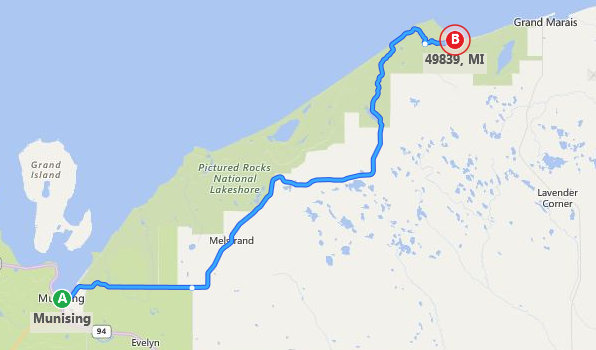
When we arrived at Munising we picked up H-58 and drove about 44 miles east to the trail head for our hike located at the Log Slide Overlook at the Grand Sable Dunes in the Pictured Rocks National Lakeshore.
Pictured Rocks National Lakeshore is a U.S. National Lakeshore on the shore of Lake Superior in the Upper Peninsula of Michigan, United States. It extends for 42 miles (67 km) along the shore and covers 73,236 acres (114 sq mi; 296 km). The park offers spectacular scenery of the hilly shoreline between Munising, Michigan and Grand Marais, Michigan, with various rock formations like natural archways, waterfalls, and sand dunes.
Pictured Rocks derives its name from the 15 miles (24 km) of colorful sandstone cliffs northeast of Munising. The cliffs are up to 200 feet (60 m) above lake level. They have been naturally sculptured into shallow caves, arches, formations that resemble castle turrets, and human profiles, among others. Near Munising visitors also can view Grand Island, most of which is included in the Grand Island National Recreation Area and is preserved separately.
The U.S. Congress made Pictured Rocks the first officially designated National Lakeshore in the United States in 1966. It is governed by the National Park Service (NPS), had 22 year-round NPS employees as of May 2006, and received 476,888 visitors in 2005.
Source: WikiPedia
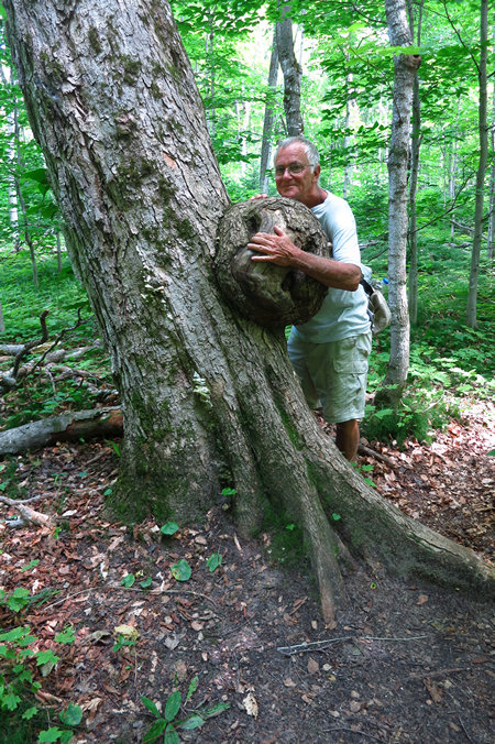
As we walked from the parking area to the trail head we spotted this nice sized burl on a Sugar Maple.
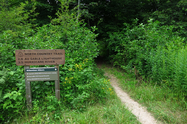
I always like to see this sign at trail heads or anywhere else for that matter.
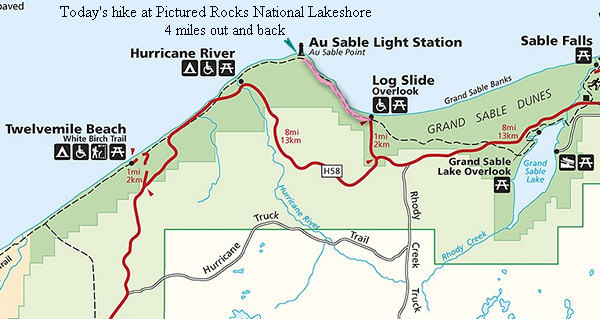
The beginning of the 4 mile out and back hike to the Au Sable Lighthouse Station.
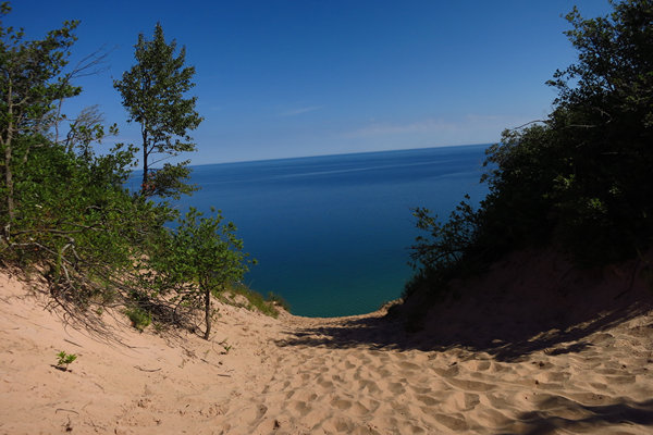
The view from the top of the log slide (aka Devil's slide) where many thousands of logs were slid down the 300' to Lake Superior to make their way to the mills. The logs were gathered into what were called "rafts" and floated to the site where they would be boomed out of the lake and sent to the mill.
Chutes for sending decked logs into the lake for rafting were fairly common. Besides the most famous at Devil’s Slide, east of Au Sable Point, there were slides at Miners Castle and one other location. The mammoth wood slide was built into the slope of the Grand Sable Dunes at a point approximately 300 feet above the lake surface. The angle of the slide would have been about 35 degrees.
Rafting presented special problems on the Great Lakes, especially when they had to be towed some 200 miles of treacherous and storm swept water. To solve the difficulty, an entirely new type of log boom was developed. It consisted of threading a series of large pine logs, three or four feet in diameter on a heavy logging chain passed through holes drilled in the logs.
The massive floating fence would surround a free mass of floating logs covering from ten to twenty acres and resembling a large balloon. In 1885, three million feet of logs were successfully towed to Bay City on Lake Huron from Lake Superior. In 1887, 30 million feet of logs were rafted down from Superior to Lake Michigan. Sullivan once rafted an eight million foot raft to Alpena, Michigan.
Source: National Park Service
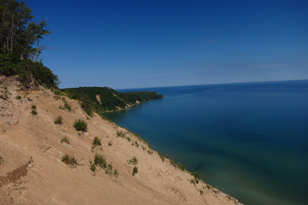
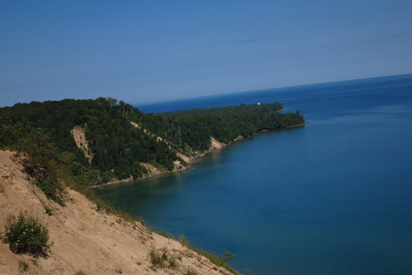
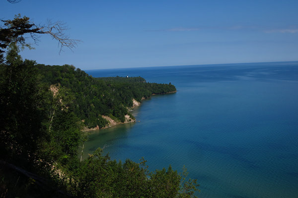
The tiny white speck on the right of the photo is the Au Sable Light Station where we would be hiking to today.
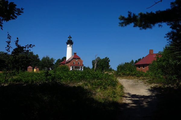
A closer look at the light station. Imagine a different scene than this picture perfect summer day: think gale force winds, think white capped waves, and blinding snow. Annual storms on Lake Superior regularly have wave heights of over 20 feet. Waves well over 30 feet have been recorded.
Think Edmund Fitzgerald.
Down in the inlet to the left turned out to be a nice place for a refreshing skinny dip.
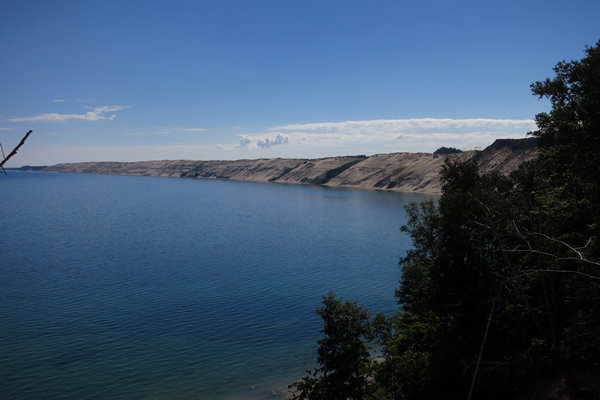
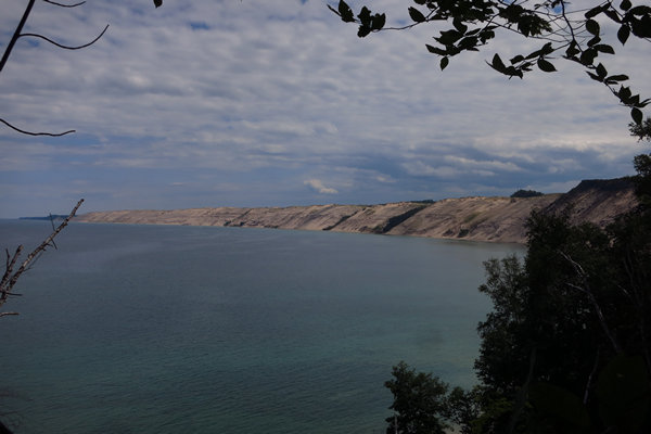
The impressive and beautiful 5 mile long Grand Sable Banks and Dunes.
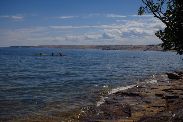
We would see this trio of kayakers a bit later in the day when we stopped for lunch.
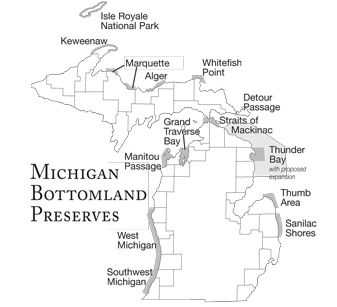
Map of Michigan’s Underwater Preserve System
It is interesting to note more than just the water, shorelines, forests and cultural resources are protected.
In the early years of the United States, the Great Lakes were a natural highway to its interior. The vast inland waterway provided convenient but dangerous transportation. Sudden storms, fog, heavy traffic, and shipping companies demanding that schedules be kept regardless of weather, all resulted in the loss of thousands of schooners, steamers and barges. The bottomland of the Great Lakes is littered with these lost ships that are time capsules from another era. They have been preserved by the cold, freshwater of the Great Lakes.
The Michigan underwater preserve system was created in 1980 by legislation supported and largely drafted by Michigan sport divers. They took action to preserve Michigan's shipwrecks for later generations. The legislation imposes stiff penalties for disturbing shipwrecks and their artifacts. It is a felony to remove or disturb artifacts in Michigan's Great Lakes. Those caught removing portholes, anchors, chain, deadeyes, blocks or other "souvenirs" will have their boat, car and equipment confiscated and will face up to two years imprisonment and large fines. Divers who have information about the theft of artifacts can report violations to the Michigan Department of Natural Resources at (800) 292-7800.
Since 1980, Michigan's underwater preserve system has grown to occupy more than 2300 square miles of Great Lakes bottomland in twelve distinct underwater preserves. They protect some of the region's most sensitive and historic underwater resources.
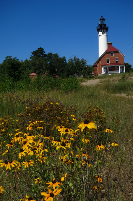
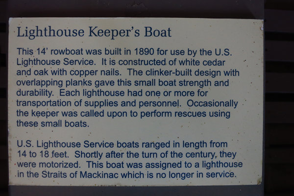
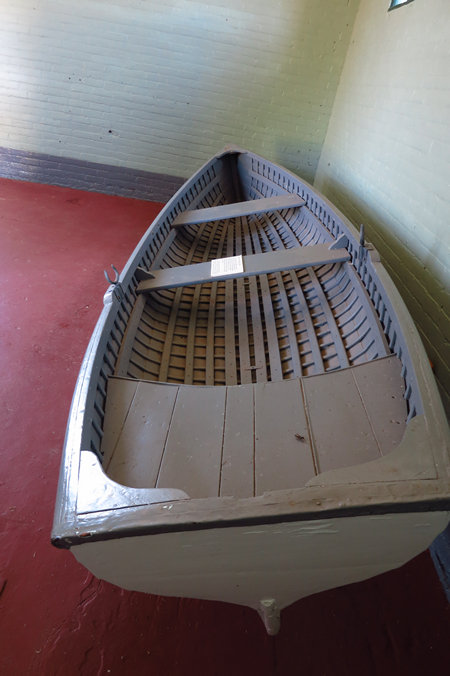
Here we are at the light station after a pleasant hike along the wooded shores of Lake Superior. The building on the left houses the light keeper's boat and the high pressure tank which was used for the warning horns.
The Au Sable Light Station was built in 1874on Au Sable Point, a well known hazard on Lake Superior's "shipwreck coast". The Au Sable Point reef is a shallow ridge of sandstone that in places is only 6 feet (1.8 m) below the surface and extends nearly 1 mile (1.6 km) into Lake Superior. The Au Sable Point reef was one of the greatest dangers facing ships coasting along the south shore of Lake Superior during the early shipping days when keeping land in sight was the main navigational method. The Au Sable Point reef was known as a "ship trap" that ensnared many ships, including the passenger ship Lady Elgin which was stranded there in 1859.
Source: WikiPedia
The proverbial brick shit house. Built to last!
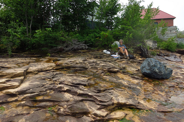
Time for lunch so we headed down to the water's edge to enjoy the view.
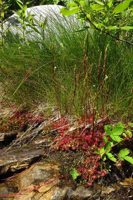
This healthy clump of Sundew (Drosera rotundifolia) was growing right at the shoreline's edge, directly behind Betsy.
Drosera rotundifolia — the round-leaved sundew or common sundew — is a species of sundew, a carnivorous plant often found in bogs, marshes and fens. One of the most widespread sundew species, it has a circumboreal distribution, being found in all of northern Europe, much of Siberia, large parts of northern North America, Korea and Japan but is also found as far south as California, Mississippi and Alabama in the United States of America and on New Guinea.
The leaves of the common sundew are arranged in a basal rosette. The narrow, hairy, 1.3-to-5.0-centimetre (0.51 to 1.97 in) long petioles support 4-to-10-millimetre (0.16 to 0.39 in) long laminae. The upper surface of the lamina is densely covered with red glandular hairs that secrete a sticky mucilage.
Source: WikiPedia
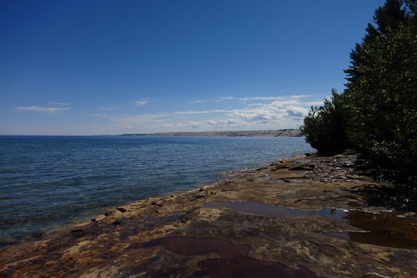
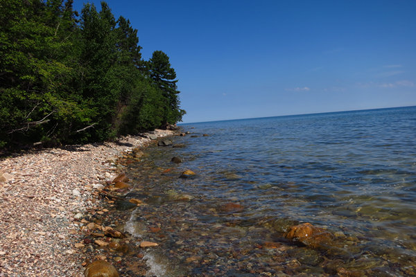
When we went down to the shoreline we could see what I think is a shale shelf/pavement extending out into the water. This is what I love about the shoreline and beaches up here in the Great Lakes. They can be strewn with rocks and cobbles, or clean sandy beaches, or pavement.
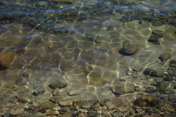
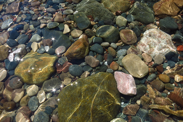
I love all the interesting patterns the combination of water movement and sunshine makes.
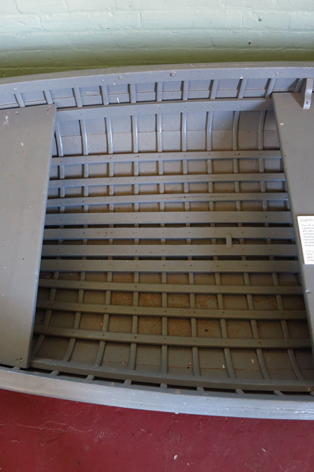
Clinker built (also known as lapstrake) is a method of boat building where the edges of hull planks overlap, called a "land" or "landing." In craft of any size planks are also joined end to end into a strake. The technique developed in northern Europe and was successfully used by the Norsemen and typical for the Hanseatic cog. A contrasting method, where plank edges are butted smoothly seam to seam, is known as carvel construction.
Examples of clinker-built boats directly descended from those of Norsemen shipbuilders are the traditional round-bottomed Thames skiffs of the River Thames, and the larger (originally) cargo-carrying Norfolk wherries of England
Source: WikiPedia
Quite the beauty.
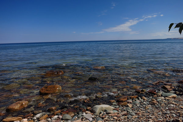
On the return trip we found a peaceful and quiet spot to enjoy the beauty of the sparkling water.
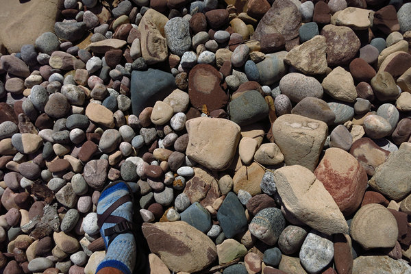
I always find the many shapes and colors of the cobbles to be fascinating.
The crystal clear waters of Lake Superior.
Gorgeous...
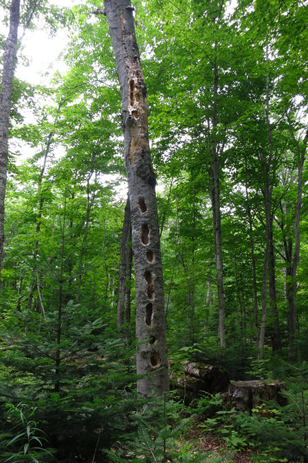
This Beech snag has provided both food and shelter for wood peckers. From the size of the cavities I would guess them to be Pileated Woodpeckers.
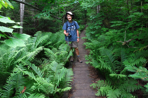
One section of the trail traverses a low wet spot which this Ostrich Fern (Matteuccia struthiopteris) flanked boardwalk spans.
One last look at the Banks before we drove back to Munising.
When we got back to Munising we checked into Scotty's Motel: 44.95 for two with the senior discount.
As was to be expected the place was full up and I noticed in particular a group of about 8 people who seemed to be there together who got back from a hike and then rushed around and took off again.
We heard them later. Much later. About 11:00 we were awoken to the slamming of many car doors and loud and boisterous talk.
They decided to all sit outside and loudly talk as if they were the only ones in the world who were staying there.
I stuck my head out the door and asked them to keep it down. That worked great. Not!
Not a good start to our first night at Scotty's.
The next morning I awoke cranky from lack of sleep and Betsy's back was killing her which concerned me greatly.
We talked things over and made the decision to start the drive home that morning. And with that our "Three Weeks in Michigan" got trimmed to two.
We arrived back in Wheeling on Saturday, July 22nd. We were delighted to see how lush everything in the yard looked and how much growth everything had. It was starting to look like the North American jungle.
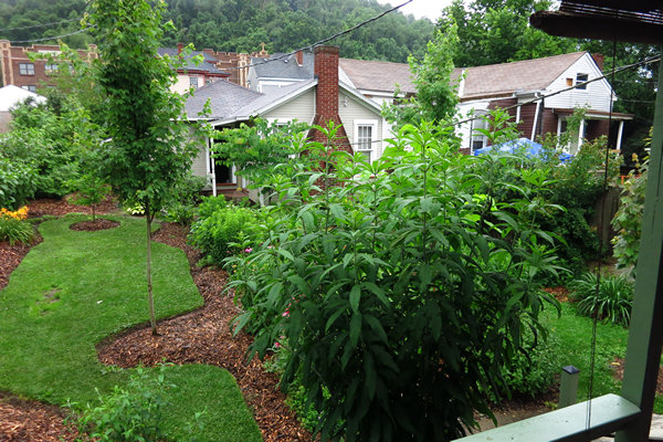
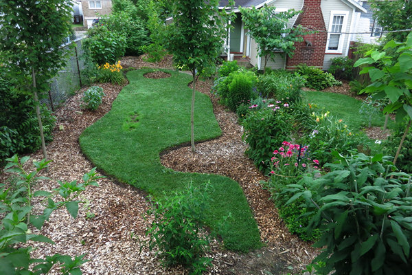
Here is what one side of the back yard looked like upon our return.
BTW - everything you see here was planted by us over the last two growing seasons. When we moved in the only thing growing on the lot were two large privet bushes and grass.
About a week before we left for Michigan I made a push and got all the edging done. In the foreground, to the right is Joe Pye weed (Eutrochium purpureum) which I brought up with us from Morgantown.
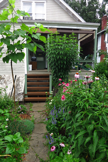
We had also just replaced the back steps and the porch railing. Note the basement hatch door on the left. I replaced that just before we left for Michigan with a one piece hatch cover made from 5/8" plywood which had more coverage and fit much tighter than the old half rotten two piece hatch.
This was shot from the roof of the back porch.
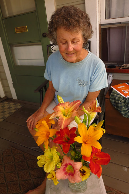
We also brought a bunch of our day lilies. I am glad we did.
Two days later the yard looked like this.
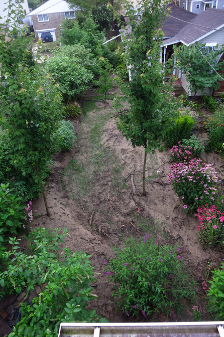
These two photos were shot from the back porch roof. Compare them to the one above.
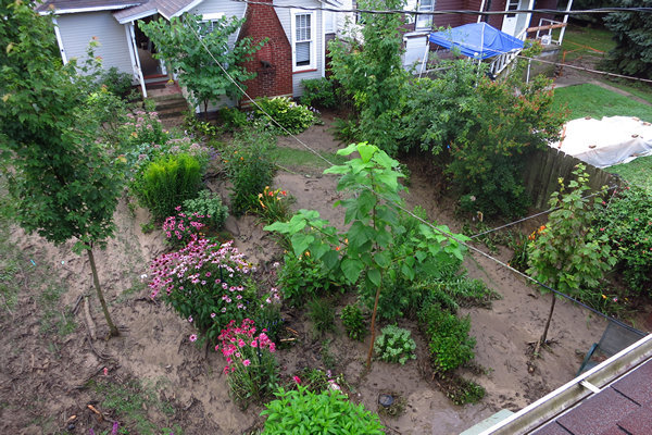
This is what is likely to happen when you live in a flood prone area. The mud and debris was deposited by a torrent of water two feet deep travelling at a velocity so fast I had trouble keeping my footing. And there was not one thing I could do but watch in disbelief and eventually go to bed wondering what the morning would bring.
Our neighborhood of Woodsdale was hit hard. Numerous people had very high water and lots of mud in ther basements. We did not. Replacing the hatch cover kept out most of the water and nearly all the mud. We had no damage to the house or loss of personal possessions.
The day after the flood there were two large roll off dumpsters being filled by my neighbors with all the stuff they had in their basements. Over the next few days as I drove around the neighborhood I saw that same scene again and again.
Although we are still cleaning up the yard damage, we got off easy.
If you enjoy looking at mud there are more photos here.
'Till next time,
Mike and Betsy


