Massif Central
From Wikipedia, the free encyclopedia.
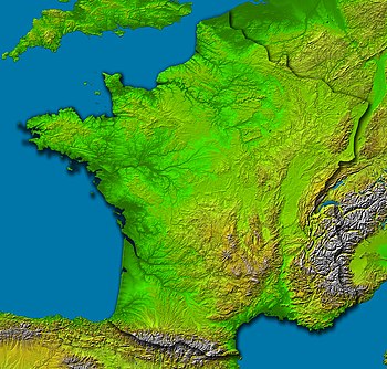
The Massif Central is an elevated region in south-central France, consisting of mountains and plateaus.
Subject to volcanism that has subsided in the last 10,000 years, these central mountains are separated from the Alps by a deep north-south cleft created by the Rhône River and known in French as the sillon rhodanien (literally "the furrow of the Rhône").
Contents |
Administration
The following départements are generally considered as part of the Massif Central: Allier, Ardèche, Aveyron, Cantal, Corrèze, Creuse, Haute-Loire, Haute-Vienne, Loire, Lot, Lozère, and Puy-de-Dôme.
The following régions are part of the Massif Central: Auvergne, Limousin. Part of the following régions are in the Massif Central: Languedoc-Roussillon, Midi-Pyrénées, and Rhône-Alpes.
The largest cities are Clermont-Ferrand and Saint-Étienne.
Mountains include
- Puy de Sancy (1886 m)
- Plomb du Cantal (1855 m)
- Puy Mary (1787 m)
- Mont Lozère (1702 m), the highest non-volcanic summit
- Mont Aigoual (1567 m), near Le Vigan
- Puy de Dôme (1464 m)


