Day Six: Tuesday, May 14
Exploring the Black Isle
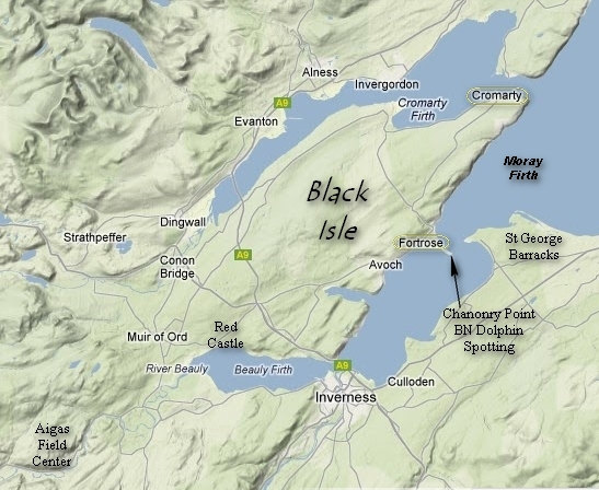
The Black Isle is about 15 miles east of he Aigas Field Centre and just to the north of Inverness.
The "Isle" is surrounded by water on the 3 sides by Beuly, Cromarty and Moray firths. Firth means estuary.
Obviously, if it is surrounded on only 3 sides it cannot be an island. Apparently in the early days of settling the area it was thought to be an island since from many view points one could see water in all directions.
Rangers Allie and Imogen would be our guides today. Around 9:00 we all piled into the van and started the drive east to our first stop: Fortrose.
Allie had lots of info for us to digest and imparted many interesting tid-bits about the area. Certainly more than any of us could remember.
Along the way Allie pointed out a place called "The Crask of Aigas". I had seen this on the maps was quite curious about the word "crask". Apparently it means a flat spot, one that was left by the glaciers. The crasks are scattered about and made handy building sites for homes, churches, etc.
As we drove along the Beauly (beautiful) River we passed a Scottish Power generating station. It is on the site where there was once a waterfall. It was a place of beauty and romance and where it was common for the locals to make proposals of marriage.
When siting the power station the waterfall site was chosen so as to keep it better hidden from the roadway and surrounding vantage points. And, I have to say they did succeed.
We then passed through Kilmorack. Allie told us the "kil" means church. Thus the frequency of the prefix in place names. In days of old it was more practical to build a settlement around the church and thus not have to make a lengthy journey by foot, wagon or horseback. The church at Kilmorack fell into disuse and is now an art gallery.
As we skirted the town of Beauly we passed by raise beaches - an after effect of glaciation. Most of these ancient beaches are now farm fields. Some of these fields had the "Standing Stones" left by the pagan Picts.
At one point we went by a "Kettle Loch" which is a small, water filled shallow depression cause by glaciation.
Then it was through the town of Tore which became famous for it's bleached linen.
Near Tole is the "Clootie Well" which is easily recognized from the roadway by all the bits and pieces of clothing hanging from the trees and shrubs.
Here's the story, it is thought if one has and illness and visited the Clootie well they shall be cured if the dip, 1, then 2 then 3 ladles of water and drink the fourth. Then they must place an article of clothing which represents the area of the illness: gloves for hands, socks for feet, etc.
This as been going on for a long time and was never a problem until clothing made from synthetic materials became common. Now, instead of a cotton or wool article clothing decomposing in the wet Scottish clime, the pits and pieces hang around for many years and this creates quite an eyesore.
The Highland Council decided the area should be cleaned up but they could find no one to take on the job. Not even with the offer of 3 times the going wage rate. So, the people continue to visit and the area continues to become more and more unsightly.
We then passed the old fishing village of Avocet. Interesting story here: before a dock was built the fishermen would leave their boats out in the shallows so as to avoid the rocky waters to the shoreline. This meant they had to start out their day by wading the cold waters to their boats and wading back to the shore at the end of the day.
Then started the custom of the wives carrying their men to the boats in the morning and meeting them upon their return back home to carry them back. It is said in order to make this chore easier on all, men would look for large strong women to marry and the women would look for small men to court. True story...?
Then it was on to the town of Fortrose and the old cathedral. We no sooner parked and got out of the van when it started to pour. That happens a lot around here. We then took to the street and walked towards the cathedral, taking a few shots along the way.

Betsy had to hastily ditch her bottle when we saw this sign. "Maximum Penalty £500" Yikes!

Passing the post office we saw these mail delivery bikes. Can you imagine what would happen if this was asked of carriers in the US?

Here is the old cathedral ruin. Allie had volumes of info about this place, none of which I can remember.

Seems as if there are always dead people lying about churches.

As well as all manner of grim warnings and imagery.

One can only imagine how beautiful the stained glass windows must have been.

Obviously the clock and weather vane are new. And, ridiculously out of place as far as I am concerned.

The church yard was surround by old yew trees. These are most commonly seen in the US as tightly clipped, low hedges.

This, the south door of the church at one time had a projecting porch. This was where the common folk would be wed as they could not afford the use of the entire church.

The round stone at lower left was placed there for the gentrified to mount their horses. Note the bright blue Scottish sky.

Yep, they still have them. But you can send text messages as well as make local and international calls. Not the mail on the front carrier of the bike.
We said farewell to Fortrose and continued on to Chanonry Point for a bit of dolphin spotting.

The beach was lovely if a bit windy.

Normally, Betsy would be stripped down and in the water by now. But not today...

As we walked along the beach to Chanonry Point we saw this one section which was covered with these stones. Why?

Gorgeous scenery is made spectacular by a little bit of sunshine and come blue sky.
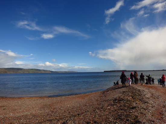
Here we are at Chanonry Point. And, we are not only ones hoping to site the Bottle Nose Dolphins. In fact, there can be 100s of people here on a summer day.
This is considered the best place in the UK to see Bottle Nose Dolphins from land. Here is why.
What you are looking at is the remains of a terminal moraine - an area where a glacier dropped massive of amounts of stone and sand which they ground up as they moved south. This particular one was eventually breached by incoming tides, no doubt over millions of years. This left a deep, narrow channel into the estuary which the salmon use. The dolphins now have their own version of "shooting fish in a barrel" and feast on the them as they make their way into the estuary.
The structure across the firth are the walls of St George Military Barracks.
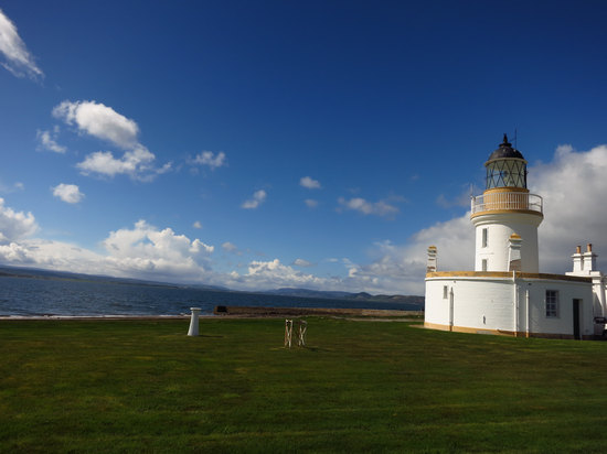
With such a narrow channel it was no surprise to see a light house here.
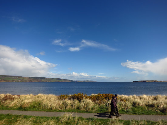
A lovely view of the firth, St George and ubiquitous Gorse.
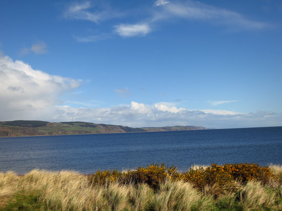
One last shot before we headed down the road to Cromarty.
Our route took us by Fairy Glen, named for the Fairys, who with the help of wizard Michael Scott were almost successful in building a bridge across the firth.
We also passed by the Navity Farm. Here, once upon a time men with horse draw plows would compete to see who could plow the straightest furrow.
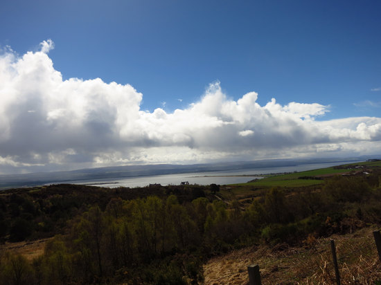
Our route took us high above the firth. This shot shows St George on the left and Chanonry point on the right.
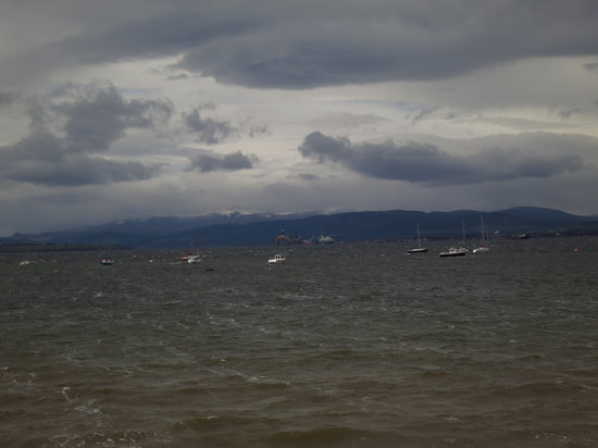
Here we are at Cromarty Firth. At one time Cromarty was a prosperous fishing town. But, when the railroad went through it by-passed Cromerty and this was the beginning of it's decline.
However, with the help of tourism and the buying of the old homes for B&Bs and vacation homes, it is undergoing a renaissance of sorts.
Betsy and I walked through the old streets and alleys for about an hour or so. The town is quite beautiful and well preserved. Why I took not one photo I do not know.
We departed Cromarty and headed down the road to our last stop of the day: the ruin of Redcastle which sits perched above Beauly Firth.
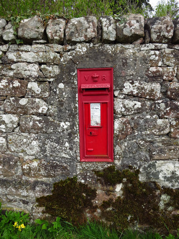
We parked along the firth at a pull-out and Allie and Imogen led us up the hill to the castle. The old estate is surrounded by a beautiful old stone wall.
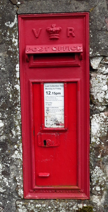
Here is does double duty as a place for a post box.
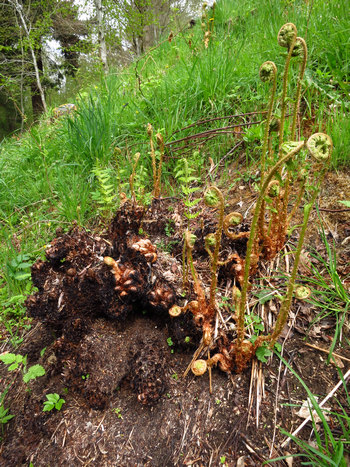
Near the top of the hill I spotted these charred ferns. Up until this time I had never thought of them as being fire resistant.
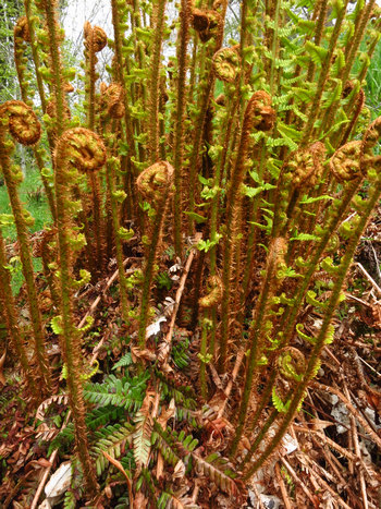
A sight we have been seeing everywhere - millions of emerging fronds.
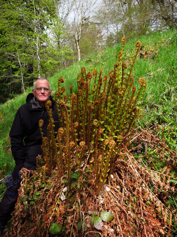
Normally these would be fully expanded. But with the late spring they still have a ways to go.
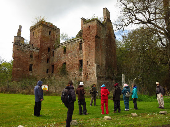
The sad old ruin of Redcastle. Several owners ago it was lost in a card game. Then, that owner only wanting the land and not wanting to pay taxes on the castle, had the roof removed. This made it uninhabitable and thus not taxable. If I have my facts straight it is now owned by the brother of Lucy Lister-Kaye.
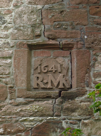
This was set in the side of one of the walls.
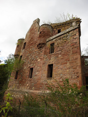
If nothing is done it will not be long before this old skeleton is just a heap of bones.
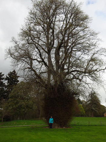
I am still trying to find out what this trees is. There were several of them and they all had the dense sprouting at the base.
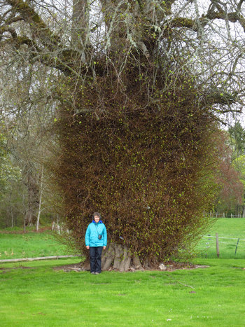
"Mystery tree at Redcastle, stump sprouts, large tree, my first guess is always basswood ('lime' there in UK and Europe), Tilia vulgaris in UK. Tilia americana here." ~Email from Larry Osborn
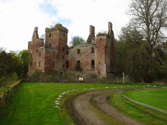
One last look before we started on our walk back down to the firth.
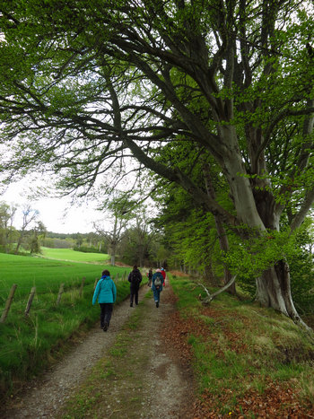
We saw many fine old beech trees along the way. The beech, like so many other trees which are common here, are not native.
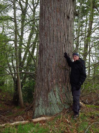
This is the largest Japanese Larch I have ever seen!
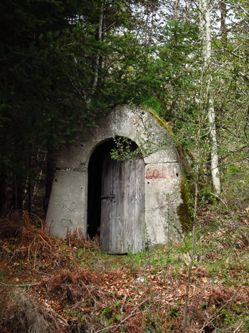
We were all mystified as to what this could be. I scrambled up the bank and had a look inside. It was being used for general farm storage. But, the heavy base and thick ribbed roof made me think if a bomb shelter. Indeed, that is what is was - and air raid shelter from WWII.
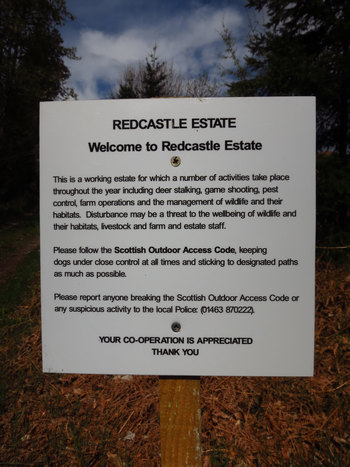
An explanation of the farm workings, natural assets and a plea to treat them gently as you pass by.
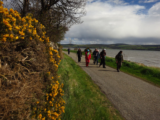
We eventually came down to the road we had driven in on and had a nice, mostly sunny stroll back to the car.
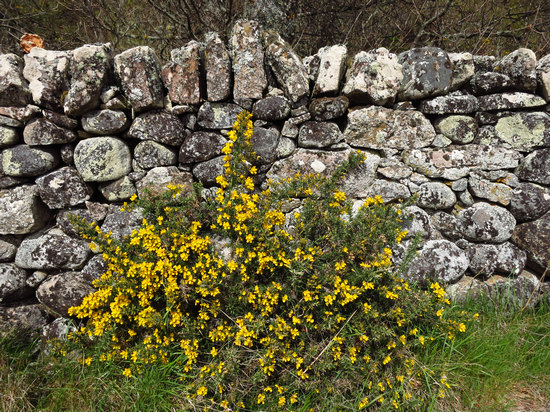
Last shot of the day - Gorse, nicely set off by the old lichen encrusted rock wall.
Then it was back to Aigas for yet another gourmet meal. How did we get so lucky...?
Stay tuned....