11 (W) September 2013
Rogers City to Cedarville
We left Hoeft State Park, which is just north of Rogers City around 11am and continued north on US 23. This would take us to Mackinac City and the Mackinac Bridge, the gateway to the Upper Peninsula (UP).

As we approached Mackinac City we were presented with two options to get to the bridge and UP. We could hop right on I-75 or go through Mackinac City. Having never stopped in Mackinac City we decided this was a good time.
As we drove along the main drag we were stunned by the number of hotels and tourist shops. It was non-stop, wall-to-wall tourist trap. Betsy and I both shuddered at the thought of what this must have been like just a few days ago over the labor day weekend. Grid lock!
But now it was relatively empty and quiet. Whew!
Click on the photos below for a larger image.

We pulled into one of the many empty parking spaces adjacent to Michilimackinac State Park where one can get a good view of the bridge and lighthouse.

Mackinaw Point marks the junction of Lake Michigan and Lake Huron. Founded in 1889, the Old Mackinac Point Light Station was in operation from 1890 until 1957.
Even before the advent of European explorers, the Straits of Mackinac were a significant hazard to water borne travelers. Consequently, before lighthouses, the Ojibwa lit the shore with fires.
Source: WikiPedia


"Mighty Mac" as seen from east side of Michilimackinac State Park. Soon we will be rolling across the UP. Yippee!

I have yet to cross this bridge when there was not some type of maintenance going on. Today was no exception.
When we crossed the bridge we stopped briefly at the info center for some brochures and maps. I would add these to the already weighty pile of stuff we have collected over the years.
Now we were on a mission.
Way back in 1977 I, along with Joe Beitel and Herb and Florence Wagner, made a stop in the UP on our way back from Lake Itaska Biological station in Minnesota. I had just spent six weeks there as unofficial teaching assistant for a graduate level class in fern biology which the Wagners were teaching. Joe had joined us later in the semester, flying in on a puddle jumper. When the class ended we all drove back to Ann Arbor together.
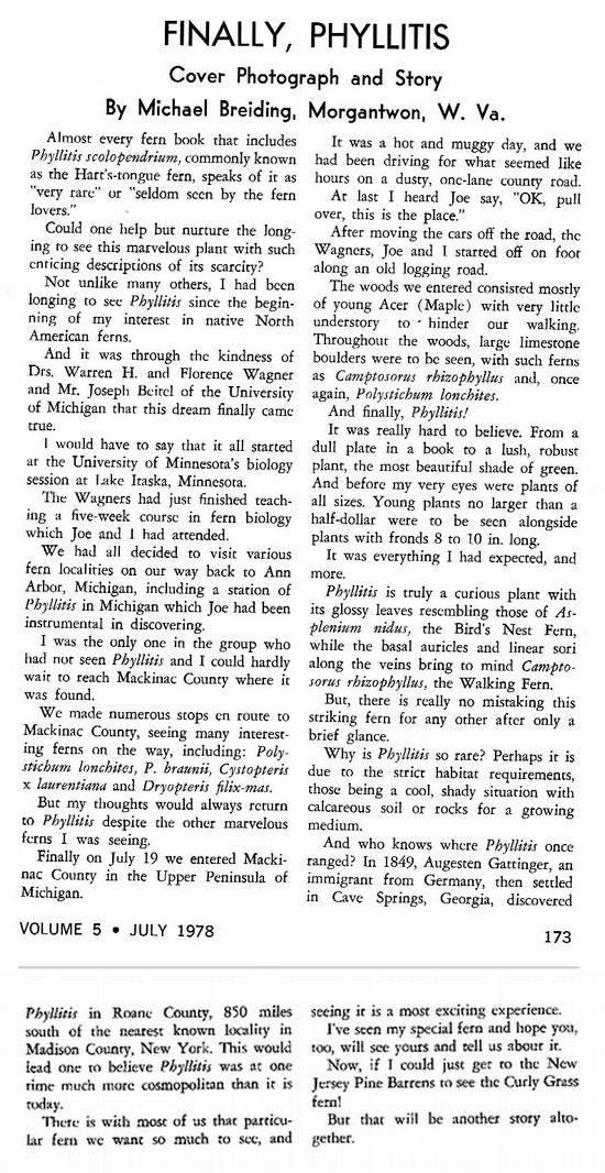
Previously Joe had located a population of a very rare fern - (Asplenium scolopendrium) AKA the Hart's Tongue Fern. Back in those days it was still assigned to the genus "Phyllitis", a name I still prefer.
With Joe as our guide, we drove a series of back roads to the site he had found. There was much excitement when we saw the first plants growing on and at the base of large limestone boulders which were scattered about in a maple woods.
I kept notes of the location and this seemed like the perfect opportunity to try to relocate the fern colony.
The location was in the area of the Daggett Lookout Fire tower. Betsy and I were able to locate this on a map but doing so on the ground was another story.
As we drove along Simmons Road, the location of the fire tower access, we passed numerous roads, all were private or unmarked. Betsy calculated the distance from the previous intersection and a bend in the road and we realized we had missed our mark.
We back tracked watching the odometer carefully. Finally we came to an unmarked road which had a cable across it. The road went up the hill and disappeared.
We parked and went up the old road. There we found the remains of the tower foundation along with a makeshift hunting camp.
There were indeed the many limestone boulders in the woods and we set about looking over each one.
This went on for over an hour and bore no fruit.
One thing that did not seem right was I remembered a much more open woods with bigger trees. Now I could see the evidence of logging. Many stumps. And the open canopy had allowed brambles and millions of ash and maple seeds to grow.
Had this done in the plants of Asplenium scolopendrium? Were we in the exact spot I had been nearly 40 years ago? Hard to tell.
Eventually we gave up and headed back to the car. Very disappointing.

Is this the woods were once Phyllitis grew?

The intrepid fern hunter takes a break.

How I would have loved to have seen this, or any other limestone boulder with plants of Phyllitis growing on and about it. Maybe on another day, in another woods...
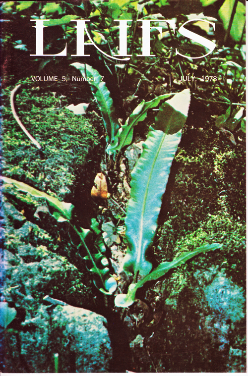
By the way, I wrote up that original visit with Joe and the Wagners for a fern publication:

A photo I had taken on the original trip was used on the cover of the magazine.


We got back in the van and slowly navigated our way back to SR 134, the route we needed to continue east.

We saw this sign out near the main road. Damned eco freaks are always complaining!
"Disappearing wetlands lead to depleted fish stocks and toxic water" - Restore our Water
Then it was east to Drummond Island - or so we thought. By the time we reached Cedarville, we were ready to call it a day and look for a bed for the night.
We passed several places in town but none struck our fancy. But we got lucky.

On the outskirts of Cedarville we found the "Les Cheneaux".
Betsy went in to inquire about rates and look at room. After a bit she came back to the van and said "This is our kind of place - they are two bedrooms with kitchenettes for sixty dollars and WiFi". When I heard that, the idea of continuing on to Drummond Island sounded even less appealing. So we made the on-the-spot decision to stay at the Les Cheneaux Motel.
We registered for the night and then it was off down the road to De Tour State Park - or, once again, so we thought. Before we knew it, we were in the town of De Tour Village which was a much smaller town than we anticipated. We saw no lodging which looked like it was open. Glad we opted for the Les Cheneaux Motel.
We doubled back to look for De Tour State Park. All we saw was a sign for "De Tour State Forest". Had we looked closer at our map we would have realized they both shared the same access road. But why we did not see a direction sign is a mystery.
By this time we just wanted to get out of the car and enjoy some of the last few hours of sunshine on this glorious day. We had passed by a road side rest earlier and decided to check it out. To our delight it had a lovely beach with expansive views of the Les Cheneaux Islands.
It took us no time to get the chairs, beers and cooler out and down to the beach where we enjoyed a very nice Happy Hour.

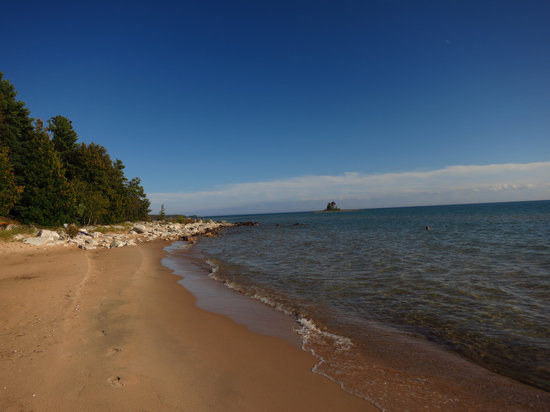
The view from our Happy Hour spot on the north shore of Lake Huron.

Betsy's chair was buried in the van so she sat on a rock with a fleece jacket as cushion.

Yet another secluded beach for the Skinny-Dippin' Queen!

The tall trees, big boulders and cobbles made this beach seem wild and remote.

Our last look at this lovely spot before heading back to the hotel.
We put the kitchenette to good use that night and had a tasty supper of salad, baked beans and kielbasa.
We had hoped to stay another night at the Les Cheneaux, but the following day the place would be full of cyclists and not one room was available.
We had a quiet evening and while looking at the maps decided to change plans and head west the next morning.
'Till next time...