12 (Th) September
We departed the Les Cheneaux Motel in Cedarville around 8:30. Rather than go on to Drummond Island we decided to head west to Manistique on the north shore of Lake Michigan.

The drive was not long, about two hours, so we decided to look for a hike in our copy of the UP hikers' bible - "Hiking Michigan's Upper Peninsula" by Eric Hansen. We found a hike which sounded promising and was barely off our route to Manistique and about an hour west of Cedarville near Moran.
The hike as described by Hansen was a 10 mile out and back along the North Country Trail (NCT).
The North Country National Scenic Trail (NCT) stretches approximately 4,600 miles (7,400 km) from Crown Point in eastern New York to Lake Sakakawea State Park in central North Dakota in the United States. Passing through the seven states of New York, Pennsylvania, Ohio, Michigan, Wisconsin, Minnesota, and North Dakota, it is the longest of the eleven National Scenic Trails authorized by Congress. Like its sister trails, it was designed to provide outdoor recreational opportunities in some of the America's outstanding landscapes. As of 2010, over 2,100 miles (3,400 km) have been certified.
Source: WikiPedia
There are about 1150 miles of the NCT in Michigan. About 750 in the Lower and 450 in the Upper Peninsula. This adds up to a lot of great hiking. We had been on the NCT before and were never disappointed.
Click on the photos below for a larger image.

After finding our way to our starting point we hit the trail around 10:30. For September the woods were lush and beautiful. Here, as at home, there had been plenty of rain straight through the summer.

One thing which confuses us on every trip to "The Yooper" is the maze of US Forest Service roads. The intersections on the ground seldom match what is on the map.

Near the beginning of the hike we passed by Guard Lake. We stopped for a bit hoping to see or hear some bird life. But now, in September, all was still and quiet and we seldom heard more than the croak of a raven.

This young section of the woods was thick with maple saplings.

We were not sure if this was the tail end of Guard Lake or a beaver pond.

We were delighted to see this plant of the Northern Holly fern (Polystichum lonchitis). This was the first of many, including some much larger specimens, we would see on this hike.

All of the limestone boulders were covered with moss.The area looked identical to the Daggett Fire Tower Harts Tongue fern site. Once again my thoughts turned to Phyllitis. Would today be our lucky day?

We saw ramps, ramps and more ramps. The forest floor was a sea of them. This place must be a solid green carpet in the spring time.

We saw more Northern Holly fern, sometimes in the company of Bulblet Bladder Fern.

Twice our trail took us across Forest Service Roads which were green tunnels.

We saw dense islands of Maidenhair Fern (Adiantum pedatum) scattered through out the woods.


We saw a number of Jack-in-the-pulpit (Arisaema triphyllum) fruit heads. This was one of the bigger ones.

Doll's Eyes (Actaea pachypoda) was also in fruit...
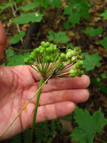
...as were the ramps.
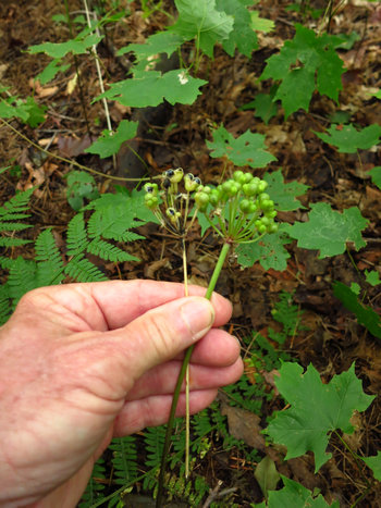

After 4 miles of very pleasant hiking we reached the icing on the cake - a limestone escarpment dripping with ferns. This dolomite reef went on for 1000s of feet and we turned back before reaching the end.

The Bulblet Bladder fern was thick. Oh, how I would like to come back to this place in spring time!
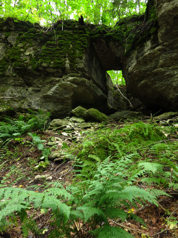
This collapse in the limestone pavement made a nice little window.
We had been scouting the area carefully hoping to see plants of Phyllitis. But we saw not one. Boo-hoo...
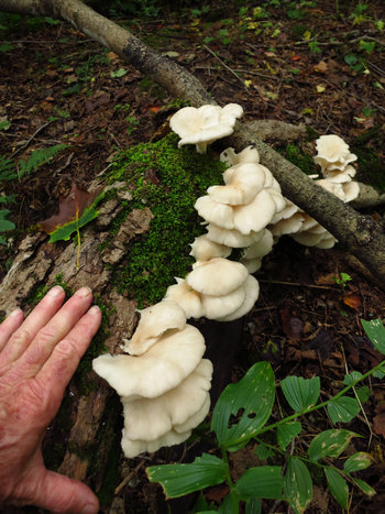
These mushrooms made me think of my buddy Bob who would always ID mushrooms for me while on these trips.
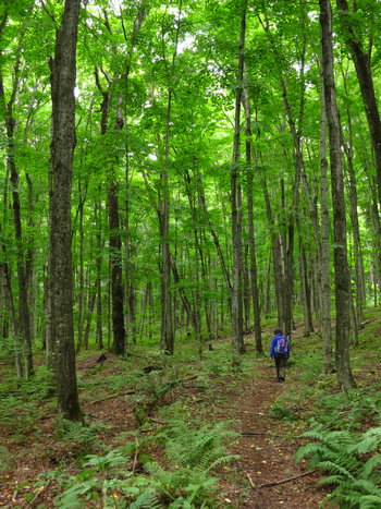
We decided to make this lovely spot our turn around point. Now we got to see this wonderful place all over again as we walked the quiet four miles back to our starting point.
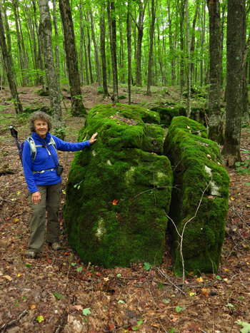
We were fascinated by these moss covered limestone boulders.
BTW this photo was "cleaned up". One of the trees in the background had bright orange paint and flag tape on it. I sent the photo to Raleigh Bill who is skilled in the art of PhotoShopping and he worked his magic. Thanks, Bill!

Boulders, boulders every where but not a Hart's Tongue fern to be seen anywhere.
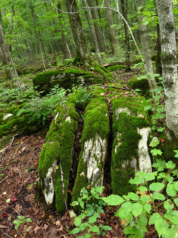
I could not resist one more shot of this interesting looking rock. Yes, we will definitely return someday in Springtime.
We arrived back at the van and made our way to Manistique and the Star Motel. The drive got confusing and longer due to a bridge detour. But we made it there by 5:00 and got settled in.
More on Manistique later.
'Till next time...