Friday - August 8th: A quick visit to South Dakota
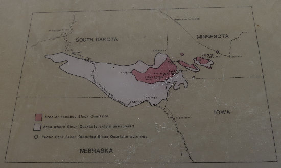
The above map from an interpretive sign shows the distribution of Sioux quartzite, both exposed (pink shading) and subterranean. It is some of the exposed areas in South Dakota we will be visiting today.
Red Quartzite “Gold of Minnehaha County SD”
You have been touring beautiful formations of quartzite in the Garretson area, but mining of quartzite is a multimillion dollar business in Minnehaha County. Three quarries of the pink to shade of purple rock are found in the County. Two are in or near Sioux Falls and the other at Dell Rapids. A 20 to 30 mile wide band of the pink quartzite stretching from the Wisconsin Dells to near Mitchell, South Dakota is the only measurable supply in the United States. Next to diamond, it is the hardest known rock. Because of its durablility, the crushed rock is shipped nationwide to be used in road building, as an additive for asphalt and concrete, and railroad track beds. Quartzite is also used in engine block for Ford and in building colorful panels for building around our nation.In the late 1890?s and early 1900?s, the rock was used extensively to build ornate buildings. Stone cutters from Europe came to help build many large buildings from quarried blocks that are found on Main Streets in many of the area towns including Garretson. The stone was also used as foundations of many area homes and barns. The rock is no longer used extensively in building construction. Quartzite also played another important part in the history of South and North Dakota. The 360 mile border between the two states was marked with 720 quartzite markers, one every half-mile.
Quartzite is relatively easy to mine locally because the rock is located close to the surface. The local quarries are expected are expected to produce stone for many more decades. When it is time for the quarries to be reclaimed, they will probably be used as man-made lakes or for water reservoirs. While in production, the companies are required to follow air and water standards. Trees and other landscaping help contain the dust and keep the mines hidden. Because of safety rules, none of the quarries are able to offer tours.
Source: City of Garretson SD
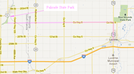
We decided to take the "back route" via county roads for our visit to Palisades State Park. Our copy of the National Geographic Minnesota Recreation Atlas had the route graded to hard surface but that turned out not to be the case. And a short distance down CR 8 the hard top turned to dusty gravel. No problem. The 20 mile drive was scenic - sure beat Interstate 90.

A shot of the wide open scenery along County route 8 between US route 75 and South Dakota route 11.

Looking southwest into South Dakota from CR 8 in Minnesota.
We found Palisades State Park with no problem, paid the $6.00 entrance fee and then looked over the park map to decide on our first walk.

We stopped first at the Interpretive Scenic Overlook. Seen here is a Sioux Quartzite cliff along Split Rock Creek. This was the site of the original settlement of Palisades.
A huge flour mill was once located on the bluff overlooking the park. The mill was powered by a large water-wheel installed along the rushing Split Rock Creek. The once-bustling town of Palisades grew up around the success of the mill. In 1886, silver was discovered downstream. The silver ore proved to be low in quality, however, and the nearly 300 claims were quickly dropped.
Source: Copyright State of South Dakota
So why is there a huge farm building where the town of Palisades stood? Read on...
The city started as a village in Palisade State Park in 1872. The railroad company decided to build a diversion point, (joining of two railroad tracks) and switching yards where Garretson is now located. Railroad officials offered the business people of Palisades free lots if they would move their business to the new town site.
The new city was named after A.S. Garretson, a millionaire railroad investor from Sioux City, Iowa. The City of Garretson began in 1889, the same year South Dakota became a state. Some buildings and homes were moved from Palisades and many new ones built. Several businesses were built of hand quarried quartzite blocks. Many of these unique quartzite buildings were on the east side of Main Street and were destroyed in a fire in 1971. They were replaced by brick buildings. Today Garretson has a population of 1065 citizens.
Source: City of Garretson SD

Adjacent to the overlook is the trail head for the Balancing Rock Trail. This short trail took us down to the creek and had some great views of the cliff faces on both sides of the creek.

A short ways from the parking lot is the trail's namesake.

This is looking northeast back towards the scenic overlook area.

There were several species of ferns growing in the joints of the rock. This one is Rock-cap Fern (Polypodium virginianum).

This fern has thick leathery leaves which help limit transpiration. During dry periods the leaves shrivel and contract as they loose moisture and then expand again when they re-hydrate. This is why some of the species of Polypody are referred to as Resurrection Fern.
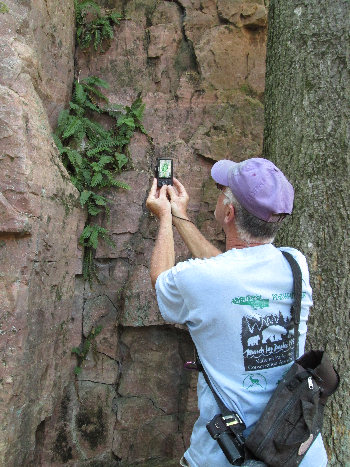
The shooter gets shot! (Photo by Betsy)

Another look at Balancing Rock on our way back up from the creek bed.

We then found the trail head for the Split Rock Creek Trail which meandered north along the creek. At one point the trail crossed the access road to the west side of the park. The Road crossed an old iron bridge from which this photo was shot.
The tree on the left is a Juniper which was loaded with the bluish-white berries.

The water was quite low but looked like a perfect place to play in the water and enjoy the sunny, breezy weather.

We saw evidence of high water - 3 feet up in the trees. It must be quite a sight when the creek is up that high.

We saw more of one of our favorite plants - Swamp Milkweed (Asclepias incarnata).

Cactus - what a surprise! And it testifies to the dry climate here. This is the Little Prickly Pear (Opuntia fragilis). A first sighting for me.

After walking the Split Rock Creek Trail loop we then found the West Wall Trail. This afforded some nice views of the old iron bridge and the west side of the park.
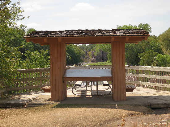
Here near the trailhead were two picnic tables, an overlook and a nice information kiosk.
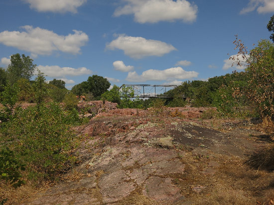
If you look closely, you can see some tiny figures on the left of this photos.
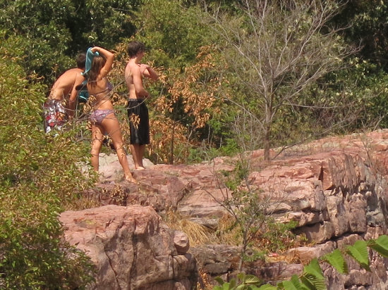
There was a group of teenagers jumping from the tops of the cliffs into the water below.
IMPORTANT NOTE: Although quite tempting, jumping or diving from the rock formations or structures into Split Rock Creek is against the law and carries a heavy fine. Please be very careful when hiking near any of the formations and outcrops. - Palisades State Park trail map
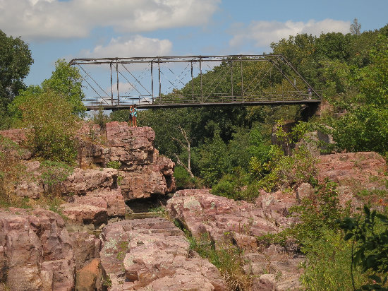
Although it looks like a romantic moment, she is actually texting and he is reading over her shoulder. "Kids today!"
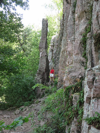
The West Wall trail had some pretty cool formations.
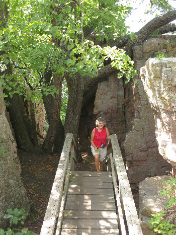
As one might expect, there were trees close to the creek - mainly oaks like this. The set of steps were built around the trees which was a nice touch.
That was the last walk in Palisades State Park. Now it was on to yet another famous place which features the Sioux Quartzite.
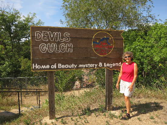
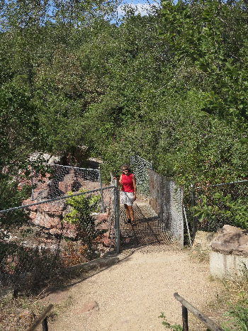
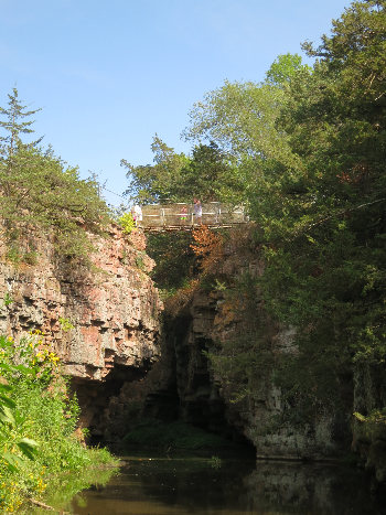
Just a short drive from Palisades is "Devils Gulch", a city park maintained by the town of Garretson. This is the view which made this place famous. It is where Jesse James, while on horse back and being pursued by lawmen, jumped the chasm which the footbridge now spans.
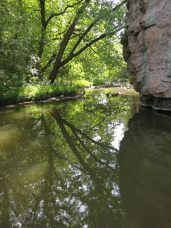
This section of Split Rock Creek is very placid as it meanders thought the Sioux Quartzite canyon.
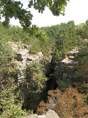
It is difficult to see, but this is a 3 way slit in Split Rock Creek.
After stopping at the gift shop and chatting with two "good old boys" who were volunteering there, we then drove a short distance down to Split Rock Park - another city park.
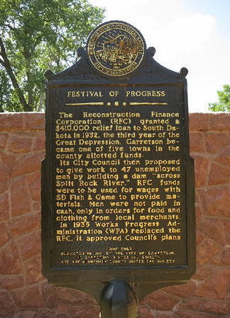
This sign at Split Rock Park is located next to what is now the Gift Shop.
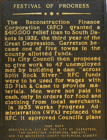
Both the WPA and the CCC put thousands of impoverished people to work doing public projects such as developing state and national parks. What a great use for tax dollars!
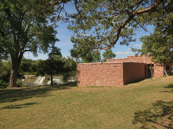
photo0000029.jpg
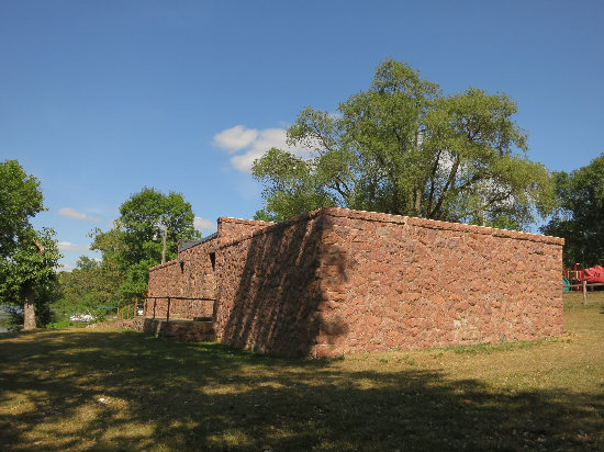
Seen here is the dam and the building which now housed the Gift Shop.
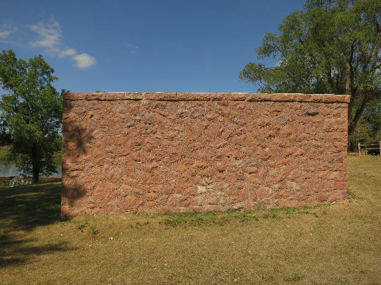
The CCC was famous for the beautiful masonry structures they built, from buildings like this one, to ornamented stone culverts in Zion National Park.
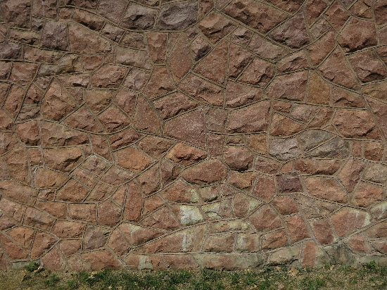
Looks like a crazy quilt!
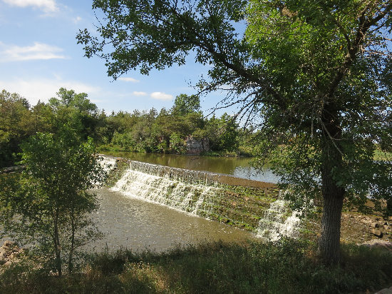
This shot of the dam was the last one for the day. We then sat a while in the shade of a tall Cottonwood tree and enjoyed the sound of the water and warm breezy afternoon.
We were tired and hungry and ready for Happy Hour so we took the quick way back via I-90.
We decided to treat ourselves and eat out. I chose the place "Taco John's". We wanted to eat outside at a local park and this seemed easiest. We took our order to the Veterans' Memorial Park so we could enjoy the last bit of the sunny day.
Betsy got a taco salad. Smart. I got a grilled beef burrito and regular bean burrito. Dumb.
The latter did not even taste like food and I could only gag down a few bites. Oh, well - live and learn!
Then it was back to the room and soon to bed.
Tomorrow we leave the prairie and head north into the lake country.