Saturday, August 20th 2011
Well, this Saturday morning marks my first full week of being on the road. So far I have logged 1,902 miles, all of which I have enjoyed. Now I am in mountain country, quite the change from the rolling hills of the midwest.
Scott and Jen have made me feel right at home. I have my own little nest in their well windowed basement (or is that "window welled"?) where I have set up shop. I have my "coffee station" and a desk to work from and a comfy little single bed just like the one I have at home. Pretty nice!
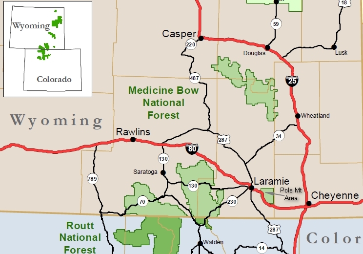
Scott is Betsy's nephew and Jen the woman he was lucky enough to meet and marry. They have three boisterous youngin's which keep the house pretty lively. And when the kids aren't in the house they have all of the Medicine Bow as their playground. Awesome!
This morning Scott is going to take me up to and area of the Medicine Bow where they like to fish, hike and go and camping.
Click on the photos below for a larger image.

The "big" picture from the kitchen door. The expanse of prairie grass (AKA Western Wheatgrass) here will coax in the Prong Horn Antelope and they can be watched right from the kitchen table. Fox are common in the area and their neighborhood is named after the same.

The "small" picture from the kitchen door. The Snowy Range still has plenty of snow even in mid-August.

Just 20 minutes from the front door and we are in the Quiet Country.
Medicine Bow - Routt National Forest is the official title to a U.S. Forest Service managed area extending over 2,769,949 acres (4,328.05 sq mi, or 11,209.59 km²) in the states of Wyoming and Colorado, United States. What were once three separate areas, Medicine Bow National Forest, Routt National Forest and Thunder Basin National Grassland were administratively combined in 1995 due to similarity of the resources, proximity to each other and for administrative purposes.
The Medicine Bow National Forest section (1,096,891 acres) is located in southeastern Wyoming and was originally created as a forest reserve in 1902. Named after the Native American powwows in which numerous tribes would congregate here in search of mountain mahogany, which was an excellent wood for the manufacturing of bows, and to perform rituals hoped to cure diseases and thus make "good medicine".
Areas of interest include the Snowy Range where the highest peak is Medicine Bow Peak at 12,013 feet (3,662 m) and is visible from Snowy Range Pass, 10,847 ft (3,306 m), on Wyoming highway 130. The Encampment River, Huston Park, Savage Run and Platte River Wildernesses are all located within the Medicine Bow portion of the National Forest. Vedauwoo is located immediately north of Interstate 80 and consists of numerous rock outcroppings popular with rock climbers. In descending order of land area the forest is located in Carbon, Albany, Converse, Natrona, and Platte counties. There are local ranger district offices located in Laramie and Saratoga.
Source: WikiPedia

This is the beaver pond area where Scott and his son Parker like to come to fish.
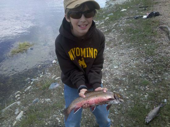
Parker's 16" trout which he caught on his own. WOW!

I thought this dead snag looked interesting so I took a snap.

Scott and I saw lots of Gooseberries with loads of fruit.

I think this is Silkyleaf Cinquefoil ( Potentilla ambigens), but I could not verify that.

This beauty was scattered though out the meadows.

This may Creeping Juniper (Juniperus horizontalis) which is widespread throughout North America.
Also shown here is Sagebrush (Artemisia tridentata). To me no plant evokes more images of the West than this one.

We saw several groups of riders. This gal was solo and had trouble with the fence opening. While I watched her struggle Scott came to the rescue and got it opened up for her. But, at that point the horse decided to engage in a lengthy and copious urination so there was nothing to do but wait.
BTW - the road had cattle guards on it so the horse could not cross via the road.

This is the winding forest service road we were on. It requires a high clearance vehicle and it quite tight in places where it goes through Trembling Aspen thickets.

Here is the Big Bummer. There has been and out break of Pine bark beetle which has caused significant conifer mortality over the Southwest. Scott and I saw some slopes which looked like they had 80% mortality.
The six species of bark beetles involved in this outbreak area all tiny, only around 1/8 of inch long or about the size of a match-head. They are named "bark beetles" because they live and feed underneath the tree's bark. People often wonder how such a small insect can kill a tree.
A single beetle alone cannot kill a tree. The key is the condition of the tree and number of beetles that attack it. The first beetles that arrive at a tree emit a scent that attracts other adult beetles. While stressed trees are the most susceptible, even healthy trees can be overcome by a "mass attack" from many beetles. The adults bore through the bark, mate and lay their eggs.
When the eggs hatch, the numerous larvae then begin feeding on the inner bark, girdling the tree. Additionally, as the adult beetles colonize the tree, they introduce a blue stain fungus that blocks the water conducting cells. This prevents water from getting to the tree crown. As a result, the foliage begins to fade from green to light green or yellow and finally changes to bright red as the needles die. Eventually the red color fades as the needles begin to fall off the tree.
Source: US Forest Service

Mountain pine beetle infestations continue to grow on public and private lands in Colorado and Wyoming. More than 1.5 million acres of forest in northern Colorado and southern Wyoming are affected by the mountain pine beetle epidemic, which was triggered by an extended drought in the late 1990s and early 2000s.
By about 2012, beetles will have killed nearly all of the mature lodgepole trees in northern Colorado and southern Wyoming. Besides affecting watersheds, future timber production, wildlife habitat, recreation sites, transmission lines, and scenic views, beetle-killed trees also present a fuels build-up situation that could result in catastrophic wildland fires.
- Mountain pine beetles are killing pine and spruce trees throughout the Rocky Mountains and western U.S. at an unprecedented rate.
- Extended droughts, warm winters, and old, dense forests have enabled this epidemic to become vast.
- Although bark beetle outbreaks are natural, the current outbreak is a major threat to regional economics and public safety.
- The mass of dead trees following beetle epidemics create severe falling and fire hazards.
- This infestation cannot be stopped. The Forest Service and numerous partners are working to reduce hazards in affected areas and to promote healthy forests in areas that have not yet been impacted.
Source: US Forest Service
It was heartbreaking to see so many dead trees! Scott told me that most of the fatalities have now occurred in these stands so hopefully what is left here will survive.

Here are a few nice survivors which hopefully will produce lots of seed to fuel regeneration.
This photos was taken on one of the trails in the
Happy Jack Recreation Area.
Scott, Jen and the kids come up here in winter to go sledding at the site of the old ski resort. Scott said it was the first time he had seen this area without snow.

The dreaded Fee Station. Plenty of info about fees, but no maps or trail info.
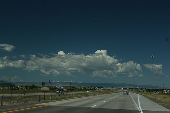
Scott had work obligations so it was back to the Big City at around noon. The constantly changing clouds have been wondrous to behold!
After a bite to eat and a bit of webwork I unloaded my bike and got my cycling stuff out of the van and got ready to roll into Laramie for a look/see.

Two bikes and more fabulous clouds.
I saddled up for the easy ride to downtown and was there in less than 10 minutes.
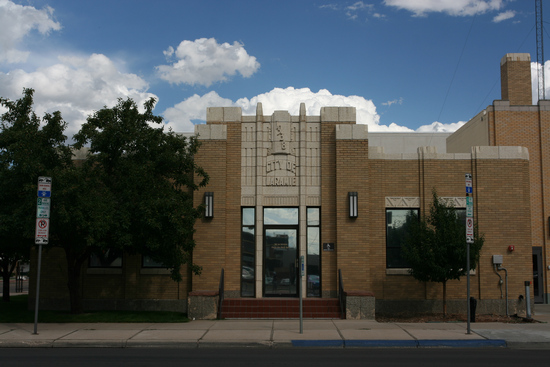
Laramie has a well preserved historic downtown with lots of fine old buildings. I started my tour here at the City Hall and fire station at the SE corner of 4th St. and Ivinson St.
Built in 1938 in the Art Deco style, the original main entrance
is visible on 4th St. While renovations moved the entrance to its
current location on Ivinson, the buildings still house the main
city offices and fire station.
NOTE: Many of the descriptions for the buildings were derived from the publication "Historic Downtown Laramie" published by
www.laramiemainstreet.org
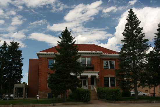
At the corner of NE corner of 4th St. and Grand Avenue is the old Carnegie Library which now housed some of the City offices.
This building was originally home to the Laramie Carnegie Library. One
of many such libraries paid for by the industrialist and
philanthropist Andrew Carnegie, it was built in 1906 in the
Italian Renaissance Revival style; the elevator on the west
side is a later addition. In addition to serving as a library, the
building also contained a small theater in the upper level for
plays, speeches and discussions.
A Carnegie library is a library built with money donated by Scottish-American businessman and philanthropist Andrew Carnegie. 2,509 Carnegie libraries were built between 1883 and 1929, including some belonging to public and university library systems.
1,689 were built in the United States, 660 in Britain and Ireland, 125 in Canada, and others in Australia, New Zealand, Serbia, the Caribbean, and Fiji. Few towns that requested a grant and agreed to his terms were refused. When the last grant was made in 1919, there were 3,500 libraries in the United States, nearly half of them built with construction grants paid by Carnegie.
Source: WikiPedia
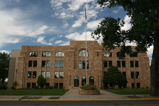
This is the Albany County courthouse at 525 E Grand Avenue. It was designed by Wilbur H. Hitchcock and built in 1931-32.
Hitchcock's legacy is represented in the hundreds of historic homes that he designed in the early 1900s in Laramie, as well as numerous buildings on the campus of the University of Wyoming. He was known as a Renaissance man with a deep appreciation of the arts and literature. He was also a family man and his two sons Eliot and Clinton followed in their father's footsteps opening their own architectural firm in Laramie, Hitchcock & Hitchcock.
Source: Albany County Tourism Board
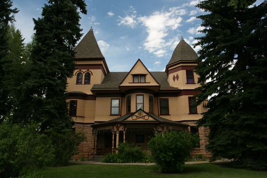
This is the Ivinson Manion which is home to the Laramie Plains Museum.
A fascination history of Edward Ivinson and his family can be read here.
Edward Ivinson (1830-1928) was a native of the Virgin Islands and educated in Britain. He emigrated to the United States. Prior to the Civil War, he and his wife moved to Memphis, Tennesee, where they spent the war. Following the war, he arranged to borrow funds for the purpose of establishing a general store in California. In 1868, Ivinson, his goods, and family arrived at the end of the line at Tie Siding, south of Laramie. There he arranged a contract to provide railroad ties to the Union Pacific. Read more...
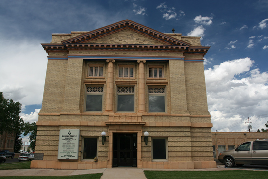
This is the Masonic Temple at the NE corner of 4th and Ivinson Streets.
Built in the Greek Revival style with classic low pitch roof and
front pediment, this building was designed in 1911 by Wilbur
A. Hitchcock and constructed by W.H. Holliday and Company.
The Greek Revival style, which includes such national icons as
the U.S. Capitol Building, had largely fallen out of style by the
1850s throughout most of the rest of the world. The yellow
coloration and bright highlights of the building are true to
the later years of the movement, when mimicry of the Greek
polychrome decorative style became popular.
The origins and early development of Freemasonry are a matter of some debate and conjecture. A poem known as the "Regius Manuscript" has been dated to approximately 1390 and is the oldest known Masonic text. There is evidence to suggest that there were Masonic lodges in existence in Scotland as early as the late 16th century (for example the Lodge at Kilwinning, Scotland, has records that date to the late 16th century, and is mentioned in the Second Schaw Statutes (1599) which specified that "ye warden of ye lug of Kilwynning [...] tak tryall of ye airt of memorie and science yrof, of everie fellowe of craft and everie prenteiss according to ayr of yr vocations"). There are clear references to the existence of lodges in England by the mid-17th century.
The first Grand Lodge, the Grand Lodge of England (GLE), was founded on 24 June 1717, when four existing London Lodges met for a joint dinner. This rapidly expanded into a regulatory body, which most English Lodges joined. However, a few lodges resented some of the modernisations that GLE endorsed, such as the creation of the Third Degree, and formed a rival Grand Lodge on 17 July 1751, which they called the "Antient Grand Lodge of England." The two competing Grand Lodges vied for supremacy – the "Moderns" (GLE) and the "Antients" (or "Ancients") – until they united on 25 November 1813 to form the United Grand Lodge of England (UGLE).
Source: WikiPedia

This is St. Matthew’s Episcopal Cathedral at the NE corner of 3rd and Ivinson Streets.
Laramie has been the official home of an Episcopal bishop
since Bishop Ethelbert Talbot selected the city to be his See
in 1887. The main cathedral building was built in 1896 in
the Gothic Revival style and the clock tower and chimes were
added in 1916.
The limestone for the cathedral was quarried
nine miles north of Laramie and is the same stone used for the
Edward Ivinson Mansion and many University of Wyoming
buildings. Donations of many pieces of art from around
the world, most notably the stained glass windows, are also
prominent features of the building. Open daily; enter for more
information.
More of those gorgeous clouds made this quite picturesque.
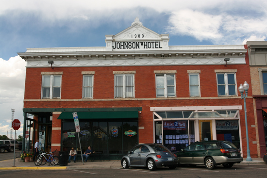
The Johnson Hotel at the NE corner of 1st Street and Grand Avenue was Built close to the original Union Pacific Depot by John Johnson in 1900 to catch the rail travelers’ attention, the Johnson Hotel was considered one of Laramie’s finest. In 1955, a fire gutted the hotel’s interior, burning six men to death and causing the death of a seventh. Though Johnson later rebuilt the interior, the shift from rail to automobile travel gradually spelled the end of the hotel’s glory days, but it remains an icon of historic downtown.
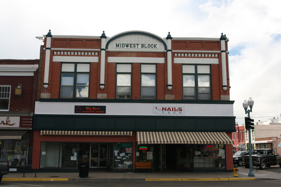
This is the Midwest Block Building at the SW corner of 2nd and Ivinson Streets. During the spring of 1868, this was the site of the “Big Tent”, a gambling and saloon hall which moved from each end of the town to the next, as the railroad was constructed. This building was built in the 1870s. It was remodeled around the turn of the century to include the words “Miller Block” in the cornice; later updates produced the current façade, which reads “Midwest Block”.
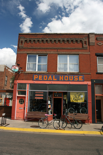
One of the
local bike shops at 207 S. First Street.
"WE STILL HANG BIKE THIEVES IN WYOMING"
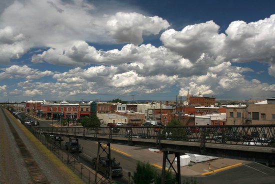
At S. First Street and Grand you can take the ramp up to the footbridge over the Rail Road Yard.
The Garfield Street Footbridge crosses the railroad tracks in Historic Downtown Laramie. Constructed by the Union Pacific Railroad Company in 1929 with the assistance from the Federal Railroad Safety Act, this iconic Footbridge is one of only a few of its kind remaining. The Footbridge connects "greater" Laramie to a historic neighborhood commonly known as Laramie's "Westside."
The Footbridge spans over two blocks and elevates pedestrians and bicyclists over one of the busiest mainlines of the largest railroad in the United States.Source: State of Wyoming
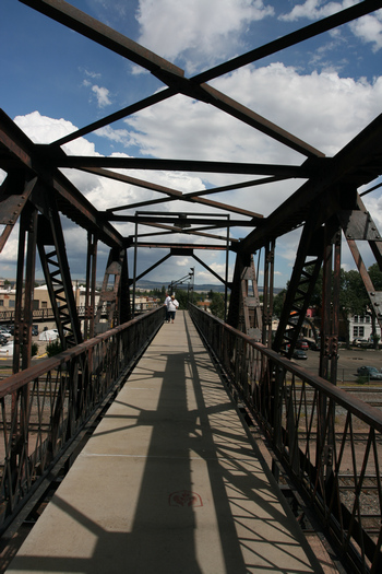
The footbridge attracts tourists like myself as well as serving as a critical link to those living on the west side of town.
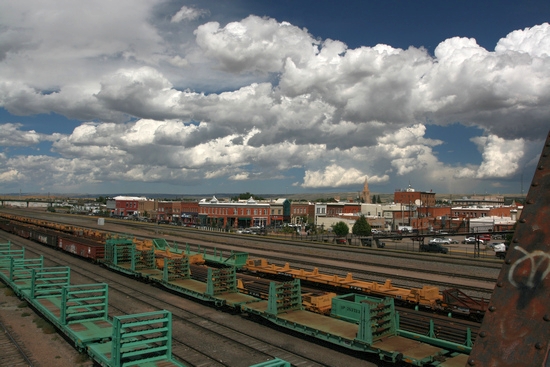
You can get a good look at the historic downtown area from the footbridge.
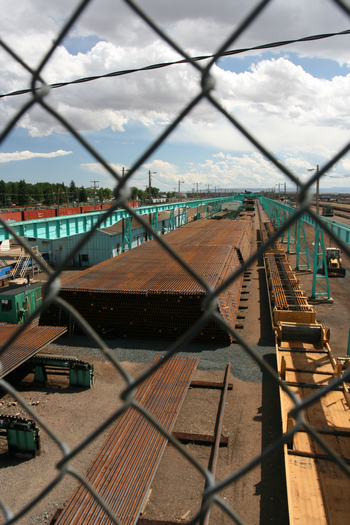
At first I couldn't figger out what this pile of stuff was. Then, when I took a closer look, I knew.
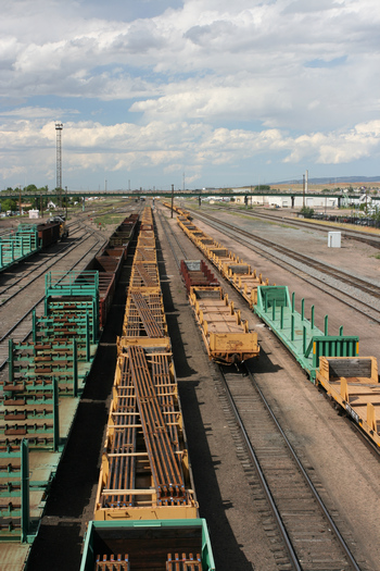
Guess they have a few miles of track to replace.
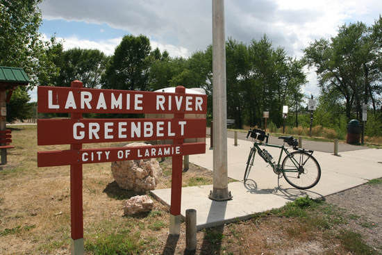
This was my destination on the other side of the tracks. There is about 6 miles of pathway.
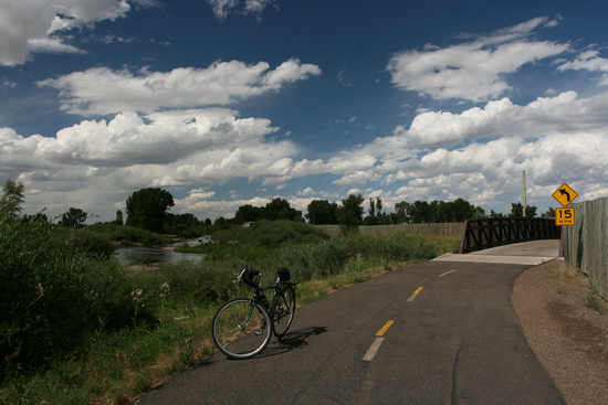
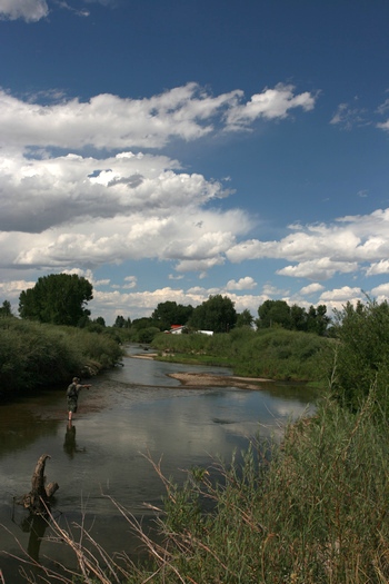
I saw people fishing, swimming and tubing in the Laramie River.
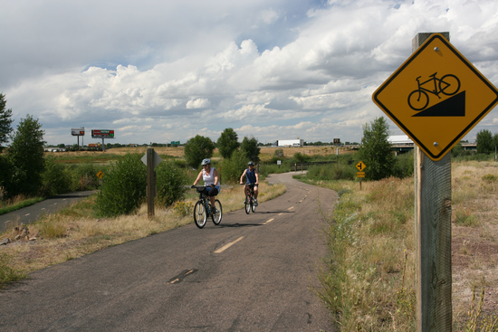
I had to laugh when I saw this! But, I guess if you are used to dead flat cycling, this might be considered a hill.

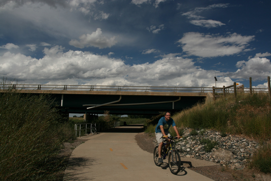
This is the underpass at I-80. Not something I see very often on bike paths.
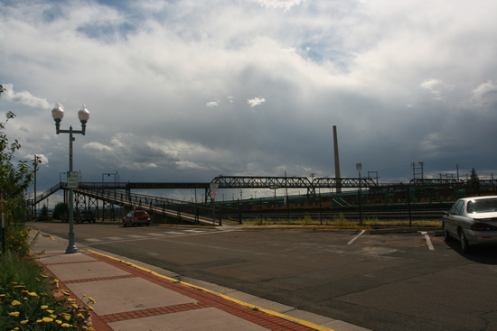
A look back at the The Garfield Street Footbridge after I returned from the Greenway.
When I got back to Scott and Jen's I got cleaned up and then we headed out for dinner. Next stop: The Bunkhouse Bar.
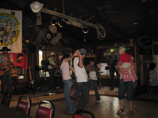
When we arrived at 7:00 the house band was rockin' the place and a few folks we taking advantage of the dance floor.

The father/daughter team on the right were dancin' up a storm!
For a bunch of old farts the band did a great job of keeping things lively.
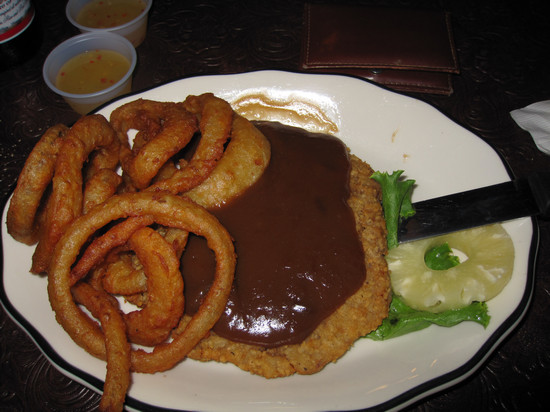
Chicken fried steak redux! This time "wet". Pretty tasty.
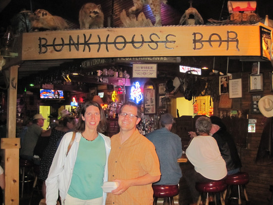
After some good eatin' there were various kinds of stuffed critters at the Bunkhouse. Note the ones above Scott and Jen. There was also a stuffed Coyote and godknowswhatelse!
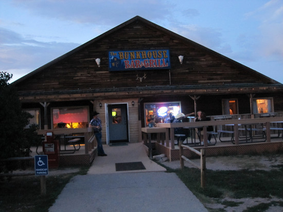
The Bunkhouse Bar And Grill is on Happy Jack Road between Laramie and Cheyenne, Wyoming.
We got back home about 8:30 and I crashed immediately. Thanks to Scott and Jen it was a full and fun day.