Mike Breiding's Epic Road Trips: April ~2018~
Tucson to Wheeling
White Sands National Monument
A Sandy Oasis in the Chihuahuan Desert
April 1st 2018: Tucson to Wheeling - White Sands National Monument
My day started a bit earlier than usual and I was up at 4:15 and had started the last bit of packing (cooler, food box, etc) by 5:30. Betsy had risen early so we would have a few moments together before I hit the road.
After a smoochy good-bye I was in the van and heading down the road at 6:00.
The drive from Tucson to Alamogordo is pretty straight forward: I-10 to Las Cruces and then US 70 into Alamogordo.
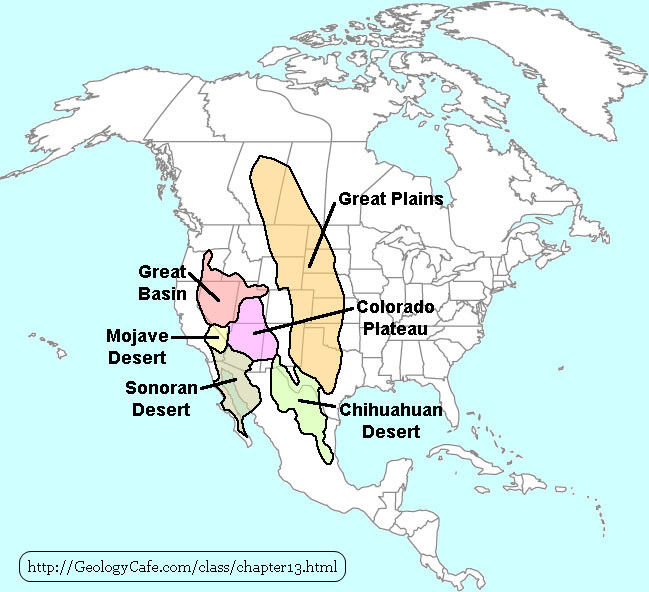
This west to east route would take me into the northern fringes of the Chihuahuan Desert and I would now leave the Sonoran Desert behind.

The above map is from the research paper "Ploidy race distributions since the Last Glacial Maximum in the North American desert shrub".
The first line of the abstract states: "A classic biogeographic pattern is the alignment of diploid, tetraploid and hexaploid races of creosote bush (Larrea tridentata) across the Chihuahuan, Sonoran and Mohave Deserts of western North America."
Pretty heady stuff! Not exactly my idea of light reading but the map came in handy to illustrate the locations of deserts in the southwest.
BTW - the creosote bush is one of the most common shrubs in the southwest deserts and in some areas can be seen what appears to be pure stands of creosote bush extending for many miles.
Creosote bush has an interesting way of surviving where resources are scarce.
As the creosote bush grows older, its oldest branches eventually die and its crown splits into separate crowns. This normally happens when the plant is 30 to 90 years old. Eventually, the old crown dies and the new one becomes a clonal colony from the previous plant, composed of many separate stem crowns all from the same seed.
The "King Clone" creosote ring is one of the oldest living organisms on Earth. It has been alive an estimated 11,700 years, in the central Mojave Desert near present-day Lucerne Valley, California. This single clonal colony plant of L. tridentata reaches up to 67 ft (20 m) in diameter, with an average diameter of 45 ft (14 m).
Source: WikiPedia
Here is another map showing the Chihuahuan Desert. The Chihuahuan is the largest desert in North America covering about 140,000 square miles. But, as you can see, only a small fraction of it extends in the to the Unites States.
What does all this mean? For me it was "Good-bye Saguaro" and "Hello Creosote bush". Although the Chihuahuan and the Sonora deserts share some species the overall landscape is markedly different.
Ok. Into the Chihuahuan desert we go! The drive to Las Cruces was uneventful. I exited I-10 and made my way through town, eventually crossing I-25 and passing by the Organ Mountain National Recreation Area.
The Organ Mountains-Desert Peaks National Monument was established to protect significant prehistoric, historic, geologic, and biologic resources of scientific interest, and includes four areas: the Organ Mountains, Desert Peaks, Potrillo Mountains, and Doña Ana Mountains.
The Organ Mountains are a steep, angular mountain range with rocky spires that jut majestically above the Chihuahuan Desert floor to an elevation of 9,000 feet. This picturesque area of rocky peaks, narrow canyons, and open woodlands ranges from Chihuahuan Desert habitat to ponderosa pine in the highest elevations. Located adjacent to and on the east side of Las Cruces, this area provides opportunities for photography, hiking, horseback riding, mountain biking, camping, and wildlife viewing.
Source: www.blm.gov/programs
This area looked mighty inviting but it will have to wait for another day.
This drive takes one in the White Sands Missile Range a military testing area which covers 3,200 square miles.
On 9 July 1945, the White Sands Proving Ground was established for testing German and American long range rockets. Just seven days later, the first atomic bomb test, code named Trinity was exploded at Trinity Site, near the north boundary of the range.
Source: WikiPedia

Another handy map for orientation. Soon we will be in White Sands NM!
Like No Place Else on Earth
Rising from the heart of the Tularosa Basin is one of the world's great natural wonders - the glistening white sands of New Mexico. Great wave-like dunes of gypsum sand have engulfed 275 square miles of desert, creating the world's largest gypsum dunefield. White Sands National Monument preserves a major portion of this unique dunefield, along with the plants and animals that live here.Source: NPS.gov
I arrived at the White Sand National Monument visitors center about 12:30. Not my idea of a good time of the day to start a desert hike. But, the temps were barely into the 80s and there was a cooling breeze/wind which helped. Anyway. I was just here for a "quickie" and would not be doing any hiking.

Photo: NPS.gov
Begin your visit of White Sands National Monument in the historic visitor center. The visitor center is an excellent example of Spanish pueblo-adobe ("Pueblo-Revival") architecture constructed on site from 1936 to 1938 using readily available local materials.
Source: NPS.gov
Click on the photos below for a larger image.
NOTE: Due to a technical error some of the linked photos below will not display the correct higher resolution images.

This sign at the visitors center gives an overview of the time line for this area. Anytime there are explanations which deal in 10s of thousands of years (or more) my brain starts to hurt.
Above it state the first people arrive in the area bout 10,00o year ago following the herd of mammoth. By the 1860s sheep ranching began.
Typical of humans the lush areas of grassland were overgrazed in a matter of decades and the grass all but disappeared.

My first look into the White Sand dunes.
Long ago, an ancient sea covered most of the southwestern United States. It was during this time that layers of gypsum were deposited on the seafloor. The rise and fall of the sea level millions of years ago influenced the making of the gypsum sand found at the monument today. Many factors, including the latest ice age, had an effect on the formation of this magnificent wonder. The journey through time shows the marvelous transformation from sea to sand, and the amazing factors that allow this dune field to exist.
Source: NPS.gov
There is much more here: Geology of White Sands

The persistent wind keeps the dunes constantly changing.

Into the dunes we go.

In case you should forget.

These signs were posted in numerous spots. Until now I had never heard of "confetti eggs" or "cascarones". This should come as no surprise considering I pay no attention what so ever to Easter and being an Anglo from the east and I never heard of this Mexican tradition.
As usual WikiPedia tells us more.
A cascarón (plural cascarones, without accent mark; from Spanish cascarón, "eggshell", the augmentative form of cáscara, "shell") is a hollowed-out chicken egg filled with confetti or small toys. Cascarones are common throughout Mexico and are similar to the Easter eggs popular in many other countries. They are mostly used in Mexico during Carnival, but in US and Mexico border towns the cultures combined to make them a popular Easter tradition.
Decorated, confetti-filled cascarones may be thrown or crushed over the recipient's head to shower him or her with confetti. In addition to Easter, cascarones have become popular for occasions including birthdays, Halloween, Cinco de Mayo, Dieciséis, Day of the Dead, and weddings (wedding cascarones can be filled with birdseed). Like many popular traditions in Mexico, cascarones are increasingly popular in the southwestern United States. For example, they are especially prominent during the two-week, citywide festival of Fiesta in San Antonio, Texas. Cascarones are usually made during Easter time.
Having a cascarón broken over one's head is said to bring good luck; however, concerns over salmonella poisoning have eroded support for the practice beginning in 2003.
In order to make cascarones, one can use a pin or knife to break a hole in the end of the eggshell and pour the contents out. The shell is then cleaned out, decorated as desired, and allowed to dry, before it is filled with confetti or a small toy. Usually, glue is applied around the outside of the hole and covered with tissue paper.
Source: WikiPedia


My first stop was the Interdune boardwalk. Not exactly your typical parking area.

The beautiful sparkily sands which give this area its name.


The sand was peppered with these small stones. What are they? Why are they there?


The boardwalk had a number of interpretive signs to help explain what one is seeing.

If you read the sign you see it noted the water table is relatively shallow in the interdunal zone - just 2 to three feet below the surface. Unusual for a desert, wouldn't you say?

I would love to be here during the wet season when this would be all greened up.

This sign reminded me of the lizards that inhabit the Namibian desert. Those far away lizards keep their feet cool by alternately raising two legs at a time to cool them off while the other two support the lizard.

Pretty wild. There can be as much stem below the surface as above. When the winds shift the sand and exposed the previously buried stem they collapse and usually die.

There was a large sign explaining the importance of the yucca to both the indigenous peoples and modern commerce.


A gentle reminder: drink or die!

This large interpretive explains how the once buried layers of gypsum, the white sand we see today was brought to the surface.

This reminded me of the Keystone thrust fault which I had recently seen in Red Rock Conservation are to the west of Las Vegas.

Living in Tucson I became acquainted term "basin and range" the formation of which is illustrated above.
The Basin and Range Province is a vast physiographic region covering much of the inland Western United States and northwestern Mexico. It is defined by unique basin and range topography, characterized by abrupt changes in elevation, alternating between narrow faulted mountain chains and flat arid valleys or basins. The physiography of the province is the result of tectonic extension that began around 17 million years ago in the early Miocene epoch.
Source: WikiPedia

There were some who just could not stand to see all this wonderful sand going to waste. Just sitting there. Serving no purpose. Fortunately others felt differently. Tom and Bula Charles were two people who felt differently and with the efforts and the efforts of others were able to have the area preserved and on January 18th, 1933, using the Antiquities Act, President Herbert Hoover created the White Sands National Monument.
If you wish to learn more on this topic you should read "Dunes and Dreams: A History of White Sands National Monument by Michael Welsh".

Thank you Tom and Bula!

A big attraction here for kids of all ages is dune sledding. I guess if you don't have snow this is the next best thing.


There were several large parking areas for sledder, hikers, picnickers and horse back riders.

A dramatic and beautiful landscape.

This guy was having lots of fun as his kids looked on.


This guy couldn't get enough! He was still at it when I moved on down the road.

Don't you love it how dog owners like to leave little presents for you?

I had never before seen a picnic area quite like this one.

Looking our at these soap tree yuccas I could not help but wonder how many feet deep the stems were buried.

Gorgeous. Until now I had only seen the photos of others.

As I exited the Monument I took one last shot of this group sand sledders.

One final shot and it was on to Alamogordo.
See you later.
~Mike