Mike Breiding's Epic Road Trips ~2016~
Wheeling to Tucson
Hiking the California Coast Redwoods - Part 2
Prairie Creek Redwoods State Park - Fern Canyon
Wheeling to Tucson ~ Tuesday - October the 11th
Hiking the Coast Redwoods
Part 2: Prairie Creek Redwoods State Park - Fern Canyon
then on to Fort Bragg, & Arrival in Tucson
Our first night in Klamath at the Ravenwood Motel was quiet and uneventful. We were up at our usual time - between 5 and 6, had our coffee and banana bread, packed our hiking gear and were out the door to the Log Cabin Diner for breakfast. The place was suggested to us by the bar maid at the Country Club Bar & Grill . She said the place was run by her sister who came to visit while we were at the bar for supper.
Klamath is that kind of town - the local whites who are probably all leftovers from the now defunct logging industry and the members of the Yurok people who all seemed to live in a new neighborhood at the north end of town.
Now that we are talking about the Yurok tribe I should mention they have a casino in Klamath called the "Redwood Hotel Casino".
Dear Tribal Member,
The ballot measure presented by the Tribal Council will provide the Tribal Membership with immediate financial assistance through a per capita distribution to individual Tribal members. This will also allow for Tribal economic development, including the thoughtful development of a profitable, tribally owned hotel and casino.We have taken a thorough look at a wide variety of economic development options. We have found that a hotel/casino located in the heart of Redwood National & State Parks, a top destination site, is one step that we should take to advance the Tribe toward economic independence and self-sufficiency. At the same time this economic venture will provide employment for Tribal members and future opportunities to generate revenue. The destination hotel will also open up opportunities for Tribal member owned businesses to flourish on the Reservation.
Source: Letter from Yurok Tribal Chairman O'Rourke about the proposed hotel and casino
Here is some promotional hype from the casino web site.
For millennia, the Yurok (Oohl) people found physical and spiritual sustenance among the majestic keehl (redwood trees) along the Klamath River. Now, you’re invited to do the same as you immerse yourself in the natural wonders and rich legacy of Yurok country – at the Redwood Hotel Casino, in the heart of Redwood National and State Parks in northern California.
Source: Redwood Hotel Casino
There is also a large Yurok administration building in Klamath.
I hope someday we will be able to stay in the area longer and explore a bit more. But for now we must concentrate on the task at hand - breakfast!
Here we are at the Log Cabin Diner killing time by reading the local newspaper.
In anticipation of a full day of hiking we did some serious calorie loading. This was one of the greasiest breakfasts I have ever had. I think they forgot to clean the griddle - for the past year.
After we finished up with breakfast we got on US 101 south and almost immediately crossed the Klamath River overflow channel at the Resighini Rancheria (Waukell Flat).
The Resighini Rancheria, located just south of Klamath, California, is a Yurok Native American rancheria and a federally recognized tribe. It was formerly known as the Coast Indian Community of Yurok Indians of the Resighini Rancheria.
The reservation (on land measuring 228 acres) is primarily settled by members affiliated with the Yurok Coast Indian Community. A resident population of 36 persons was reported during the 2000 census. The 2010 US Census shows a decrease, with a population of 31. It is entirely surrounded by the Yurok Indian Reservation.
Source: WikiPedia
As one might expect there has been major flooding along the Klamath River. Significant floods on the Klamath River have occurred in 1926–1927, 1955, 1964, 1997, and 2005. This is an account of the Klamath River Flood of 1997and will give you an idea of the severity of just one such flooding.
Driving 5 miles south on US 101 put us at the exit for the Newton B. Drury Scenic Parkway. This 9 mile parkway would take us to the Prairie Creek Visitor Center where we hoped to get some ideas for a scenic, all day hike.
Newton Bishop Drury (April 9, 1889 – December 14, 1978) was the fourth director of the American National Park Service and the executive director of the Save-the-Redwoods League
In 1919, he and his brother Aubrey formed the Drury Brothers Company, an advertising and public relations agency. That same year, the organizers of the Save-the-Redwoods League, many of whom knew Drury from the university, asked Drury Brothers to manage the League. Newton Drury became executive secretary in charge of publicity and fund raising, a position he held for twenty years. Drury and the league obtained a six-million dollar bond measure passed to buy California redwood groves.
Drury declined appointment as NPS Director in 1933, but accepted the job in 1940. He was the first director without prior national park responsibilities, but came with strong conservationist credentials, having served as executive secretary of the Save-the-Redwoods League in California. During World War II he successfully resisted most demands for consumptive uses of park resources.
Source: WikiPedia
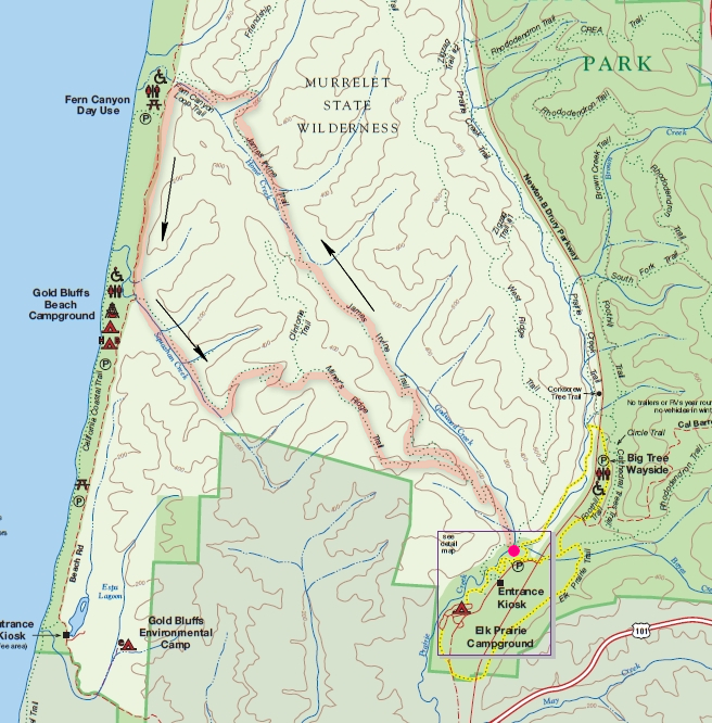
The woman at the Visitor's Center was quite the dynamo of energy and we soon had a marked up trail map complete with mileages and route options. Here is the one we chose.
On this hike we would take the James Irvine Trail to Fern Canyon, explore a short section of the canyon, then walk out to the beach for lunch then down the unpaved access road to the Miners Ridge Trail and then back to the Visitors Center. This would make a grand total of 12 miles round trip.
It had been a while since we hiked that much in one day but I was confident we would have no problems.
We weren't more than 100 feet down the trail when we were back in FernLandia. Here we see the Deer Fern (Blechnum spicant) and Sword Fern
Polystichum munitum.Source: WikiPedia
This small clump of Maiden-hair fern (Adiantum aleuticum) was growing on a vertical cut which was made for the trail. Take a look at that "soil". Rocks and pebbles all held together with ???. Apparently the Maiden-hair fern likes it just fine.
The mighty do fall. I wonder what the MPH of the wind was which took this one down.
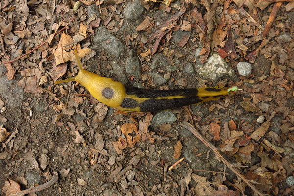
Meet the Banana slug - a true icon of the wet coastal forests of California, Oregon and Washington. This one was feeding on some type of fecal matter. Apparently this is one of their favorite foods. Shit Happens! So why not take advantage of it?
Here is a real beauty. And it shows us very clearly why they are referred to as "Banana slugs".
Banana slug is a common name for three North American species of terrestrial slug in the genus Ariolimax. These slugs are often yellow in color and are sometimes spotted with brown, like a ripe (or overripe) banana.
Banana slugs are often bright yellow (giving rise to the banana sobriquet) although they may also be greenish, brown, tan, or white. The species Ariolimax columbianus sometimes has black spots that are so extensive that the animal looks almost entirely black. Individual slugs will change colors with alterations in food consumption, light exposure, and moisture levels. Color may also indicate whether a slug is healthy or injured or what age it is.
The Pacific banana slug is the second-largest species of terrestrial slug in the world, growing up to 25 centimetres (9.8 in) long, and weights of 115 grams (4.1 ounces). (The largest slug species is Limax cinereoniger of Europe, which can reach 30 centimetres (12 in) in length.) Banana slugs have an average lifespan of 1-7 years.
Source: WikiPedia
Here is an interesting article on the Banana slug: The Banana Slug – Nature’s Giant Recycler. There are some really cool photos!
I do not know what species of conifer this was but I thought the bark was quite beautiful.
Here we have the namesake for yesterday's hike. This is the Pacific trillium (Trillium ovatum) or western white trillium.
In the northern part of its range, which includes southern British Columbia, extreme southwestern Alberta, Washington, Oregon and east to Montana, Wyoming and northern Colorado, it often grows under Douglas-fir. Other trees which frequently shade this trillium include grand fir, western red cedar, and western hemlock; big leaf maple, red alder and Sitka spruce join in near the coast.
Near California shores, it is common under coast redwood. Associated understory plants include swordfern, vanilla leaf, violets, redwood sorrel and salal.
Source: WikiPedia
My, oh my, oh my. Words cannot express...
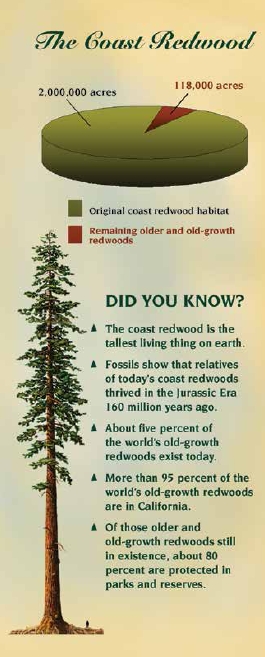
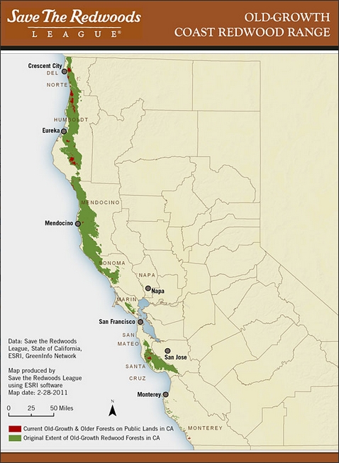
I found these two graphics a bit sobering to say the least.
Redwoods (Sequoia sempervirens) once grew throughout the Northern Hemisphere. The first redwood fossils date back more than 200 million years to the Jurassic period. Before commercial logging and clearing began in the 1850s, coast redwoods naturally occurred in an estimated 2 million acres (the size of three Rhode Islands) along California’s coast from south of Big Sur to just over the Oregon border. When gold was discovered in 1849, hundreds of thousands of people came to California, and redwoods were logged extensively to satisfy the explosive demand for lumber and resources. Today, only 5 percent of the original old-growth coast redwood forest remains, along a 450-mile coastal strip. Most of the coast redwood forest is now young. The largest surviving stands of ancient coast redwoods are found in Humboldt Redwoods State Park, Redwood National and State Parks and Big Basin Redwoods State Park.
Source: © 2016 Save the Redwoods League
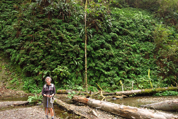
Ferns galore!! Do you see Betsy? She is that little blue dot in the center of the photo.
As with our hike yesterday, we spotted some pretty bizarre growths on some of the redwood trees.
This is Redwood sorrel (Oxalis oregana). The genus Oxalis is one we see all over the US and it is always a welcome sight. Here is an interesting tid-bit about this species.
Redwood sorrel, Oxalis oregana, photosynthesises at relatively low levels of ambient light (1/200th of full sunlight). When direct sunlight strikes the leaves they fold downwards; when shade returns, the leaves reopen. Taking only a few minutes, this movement is observable to the eye.
Source: WikiPedia
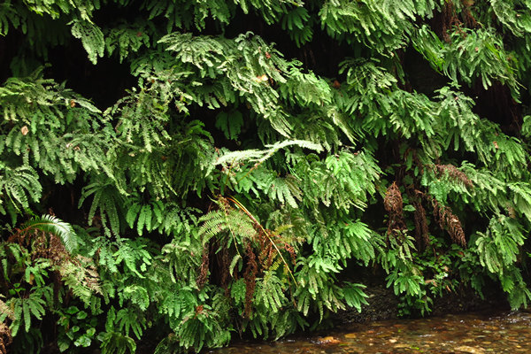
More Maiden-hair fern. We will see lots more.
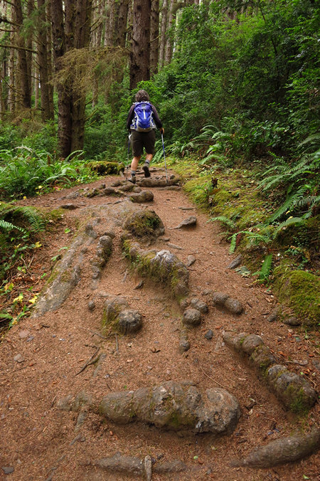
Many thousands of hikers have laid bare these surficial roots.
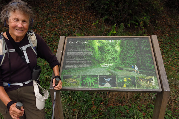
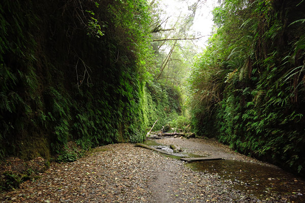
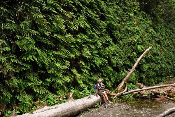
Here we are in Fern canyon where thousands of Maiden-hair ferns cover the canyon walls.
The park lays out boards for little bridges so people don't have to get their tootsies wet.
After miles of human-free quietude it was a bit of a shock to come out of the canyon and see a gravel road with cars and people all over the place.
We crossed the road to a beach trail and saw more beautiful wild flowers.
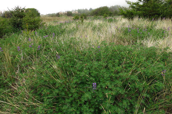
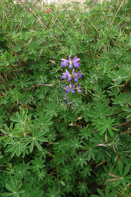
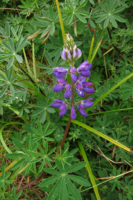
This is Silver lupine (Lupinus albifrons) which was thick along the beach access trail.
Lupinus albifrons, silver lupine, white-leaf bush lupine, or evergreen lupine, is a species of lupine (lupin). It is native to California and Oregon, where it grows along the coast and in dry and open meadows, prairies and forest clearings. It is a member of several plant communities, including coastal sage scrub, chaparral, northern coastal scrub, foothill woodland, and yellow pine forest.
Source: WikiPedia
Lupinus is another genus we've seen all over the US, most notably the Santa Rita mountains and some pretty amazing plants in Michigan.
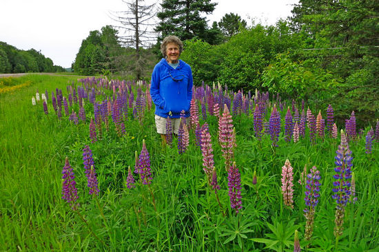
The above photo is from our June, 2015 trip to the Upper Peninsula of Michigan. We came across this stand just outside the town of Bergland. They were growing in the road ditch. Must be good soil!
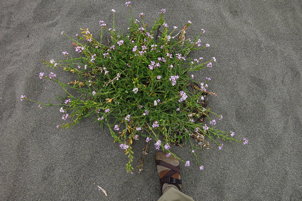
I did not think to get a closeup of the flowers of this beach plant. It you think you know what it is, please let me know.
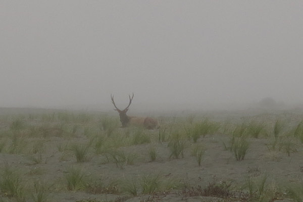
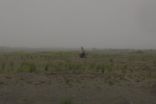
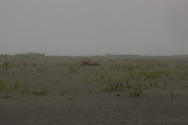
We were told we might see Roosevelt Elk lounging on the beach. Sure enough - we saw several.
I wanted to get a closer picture but there were warning signs which stated: "Do not approach Elk on foot". So I decided not to.
Nice place for a nap!
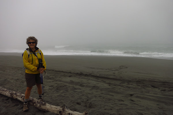
Once again we found the beach and waves beautiful but not exactly conducive for a dip.
This was at the beginning of the Miners Ridge Trail - our route back to the Visitor's Center.
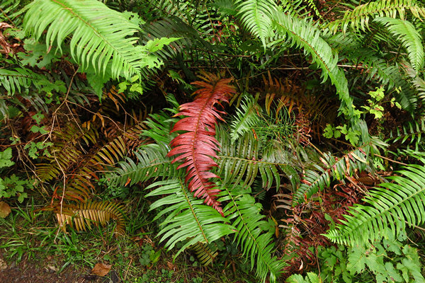
When I think of fall color, ferns do not come to mind. But this Sword Fern was lookin' pretty good.
It was wonderful to get away from all the people and be back in the quiet woods.
Gnarly, Dude!
This was my last shot for the day. We still had quite a few miles to put under out belts before we could enjoy some much needed time off our feet.
When we were about 2 miles from the finish line I noticed Betsy's pace picked up. Pretty soon I had to make a concerted effort to keep up.
As I watched her in front of me, her legs and her trekking poles were making steady powerful movements that propelled her forward at a rate I found hard to keep up with.
Who is this woman!!?? "Wonder Woman - You're a Wonder - Wonder Woman!"
I commented on her power hiking and Betsy said she was singing to herself and hiking to the rhythm in her head. I must try that some time when I start to flag!
After our wonderful, but quite tiring 12 mile hike we headed back to Klamath and the Ravenwood Motel. We were not too keen on going anywhere for dinner so we ended up with a delicious and healthy meal of Chicken Tenders and ranch dressing from the gas station next door. Washed down with some cold beers they were Mm-mm Good!
Tomorrow we would be pulling up stakes and continuing the drive south so after that deluxe meal we spent a quiet evening in the room going over some maps and talking about tomorrow's drive. Then it was lights out.
Wheeling to Tucson ~ Wednesday - October the 12th...
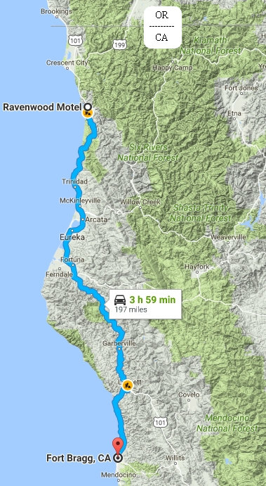
Klamath CA to Fort Bragg
We departed Klamath around 9:00. Our route today would be pretty straight forward: US 101 south to Legget (home to the famous "Drive Through Tree") where we would pick up the very hilly and windy SR 1 (Shoreline Highway) and take it west to the coast.
Or plan was to stay over in Fort Bragg if the weather looked agreeable enough to spend some time on the beach and take some hikes/walks.
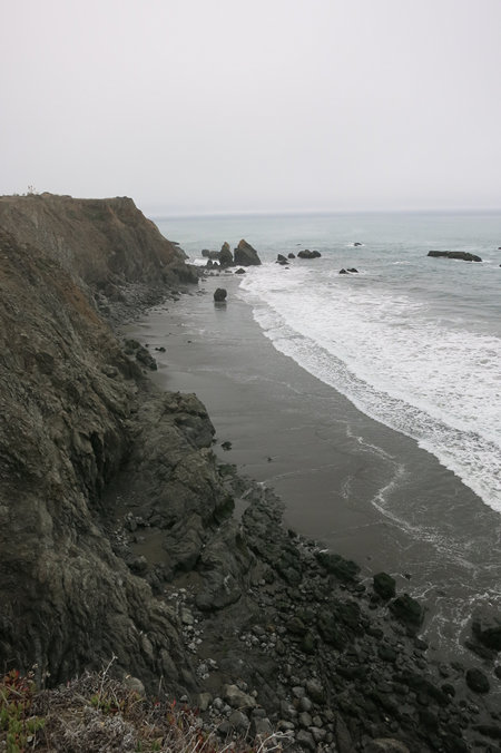
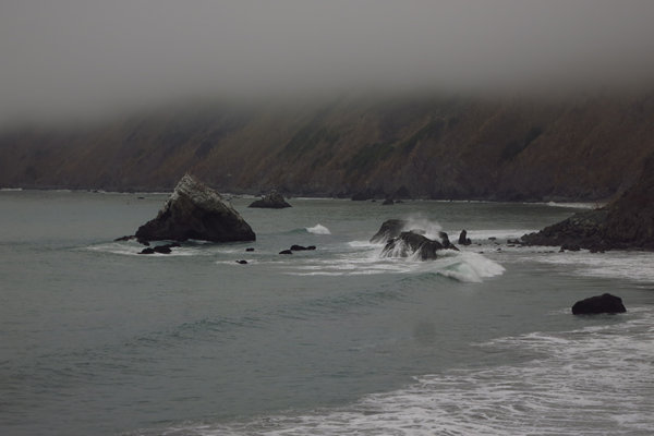
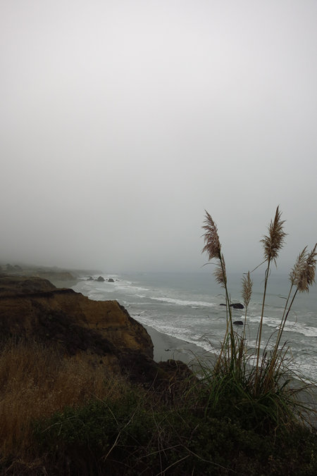
After the 20 mile twisty-turny and nicely wooded drive from Legget to the coast we popped out of the woods and almost immediately came to a big pull-off with a beautiful view of the ocean and shoreline.
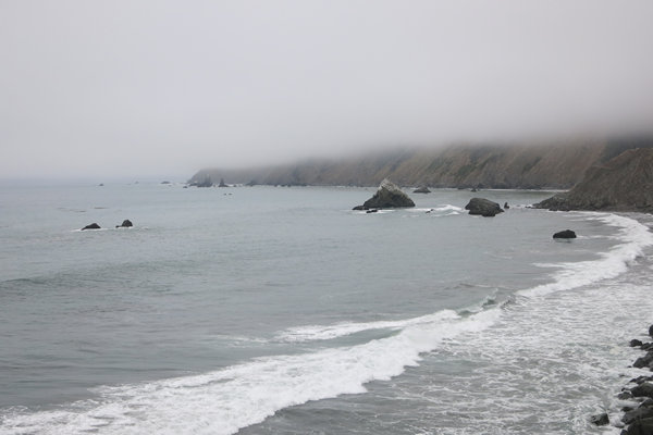
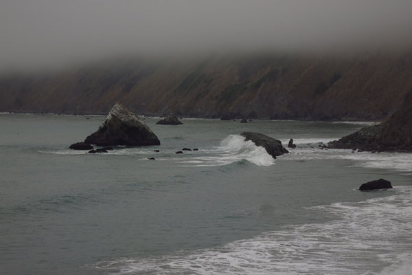
We stopped at this pull out to take in the scenery and get a few snaps of the rock strewn coastline.
I really wish I had shot a short video of the waves crashing against the rocks. It was mesmerizing.
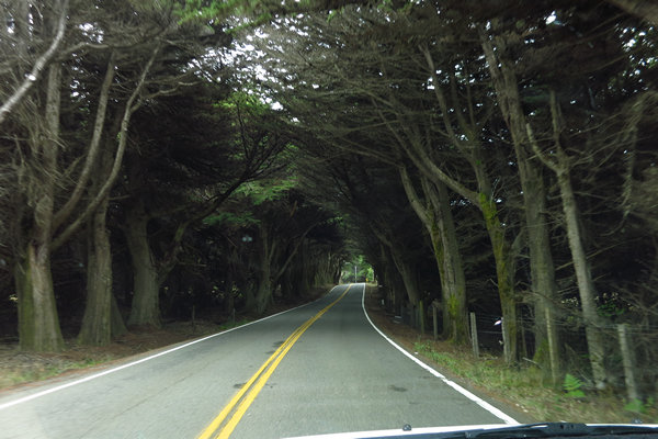
The enclosure of Monterey Cypress (Cupressus macrocarpa). The natural range for this conifer is a small area near Point Lobos near Carmel, California. It has been widely planted outside its native range, particularly along the coasts of California and Oregon and it is not uncommon to see it anywhere along the California coastline or coastal cities like San Francisco.
We stopped in Fort Bragg for a pit stop and at that point decided to continue to move south. The coastal weather was cloudy, windy and cool and we decided to move inland in search of warmer weather.
One of the routes we had talked about was driving east about 4 hours to Sacramento and staying overnight then continuing on to Lake Tahoe via US 50. There we would pick up scenic US 395 and stay over in Lone Pine. I have stayed in Lone Pine several time before at the Trails Motel and never paid more than $45.00 a night.
After we left Fort Bragg, Betsy called the Trails Motel while we were on our way to Sacramento - our first stop after Fort Bragg.
To our shock and surprise we were told a room for two people would be $129.00 !
Betsy phoned several other places and they were all within that price range. So we decided to chuck that idea and pretty much just head straight south through the Central Valley and then on to Tucson.
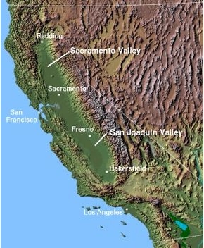
California's Central Valley is a large, flat valley that dominates the geographical center of the U.S. state of California. It is 40 to 60 miles (60 to 100 km) wide and stretches approximately 450 miles (720 km) from north-northwest to south-southeast, inland from and parallel to the Pacific Ocean coast. It covers approximately 18,000 square miles (47,000 km), about 11% of California's total land area (or about the size of Denmark).
Bounded by the Sierra Nevada to the east and the Coast Ranges to the west, it is California's single most productive agricultural region and one of the most productive in the world, producing more than half of the fruits, vegetables and nuts grown in the United States.
More than 7 million acres (28,000 km) of the valley are irrigated via an extensive system of reservoirs and canals. The valley also has many major cities, including the state capital Sacramento; as well as Redding, Stockton, Modesto, Fresno and Bakersfield.Source: WikiPedia
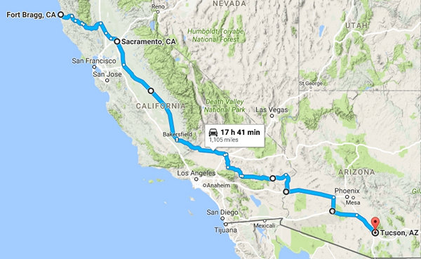
Our route from Fort Bragg to Tucson.
9 hours and 550 miles got us from Sacramento to Needles. The next day was the final leg of the ERT from Wheeling to Tucson - 6 hours and 370 miles from Needles to Tucson.
And before you know it we were having Happy Hour with our neighbor Joan in good old Tucson Estates.
And there you have it! FINIS...
Until next time.
~Mike and Betsy


