Three Days in Segovia
Day Three: Thursday: 23 May 2013
Road Trip to La Granja, the Sierra de Guadarrama, Pedraza, Turégano and Coca
Part One: La Granja
Today we would strike out on our own via a rented car. After finishing up breakfast and getting our daily needs together we headed out the door of the Hotel La Casa Mudejar around 8:15 am.
The EuroCar rental office did not open until 9:00 so we used the time to first stop by the bus station and "complete" our tickets. When we purchased the tickets in Madrid they were opened ended. Now that we had decided on a departure time back to Madrid we needed to get the tickets for the return trip. The gentleman at the bus station had no problem with my English and when handing us our tickets carefully pointed out and read to us the time of departure and day of departure, all with a questioning look. We confirmed this was correct and then were on our way to the Eurocar office.

On our way to the bus station we passed this sandwich shop. Up to that point I had no idea the The Baby Jesus was the proprietor of a bar and Bocateria. Very curious.
The shop was located on Calle bel Puenta de Sancti-Spirit in barrio de San Milan just around the corner for the Candido monument.
After taking care of business at the bus station we walked down Avenue de Fernández Ladreda, the pedestianized street which leads to the Plaza bel Azoguejo at the base of the Aqueduct of Segovia.

Here is Betsy, dwarfed by the size of this amazing structure.
The first section of the aqueduct contains 36 semi-circular arches, rebuilt in the 15th century to restore a portion destroyed by the Moors in 1072. The line of arches is organized in two levels, decorated simply, in which predominantly simple moulds hold the frame and provide support to the structure. On the upper level, the arches have a total width of 5.1 meters (16.1'). Built in two levels, the top pillars are both shorter and narrower than those on the lower level. The top of the structure contains the channel through which water travels, through a U-shaped hollow measuring 0.55 by 0.46 in circumference size. The top of each pillar has a cross-section measuring 1.8 by 2.5 meters (5.9 by 8.2'), while the base cross-section measures approximately 2.4 by 3 meters (7.9 by 9.8').
The aqueduct is built of unmortared, brick-like granite blocks. During the Roman era, each of the three tallest arches displayed a sign in bronze letters, indicating the name of its builder along with the date of construction. Today, two niches are still visible, one on each side of the aqueduct. One of them is known to have held the image of Hercules, who according to legend was founder of the city. The other niche now contains the images of the Virgen de la Fuencisla (the Patroness of Segovia) and Saint Stephen.
Source: WikiPedia

Although it looks like the autos are going to drive through the arches of the Aqueduct, this no longer permitted.
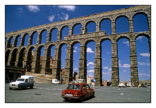
The Plaza bel Azoguejo before traffic was eliminated and it was renovated for pedestrian use only.
We continued our walk to the EuroCar office which was about 15 minutes down Avenue la via Roma. We completed some paper work and soon we were on our way. With Betsy as navigator we made our way around the north and east edge of the Segovia until we picked up Rt N-110 which we then took south to CL-601 which would take us to our first stop, the Royal Palace and Gardens of La Granja de San Ildefonso.

Here is the route map for our Road Trip. Click on the map to get more details.
This was my first experience driving in a foreign country. I was not too concerned about getting "lost", but I was concerned about negotiating all the round-abouts. But, I had no problem and with Betsy as my second set of eye-balls we managed to avoid any close calls or directional mistakes.

Here we are at La Granja. Not bad for a summer home!
The Royal Palace of La Granja de San Ildefonso (Spanish: Palacio Real de La Granja de San Ildefonso) is an 18th-century palace in the small town of San Ildefonso in the hills near Segovia, 80 km north of Madrid, central Spain, formerly the summer residence of the Kings of Spain since the reign of Philip V. The palace is in a restrained baroque style surrounded by extensive gardens in the French manner and sculptural fountains. It is now open to the public as a museum.
Source: WikiPedia
It takes lots of moolah to build and maintain places like this. Find out where the money came from at WikiPedia: Economic history of Spain. If you follow the links in this article you are in for some interesting reading.
Wool was a primary generator of Spanish wealth:
As the original breeders of the fine-wooled merino sheep that have historically dominated the wool trade, the Spanish gained great wealth. Wool money largely financed Spanish rulers and thus the voyages to the New World by conquistadors.The powerful Mesta (its full title was Honrado Concejo de la Mesta, the Honorable Council of the Mesta) was a corporation of sheep owners mostly drawn from Spain's wealthy merchants, Catholic clergy and nobility that controlled the merino flocks. By the 17th century, the Mesta held in upwards of two million head of merino sheep.
Source: WikiPedia

Here are some really old trees, a Sequoia and a Weeping Beech. As with the Scottish clansman we had recently learned about, these trees were status symbols for the big shots of Spain.

I had not been inside the palace and really had no interest. When I was here in 2010 Jeff and I walked the gardens and this is what I wanted Betsy to see.

The gardens are quite amazing. Of course you are hearing this from a country boy who ain't been around much. I am sure there are gardens in France, Italy and other places which would make this look average.

Everyone of these sculptures is a fountain. But, they run on a limited schedule. Had I stuck to my original schedule of picking up the car on Wednesday evening and driving down here then, we would have seen all the fountains running. Guess it will have to wait until our next visit.

Ready for a bath?

Even without the fountains going they were quite beautiful.
This WikiPedia Commons photo will give you an idea of what we missed.

Detail of "Diana's Bath". Pretty nice bath tub!
"Of the elaborate "Baths of Diana", the focus of several garden axes, the chronically depressed Philip V remarked, 'It has cost me three millions and amused me three minutes.'
And I thought I had a short attention span. Sheesh!

There were lots of scantily clad beauties.


Talk about bizarre! Half human, half frog.

There are 26 sculptural fountain at La Granja and each one is unique.
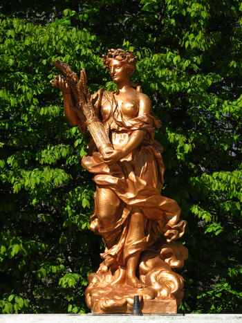
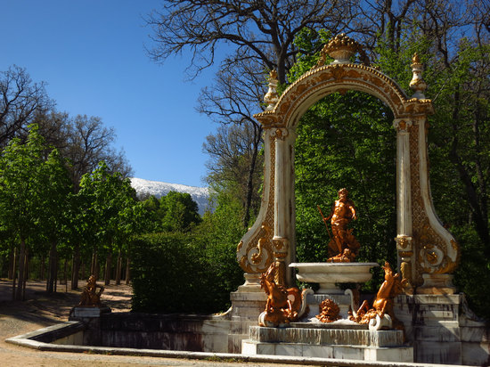
What a great escape this would have been from the hot, sultry lowlands.
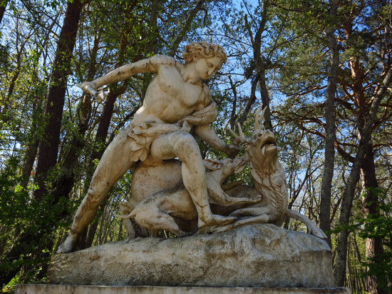
Now this is what I call up close and personal deer hunting. These days some "sportsman" use hidden cameras and bait to get their deer.
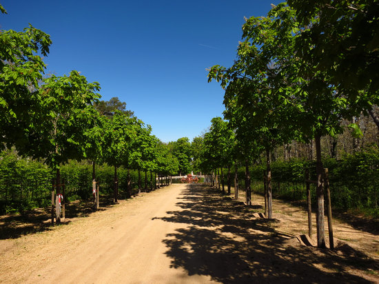
A very typical allée planting. This one is relatively new and the trees were still staked.
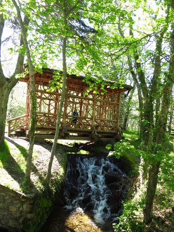
What an interesting "tree house" this was.
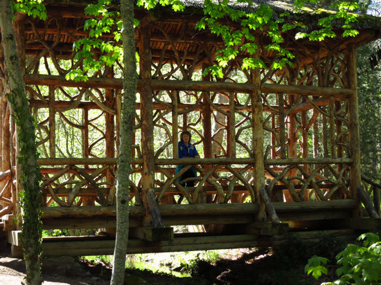
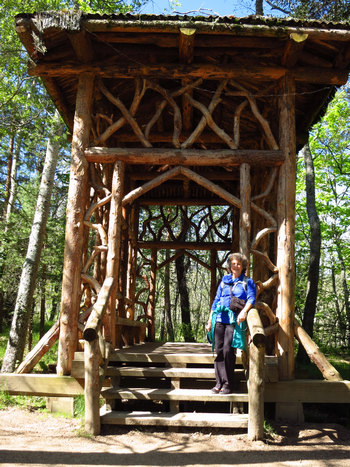
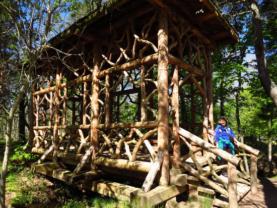
Some fancy joinery, to be sure.
What a job piecing all that together!
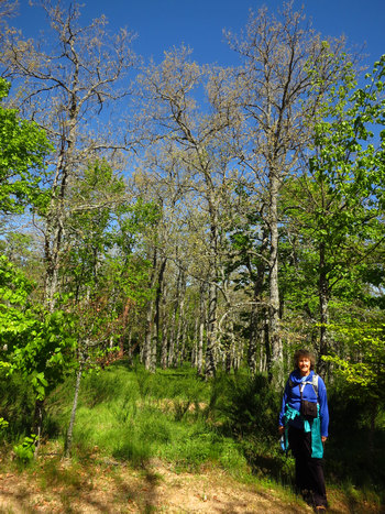
I took this shot just to show how late the season was here. Although we were at a higher elevation than Segovia, I was still surprised to see this oak forest barely breaking bud in late May.
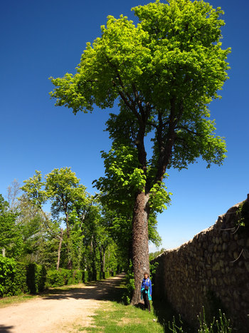
Yet another giant Horse-chestnut tree. Segovia is full of them as is Madrid.
Although the Horse-chestnut is not native to Spain, it obviously thrives here. The home region of the species is the Balkans, AKA Southeast Europe.
The common name "horse-chestnut" (often unhyphenated) is reported as having originated from the erroneous belief that the tree was a kind of chestnut (though in fact only distantly related), together with the observation that eating the fruit cured horses of chest complaints despite this plant being poisonous to horses.
Source: WikiPedia
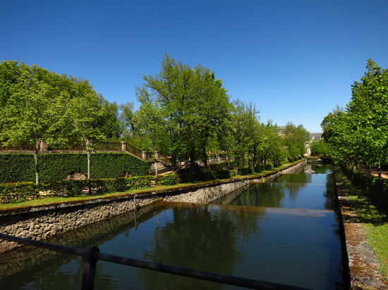
La Granja even has it's own Rio, fed by the water tumbling down from the Sierra de Guadarrama.
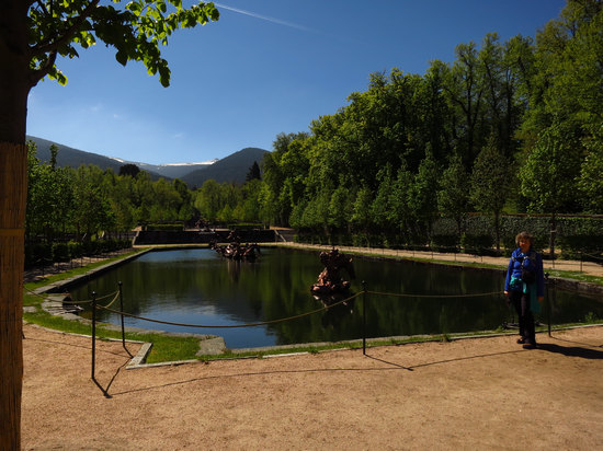
Elly May would have loved this "Ceement Pond"
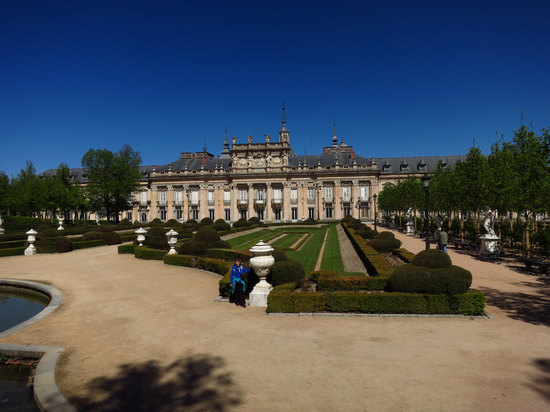
Not too shabby - for a summer home.
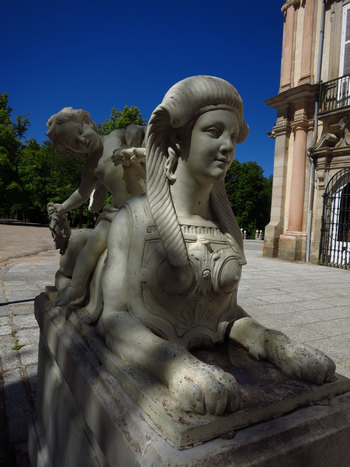
I remember admiring this buxom Sphinx when I was here in 2010.
She hasn't aged a bit...
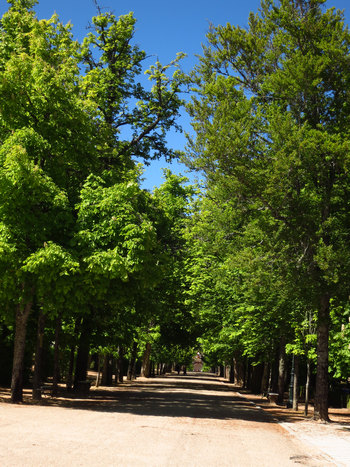
The last shot of one of the ubiquitous tree allées before we want back through the Garden gate and headed down to the car.
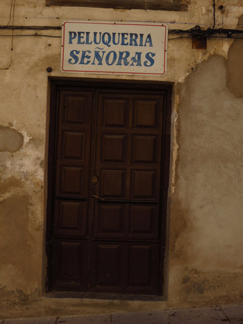
On our way back down to the car we wandered past various shops, bars, residences and restaurants.
We had seen this shop sign before when in Segovia. This time I looked it up: "Lady's Salon".
When we got back to the car we snacked on our bocadillos which had been made from the jamón and pan from the breakfast buffet at the Hotel La Casa Mudejar. Then we took another look at the map to make sure we did no get off track. It was pretty straight forward. Would just continue south on CL-601. The stretch of road would take us up into the mountains on a winding and scenic route to our next stops: Boca bel Asno and Puerto de Navacerrada.

Here is the route map for our Road Trip. Click on the map to get more details.
Part 2: La Granja to Pedraza
On this drive up into the Sierra de Guadarrama to Puerto de Navacerrada we would top out at 5500' elevation . By contrast Segovia is about 2700' and La Granja is about 4000'.
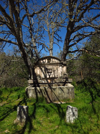
Not far down the road from La Granja we stopped at this road side spring to look around. Although no longer in service I am sure it watered many people, heads of livestock and boiling radiators over the years.
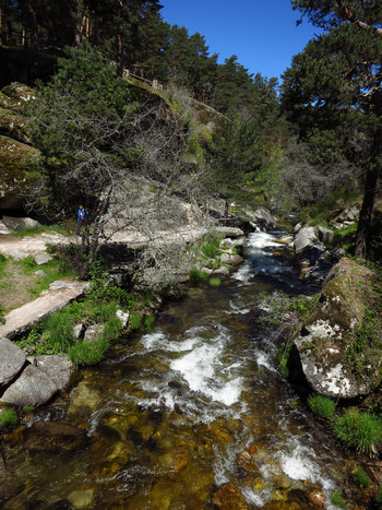
Next we made an unplanned stop at Boca bel Asno which has a nice picnic area and walking trails. There is a foot bridge which crossed the Eresma River, the very same river which runs through Segovia.
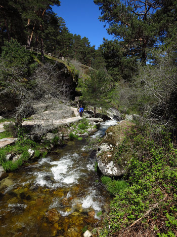
What a lovely spot and a great place to cool off on a hot and steamy Madrid day.
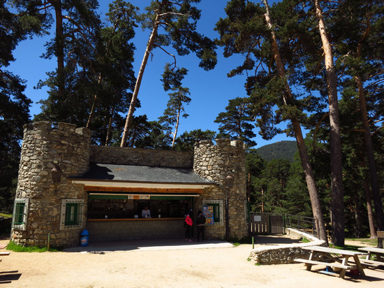
The concession stand. It mimics a castle/fort. Go figger...
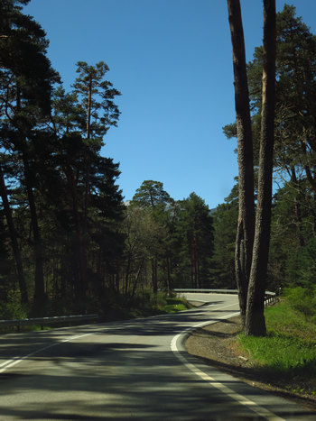
This was to be the order of the day - beautiful, windy mountains roads in the middle of a dense coniferous forest.
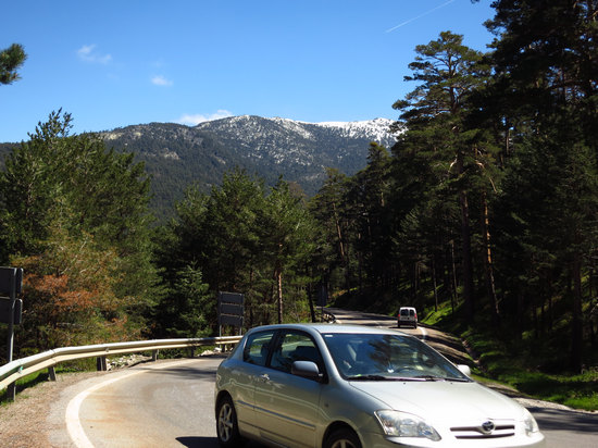
There were some gorgeous views on the climb up the mountain but very few places to pull off and snap a shot.
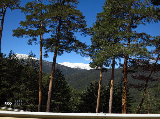
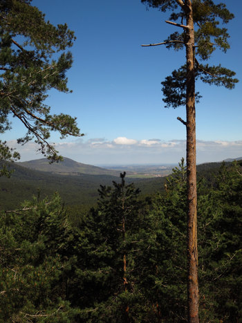
At this point we are still on the west side of the Guadarramas. I am assuming this is looking back towards Segovia.
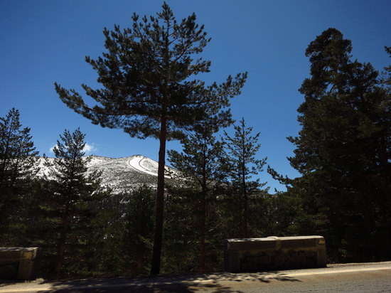
Since I did not do much homework for this little road trip I had no idea there was a ski resort at the top of the mountain pass. The summit of the slope is 7,142'. This area is only about an hour from Madrid and I bet some weekends are pretty crazy up here.

The view from up here was quite spectacular. And so close to Madrid. Heaven...
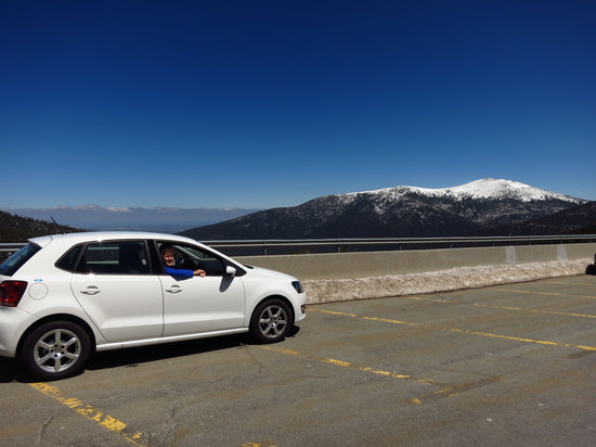
Here is Betsy in our VW diesel rental. It was a 5 speed manual and kept to the road pretty well.
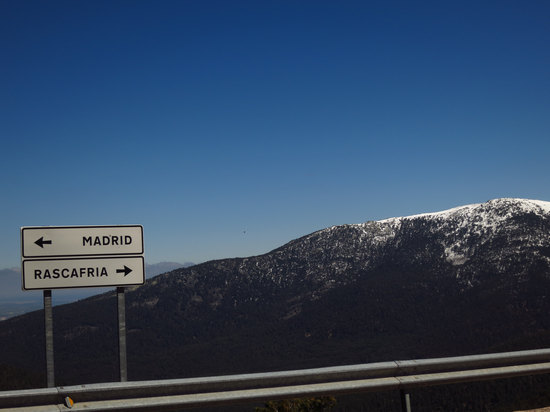
Down, down, down - Rascafria here we come!
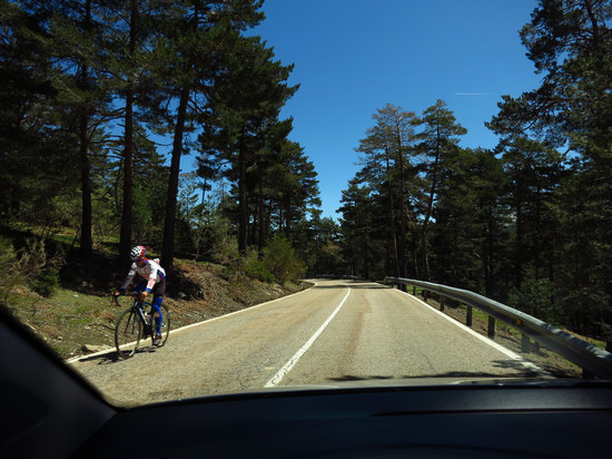
During the 13 miles down route M-604 to Rascafria we saw quite a few cyclists both coming and going...
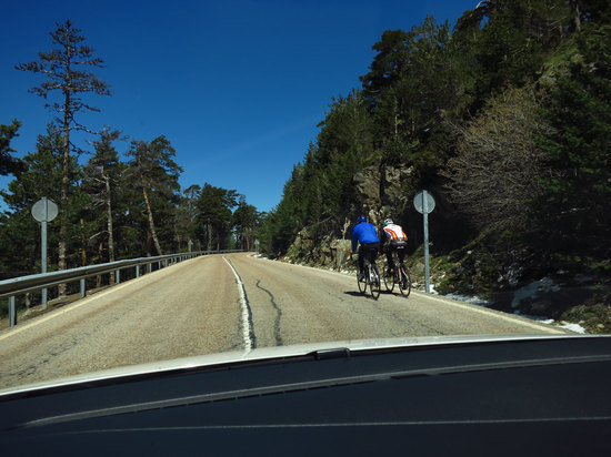
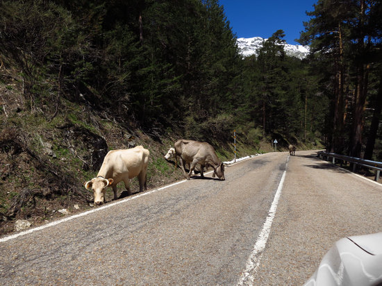
We also saw a few of our bovine buddies. Apparently this is open range here and one needs to be very careful and keep a sharp eye out.

We arrived at Rascafría in short order. This would have been a great place to explore and spend some time, but we could not do that on this day trip.
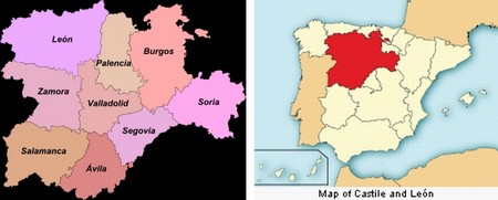
Rascafría is a beautiful, peaceful town in the northwestern area of the Madrid region, sitting in the incomparable geographic surroundings of the Lozoya valley.
In town is the parish church of San Andrés Apóstol, dating from the 15th century and restored in the 20th century, which preserves in its central nave some Gothic vaults and coffered ceilings from the 16th century.
But the most outstanding feature of Rascafría is the Monastery of El Paular, which was founded in the 14th century and is situated two kilometres from town. Particularly striking are the church, the cloister and the Hail Mary courtyard, with a main front worked from stone by Gil de Hontañón. Both the monastery and the church bear traces of several architectural styles, ranging from Gothic and Mudejar to baroque.Source: Turespaña / Segittur © 2013
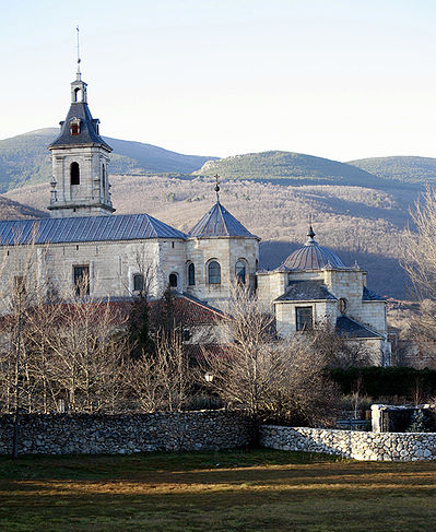
We passed by the Monasterio de Santa María de El Paular. Someday we will be back for a closer look.
By order of Henry II of Castile construction of the Carthusian monastery began in 1390 and lasted for several centuries. It was the first foundation of the Order of St. Bruno in Castile. The location was chosen by the monarch and, according to tradition, it was decided that the monastery of the Carthusian order because, during the war in France , his army had burned down a monastery of the same order. Henry II note addressed to his son, who would reign as Juan I of Castile , the exact location of the building, next to a chapel that became known as Santa Maria de El Paular. This chapel still survives today although renamed Chapel of Our Lady of Montserrat.
Source: WikiPedia via Google Translate
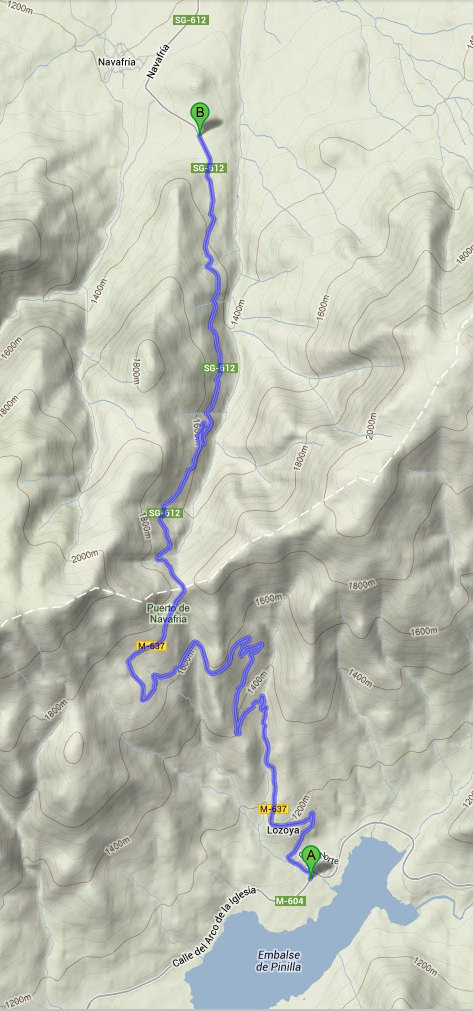
Just a few miles east of Rascafría we came to route M-637, our next turn off. For the next 10 miles or so we would wind and climb and wind and climb our way up to Puerto de Navafria, elevation 5816'.
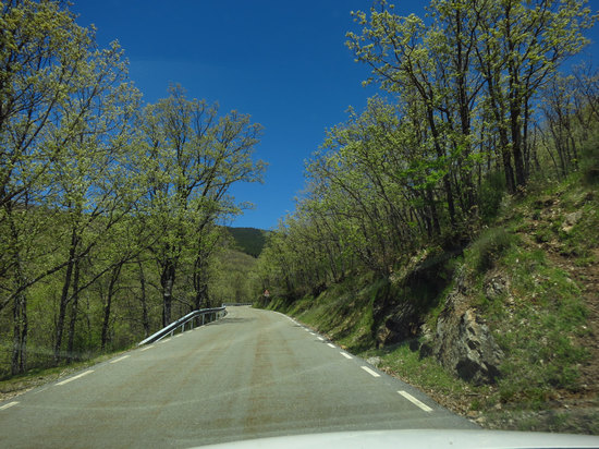
At the base of the mountain was an extensive oak forest. As you can see, the leaves are just starting to come out.
In the distance you can see the pine covered mountains we will soon be ascending.
On the way up the mountain we saw several recreation areas which had campgrounds and hiking trails. I hated to pass these up...
At the summit we saw two cyclists catching their breath and having a drink of water. That would be one long, steep climb on a bike.
We also passed by a Nordic Ski Center. As you can imagine, this area gets a lot snow in the winter.
We now had about 15 miles to go before out next stop at Pedraza (pop. 450). On this leg of the trip we would be dropping back down to around 3300' and be driving through more open, rolling countryside.

A snapshot of the elevations on our route from Rascafría to Pedraza.
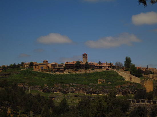
Declared to be a Historic-Artistic Site in 1951, the village of Pedraza has one of the most beautiful main squares in Castilla y León.
Its cobbled streets and emblazoned houses form a medieval urban setting where every corner must be seen, from the Puerta de la Villa (town gate) to the far end of the village, crowned by a castle, in whose tower, currently a museum, the painter Zuloaga had a studio. Also of interest are the medieval prison and the church of San Juan.
Source: Turespaña / Segittur © 2013
A bit more:
Pedraza is one of Spain's most beautiful walled medieval villages. When you enter the village (there is a large carpark next to the Castle where visitors are asked to park their cars to limit traffic on the village's cobbled streets), and walk through its narrow streets, you feel as if you have suddenly been transported back through history.
Pedreza is in the province of Segovia, and is just one hours drive away from Madrid. Although clay pots found buried in the area suggest that people lived in clusters in the area as early as 400 B.C., it was not until the Spaniards reconquered Castilla from Arab occupation in the Fourteenth Century that the village began to grow, and dukes and nobles built residences there. The village is full of large houses where nobles lived during the middle ages. Until recently, many were derilict, but in the past 25 years houses, streets and the castle itself have been restored and as you stroll through the streets, you feel that the local inhabitants are very proud of their village.
Source: Beautiful villages in Spain
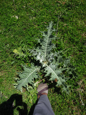
Just before climbing the hill to Pedraza I pulled off the side of the road for a pit stop. I almost stepped on this prickley looking devil. I have no idea what it is. Do you?
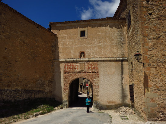
The entrance to the walled city of Pedraza.
The gate of the villa is the only access to Pedraza, and therefore is used as input and single output of the people. Its origins date back to the eleventh century, and was rebuilt in the sixteenth century Pedraza being lord of Iñigo Fernández de Velasco , whose shield dominates the entrance.
The gates are made of black poplar and for several centuries were closed at night to prevent the entry or exit of any person except emergency, in which case the jailer was responsible for opening the door.Source: WikiPedia
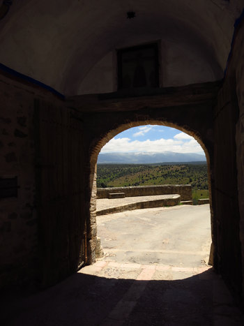
Looking back out through the gate to the snow capped mountains.
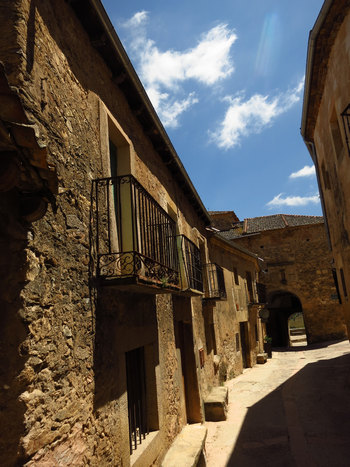
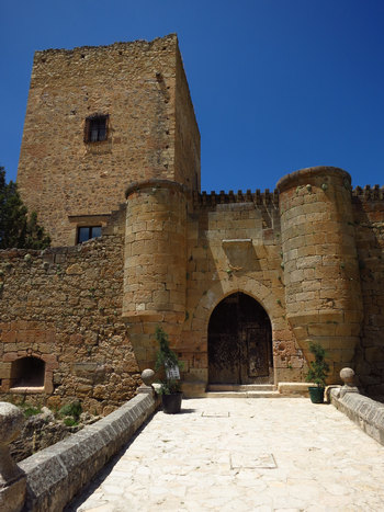
Castles, castles everywhere! All four of our stops today feature castles/fortresses. And that is on a loop around Segovia that is less than 150 miles in length. OK. Four stops, four castles, and then you have Segovia with the monumental Alcázar with it's looming Torre (tower) de Juan II shown below.

Torre (tower) de Juan II at the Alcázar in Segovia.
And, who was Juan II?
John II (Juan II) (1405-1454), king of Castile and León (1406-1454), succeeded to the throne when he was only a year old. His regency was well administered under his mother Catherine and his uncle Ferdinand I of Aragón until 1419.
His chief counselor was Don Alvaro de Luna, an accomplished administrator and diplomat who arranged an advantageous second marriage to a Portuguese princess in 1450 when John II's first wife died. John II's new wife resented de Luna's influence and had her husband execute de Luna in 1453. John II is reputed to have died of remorse for this treacherous act.Source: The University of Calgary
The above info started me thinking. If good old Juan was the king of Castile and León. Then, who was the king of Spain? And who built and inhabited all the other castles in the region? Indeed, the rest of Spain? Where did the King of Spain fit into all of this?
I posed this question to Professor Bruner and he got me educated on this little bit of Spanish history.
Let's start with 1492.
The much simplified version of Spanish history says that in that year --in addition to Columbus's voyage-- Spain became a unified country under Isabel of Castilla and Fernando of Aragón.
Before that time, Spain existed as a group of separate kingdoms (principalities, duchies, etc.), which over the years tended to merge into larger units. For example, Castilla started out as a "condado" (county) beside the kingdom of León and eventually grew in power to dominate the area, forming the Kingdom of Castilla y León (a few Leonesesare still angry about this!).
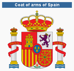
The Spanish coat of arms represents this varied history: you see the castle of Castilla, the lion of León, the red and yellow bars of Aragón and the chains of Navarra; at the bottom the pomegranate of Granada (granada = pomegranate) and in the middle are the fleurs-de-lis of the Bourbon dynasty (the family of Juan Carlos I).
Source: Dr. Jeffrey Bruner
So, there you have it. An explanation as to why the landscape seems peppered with hilltop fortresses and walled towns.
Now, back to Padraza.
But, wait! That's not all! See: A big collection of images about castles of Spain:
71,659 images of 3,168 castles and fortified places made by 420 photographers.
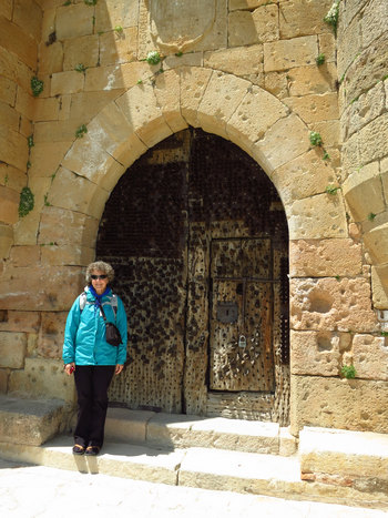
The entrance door to the fortress at Pedraza.
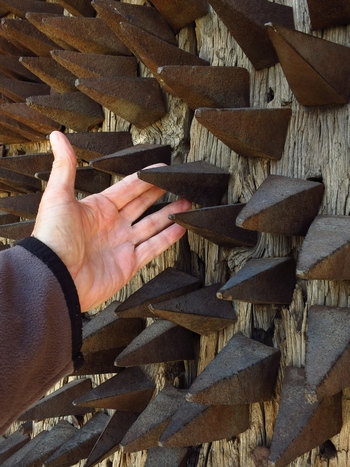
That is what I would call a heavily fortified door!
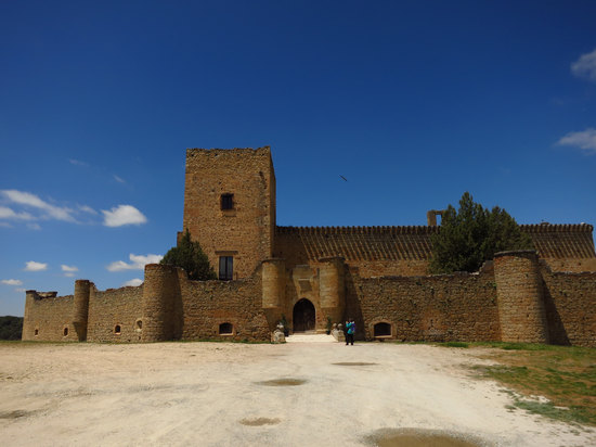
Most of the castles are so big and sprawling it is difficult to get a good photo.
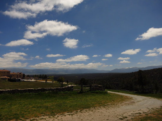
A view of the mountains from near the castle.
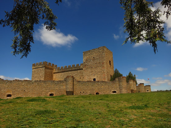
Like many other fortifications the castle at Pedraza is perched out on a rocky promontory.
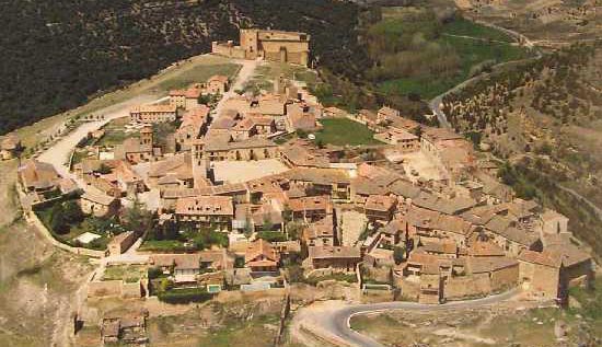
The aerial view from www.spainpourseniors.com clearly shows the strategic placemant of the fortress and walled city.
Pedraza Castle is a fortress built in the thirteenth century it was rebuilt in the fifteenth century by Garcia Herrera. In the early sixteenth century the Dukes of Frías , Constables of Castile, reformed the castle again, adding the great defensive wall attached to the keep and outer wall provided with gunboats and a drawbridge (now defunct). The castle has an impressive keep, moat, and surrounded on most of its perimeter by a precipice.
In this fortress were imprisoned two sons of King Francis I of France , Francis, Dauphin who died young and his younger brother who reigned as Henry II. They had been given by his father as hostages to the Emperor Carlos I of Spain. To release, the French king should fulfill the agreements of the Treaty of Madrid, in 1526, signed after the defeat of the army of Francis I at the Battle of Pavia, where he was taken prisoner. In the castle of Pedraza remained for two years, until March 1530, when by the Peace of the Ladies were returned to France.
Previously they had been in the castles of Villalba, Villalpando and Berlanga de Duero and a short period of rest in Castle. Like Pedraza, all these belong to the family strengths Fernandez de Velasco, Duke of Frias and Constables of Castile. The documentation of these events is preserved in the Archivo General de Simancas.In 1926, the painter Ignacio Zuloaga acquired the castle and restored him severely, installing a workshop there. The heirs of the painter adapted one of the towers for a public exhibition of the artist's work.
Source: WikiPedia via Google Translate
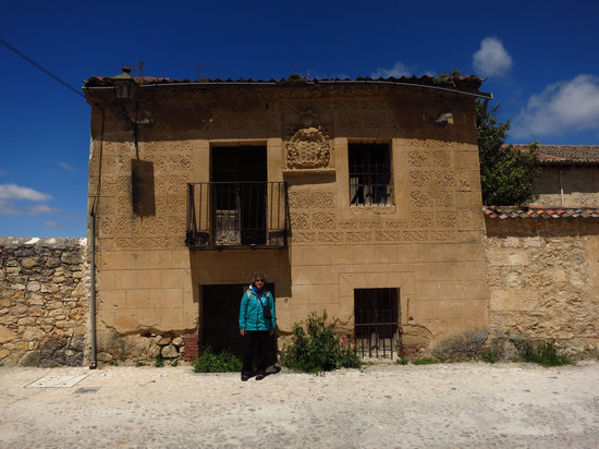
An abandoned residence showing what might be a coat of arms. The relief plaster work is Esgrafiado. AKA graffito or grafitti.
The graffito is a decorative technique that involves making incisions on the body of the object or wall, on the surface, so as to expose the bottom layer, which is of another color. Usually use templates for repeating geometric got. The graffito is applied on the plaster of a wall, on objects of pottery and in the Middle Ages on manuscripts in the illustrations in gold.
The term comes from Italian sgraffiare, ie, scoring or scraping with a special tool called graphite.Source: WikiPedia
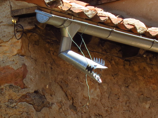
Decorative detail on one of the gutter down spouts.
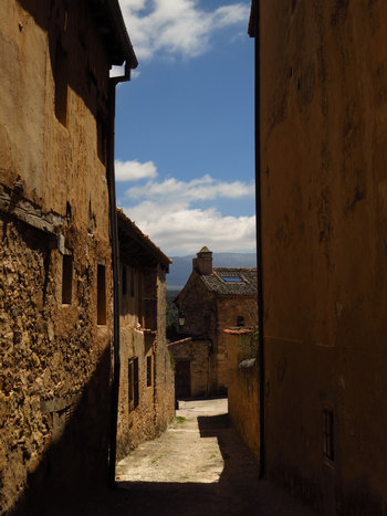
Although Pedraza is a tiny town, one could easily spend the day here wandering the narrow cobble streets and stopping occasionally for a rest with a caña or glass of vino.
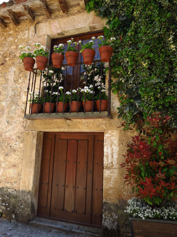
Most of the residences are well maintained. It is nice to see so many were saved from eventual ruin.
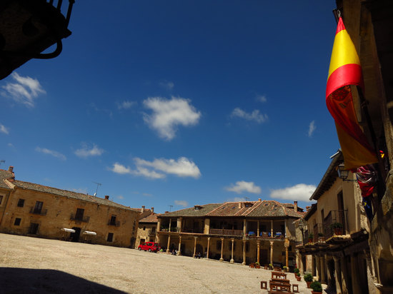
The Plaza Mayor at Pedraza. The Plaza Mayor of Pedraza is still used for a bullfighting festival once a year in September and when Jeff, Ana and I were here in 2010 it was set up for that event.
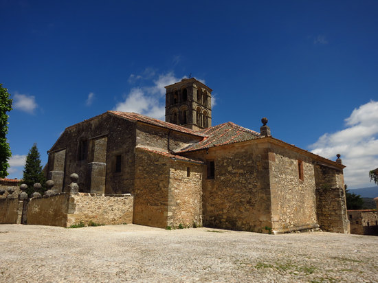
This is the Church of San Juan Bautista.
The Church of San Juan Bautista is located on the south side of the Plaza Mayor. It was a Romanesque church built in the 12th century. Most of the building was constructed in the 16th century. There were renovations in the 17th, 18th, and 19th centuries. Of interest in the church is a Romanesque baptismal font from the 13th century.
The base of the tower has the Green Balcony, constructed by Juan Perez de la Torre to see the bullfights that took place in the plaza. Its tower can be seen from any place in the town. The church has some sculptures from the 17th century. The interior of the church is very Baroque due to the renovations.
Source: © 2013 TripAdvisor LLC
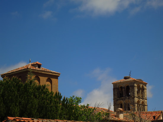
See the two Stork nests on the right? Only the one in the middle of the roof was active. Now that we were down out of the mountains we were once again seeing the storks in every small town we went through.
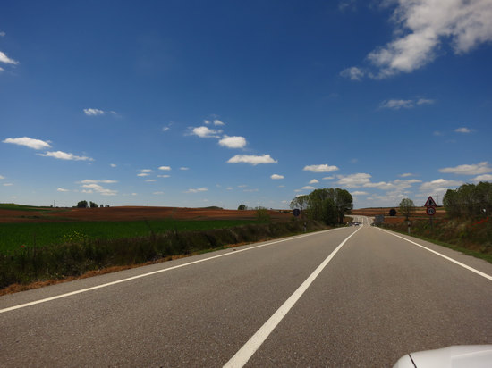
We departed Pedraza and drove west towards our next stop: Turégano.

Here is the route map for our Road Trip. Click on the map to get more details.
Part 3: Pedraza to Turégano
After leaving Pedraza we went through a number of small villages including La Velilla, Pajares de Pedraza (pop. 18), Rebollo (pop. 126), Puebla de Pedraza (pop. 91), Veganzones (pop.300) and finally, Turégano (pop. 1200).
Fortunately every little town had prominent directional signs which greatly aided in our navigation.
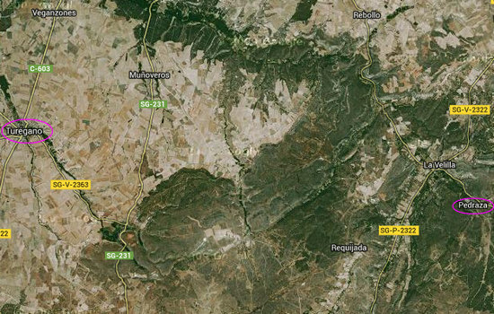
As you can see, the area between Pedraza and Turégano is dominated by agricultural use. We saw cattle ranches as well as cereal and forage crops. I would assume all those little tiny towns are heavily dependant on agriculture.
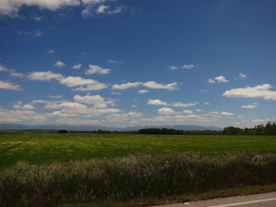
Cereal? Forage? I had no way to tell.
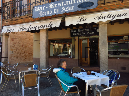
We made it! Now in Turégano we decided to get a bite to eat before going on to the main event. Sounds simple, right? HA!
When Jeff and I were here in 2010 it was simple. Jeff speaks fluent Spanish and has a very thorough knowledge of the cuisine. So of course he ordered and I ate.
But this time we were on our own. When the waitress came out with the "menu" she showed us a short piece of recycled card stock with a bunch of hand written items on it. Hmmm... now what?
First we tried English. No luck. Then we looked over the items again. The woman kept talking earnestly to us and was no doubt explaining every item to us. In Spanish of course. When we indicated we did not have any idea what she was talking about, she tried harder. It was as if she thought the more pointed and thorough she was in her explanation it would somehow sink in and we would then understand.
After a while it seemed pointless, so Betsy and I looked at the hand written items one more time and then pointed to what we wanted. Betsy saw the word "pollo" and knew this meant chicken so she ordered that item. I recognized the word "sopa" as soup and so ordered that item.
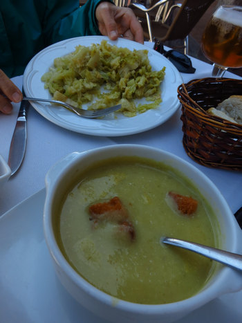
Well, here is what we ended up with. I got some kind of soup and Betsy got a plate full of cooked cabbage. At least we knew how to order beer!
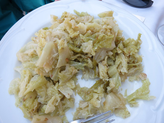
So, how did Betsy end up with cabbage? It turns out the menu item said "repolla". That is Spanish for cabbage. What a difference two letters can make!
Shortly there after, the bar maid came out with her phone and showed it to us. It said, in English: "We have second course" or something like that. So, it appeared the hand written menu was the list of first course items they had that day.
Later on we were brought the "real" menus. When we opened them up we just looked at each other and started to laugh. It was hopeless. So, rather than end up with a plateful of fried pig ears and jellied tripe we indicated we did not want to order anything else. Oh, well...
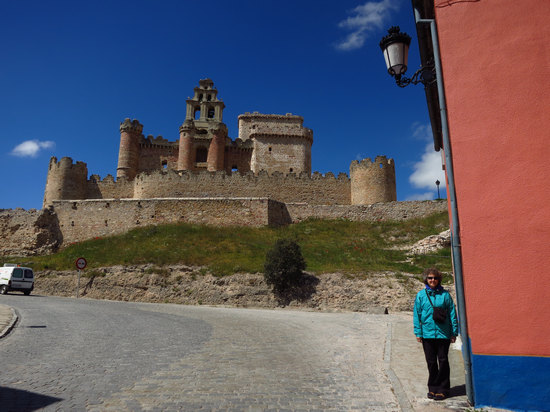
After paying the bill we headed up the hill to the old fortress and church.
The castle of Turégano, symbol of the village, dates back to times Celtiberians. One of the peculiarities of this castle is that the Church of San Miguel is built into its construction. In 1585 he was imprisoned in this castle Antonio Pérez, secretary of the king Felipe II. Their supporters were plotting his escape, and to do this were established in the nearby town of Munoveros. These gained access to the castle, but the cleverness of the warden convinced them to desist from this attempt.
It was declared a historic-artistic site in 1931.Source: WikiPedia via Google Translate
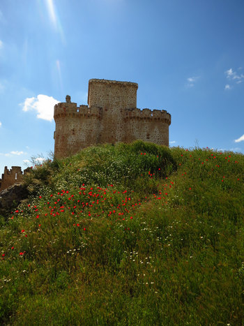
The site of the castle was known to be occupied by a Roman fort but there appear to be no remains above the ground of this structure. The castle today reveals an inner curtain wall inside which is the main structure of the complex including church/keep combination. This inner curtain has a show façade facing the town. From the Plaza Mayor (town square) the castle appears aligned with the main street and dominates the town.
Source: Peter A Burton, 2013
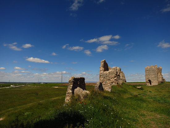
Around the castle on the other three sides facing outward to the field is an outer curtain of an earlier construction. This outer wall is much ruined and constructed of tapial (mud/rubble cement) with stone-faced square section interval towers.
The outer curtain is typically Islamic construction and dating from the Islamic occupation of the region and no later than the mid 11th century when the Christian reconquest reached this area. There is a deep ditch surrounding the outer enclosure on all sides adding extra defensive strength to this original Islamic enclosure castle.
Source: Peter A Burton, 2013
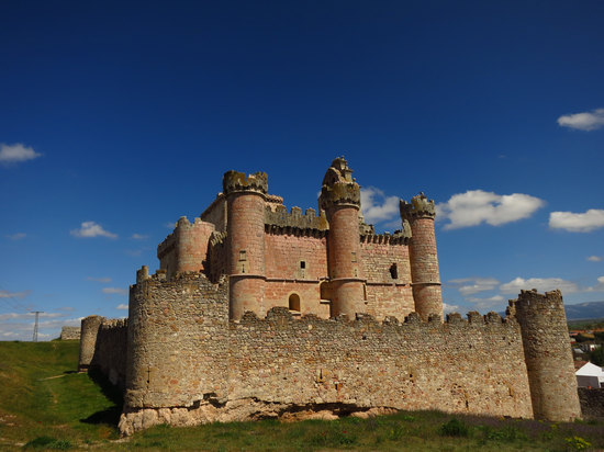
On top of the far right tower, barely visible in this photo, is a Stork sitting on its nest.
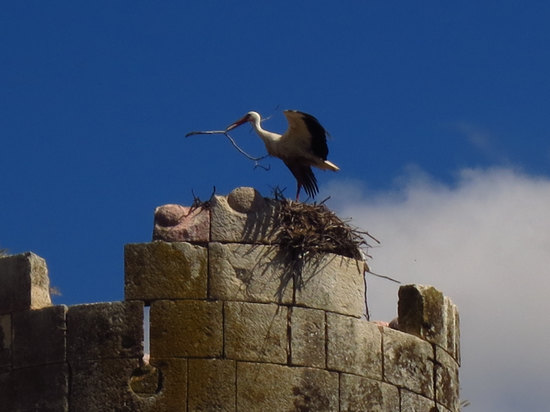
Shortly after this, the stork flew off with the branch in its mouth. This leads me to belive it was salvaging material to build a new nest at another location.
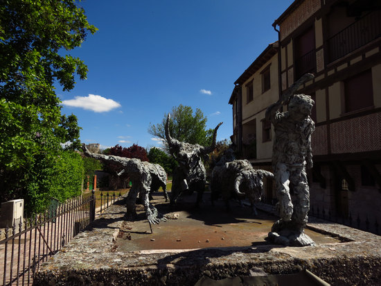
As we walked back down to the car we passed this sculpture of "The Running of the Bulls". The shot does not do it justice. It really conveyed a sense of movement and urgency.
Once back to the car we check the road map again and were soon on to our last stop - yet another Castle. This one is at Coca and it amazed us both!

Here is the route map for our Road Trip. Click on the map to get more details.
Part 4: Turégano to Coca and back to Segovia
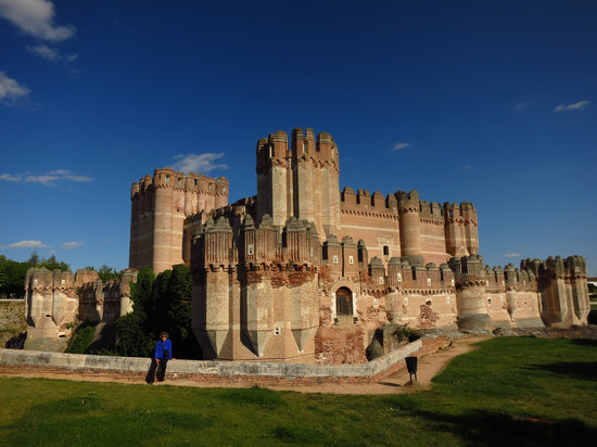
A mere 32 miles to the east of Turégano sits the Castillo de Coca. For this one day road trip Coca surely fits in the "last but not least" category.
It was built on the site of ancient Cauca, the birthplace of the Roman emperor Theodosius, and was populated by the Arevaca in the 2nd century BC.
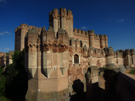
This shot is from the backside of the Castle. I took no shots from the front since I would have been shooting directly into the sun.
Fortunately, good old WikiPedia came through with one.
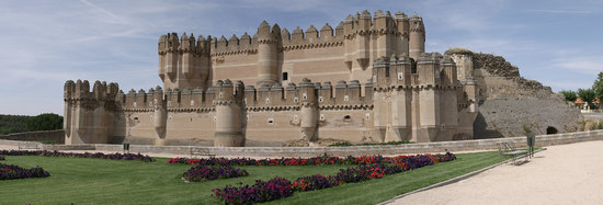
The architects and engineers of the day did an amazing job!
Its construction, attributed to the builders Seville, took place in the fifteenth century mainly in brick, used not only as material for work, but also as a decorative element, the limestone appears in the loopholes, patio columns weapons and other decorative elements.
Source: WikiPedia via Google Translate
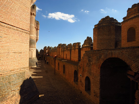
The castle entrance was open and we walked right in and circled the interior wall.

The wall had a cat walk which led to various openings in the wall. These had short, sometimes spiral staircases which then led to tiny rooms with openings. From these openings one could see in three different directions and thus easily target an intruder. There were many of these stairways and openings along the perimeter wall to insure no intruder would go unseen and unchallenged.
The engineering and masonry skills for just these tapering "loopholes" were, to me, simply amazing.
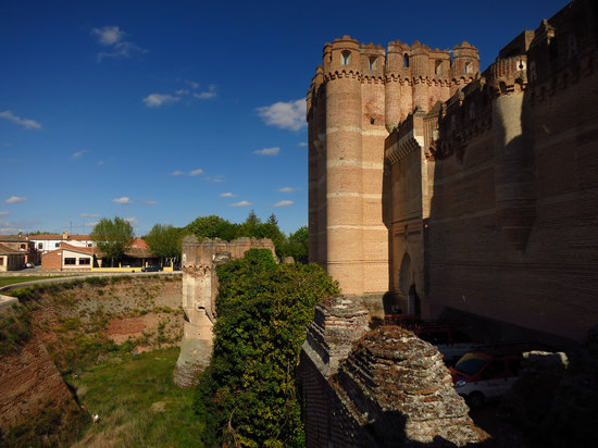
As you can see, Coca has a wide and deep moat. Think about trying to mount an attack on such a place. Here you are swimming your way across a moat filled with sewage, offal, the dead and wounded bodies of your comrades and god knows what all. And all the while arrows are raining down upon you. What fun...
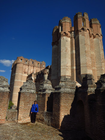
It was built by the Archbishop of Seville and Don Alonso de Fonseca, lord of Coca and Alaejos. During the Revolt of the Comuneros, (when Castile rebelled against the king), it remained faithful to Charles V.
It is a mixture of western and Moorish military architecture, as can be seen from its decoration. It has a square ground plan, a moat and two walled enclosures, which gives it the air of impregnability for which it has been known over the centuries. The keep is located in the second area. It is made of brick and its walls are profusely decorated. The interior is very luxurious and lavish, and conserves its Mudejar decoration. Due to its great splendour, it was used more as a palace than as a fortress. It is one of the crowning works of the military Mudejar style.
Source: Turespaña / Segittur © 2013
Here you can see an entrance door to the backside of the castle. The bridge across the moat is now long gone.
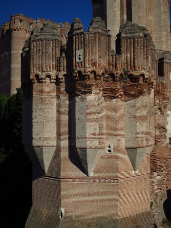
Check out the arrow slots (loopholes) which are shaped like a cross. "Kill'em all! Let god sort'em out..."
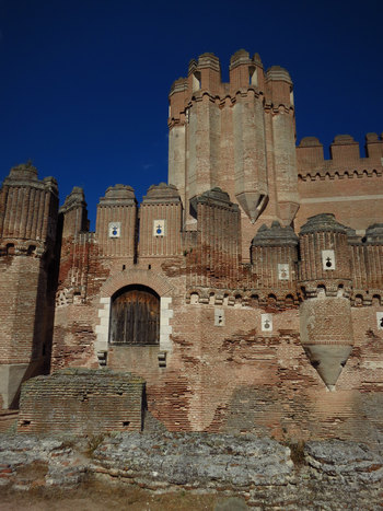
Lots of loopholes.
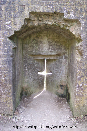
An arrow slit (often also referred to as an arrow loop or loop hole, and sometimes a balistraria) is a thin vertical aperture in a fortification through which an archer can launch arrows.
The interior walls behind an arrow loop are often cut away at an oblique angle so that the archer has a wide field of view and field of fire. Arrow slits come in a remarkable variety. A common and recognizable form is the cross. The thin vertical aperture permits the archer large degrees of freedom to vary the elevation and direction of his bowshot but makes it difficult for attackers to harm the archer since there is only a small target to aim at.
Balistraria can often be found in the curtain walls of medieval battlements beneath the crenellations.
Source: WikiPedia
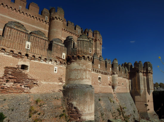
I would sure like to know how many bricks were used and where they were made.
By now it was approaching 6:30 and we had to get the car back to Segovia by 8:00. Segovia was just 30 miles down the road so we made it there in time with no problem.
We checked in the car and started the walk back to the Hotel La Casa Mudéjar.
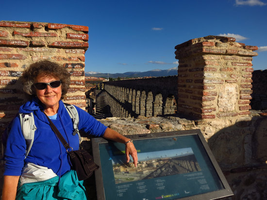
Although beat, I cajoled Betsy into a slight detour so I could get this shot.
This should have been the end of our very busy day. But, it was not. Just a few blocks away from the Hotel La Casa I realized I was wearing my sun glasses. This meant my other glasses were back at the rental car. Great. I checked the time. I had 15 minutes before the EuroCar closed and it would not reopen before we left for Madrid the next morning. I gave Betsy my back pack and asked that she go to the market for some grub - we were both famished - after she went back to the motel. Then, at a jog I rushed down busy and crowded Calle de Juan Bravo, across the Plaza del Azoguejo and then down Avenue la via Roma. I got there with only minutes to spare. Whew!
Glasses retrieved I then walked back to the Hotel La Casa Mudéjar. But when I got to the room - no Betsy. Hmmm... I knew she probably did not get lost getting back to the hotel, but I thought she might have had trouble finding the market.
After about 15 minutes of pacing back and forth in the room worrying, the phone rang - it was Betsy. She was down in the lobby and said she could not find the market. I rushed down, grabbed her hand and we walked the short distnce to the market for jamon, pan, cheese and Cervesa. DAMN! did that beer ever taste good!
What a day...
We had a quiet evening, our last one, on the terrace enjoying our frugal dinner. Tomorrow we would pack up and catch the 9AM bus to Madrid. And then it would be farewell to Segovia.
But, this trip is not over yet!
Stay tuned....
