Day 17: Sunday, June 27th
Slept in until nearly 7:00 today. A late start for the likes of me.
There were on and off showers overnight and this AM was cloudy with a light breeze and about 64 degrees.
Betsy was still snoozing so I decided to take my coffee for a walk around the campground and picnic area. My calves, which had been screaming by the end of yesterday's hike felt OK now. I had never had calves that sore from hiking and all I can attribute it to was not being used to hiking in Chacos. My feet were a bit tired from the hilly 8 mile hike we had done the day before, but they were not sore. A good sign!
Click on the photos below for a larger image.
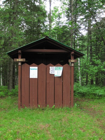
Our previous campsite at East Lake in the Hiawatha NF had no out-house. The one here at Robbins Pond did and even had separate stalls for men and women. Quite the luxury!
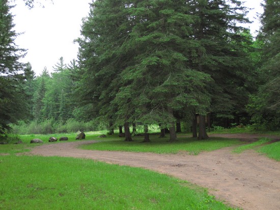
Below the bluff of the campground and next to the impoundment was the picnic site. It had no picnic table and no grill but I noticed more than one condom wrapper in the parking area. This must be the Yooper equivalent of a Lovers Lane.
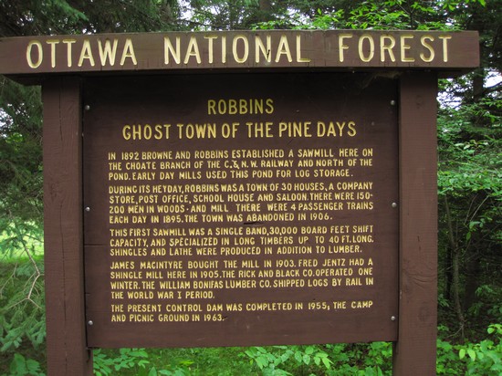
A little history on how Robbins Pond came to be.
It seems Mr Robbins was a busy fellow and there is a good bit of info about him at Men of the 3rd Michigan Infantry.
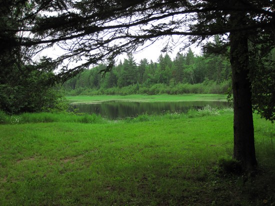
The pond is slowly becoming a wetland - there is little open water left.

Along the road at the outflow of the pond I noticed this Cow Parsnip (Heracleum maximum) in bloom. The water was brownish from tannin, but crystal clear.
I wandered back up to the campground to find Betsy sipping her tea and working on her journal. After tending to our site we packed up and headed to Bergland at about 8:30. The plan was to breakfast at Antonio's and then take the road we had come to know oh so well up to the Porkies and hike the Escarpment trail. I had decided cooking breakfast at the campsite for just the two of us was not worth the effort so when we were camping we would pack lunches, cook dinner and have breakfast out if possible.
This is a look down
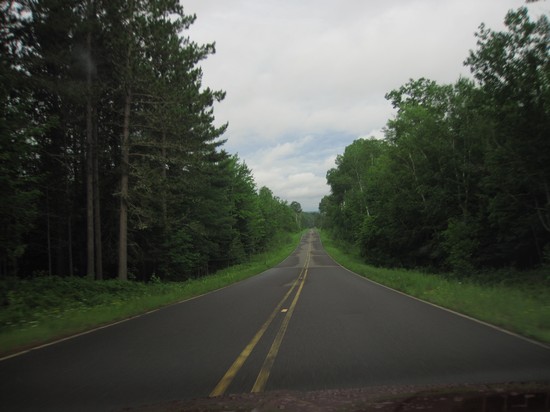
Sleepy Hollow Road which is the closest paved road to Robbins Pond.
The promising patch of blue sky eventually disappeared and remained cloudy until late afternoon.
At Antonio's Betsy and I both had the "Mini breakfast": one egg, hash browns, 2 sausage or bacon and two pieces of toast for $3.99.

On the way out I noticed these two items posted in the entryway of Antonio's. "Popple" is local vernacular for poplar which is the common name for Trembling and Big Tooth Aspen which are both in the genus Populus. Now you know.
A letter home.
After we left Antonio's we headed up to the visitors' center at
Porcupine Mountains Wilderness State Park to get the hiking info we needed.
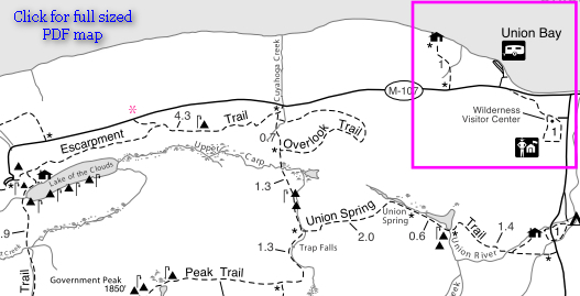
We had originally planned to hike the Escarpment Trail in it's entirety, but, we were both dragging a bit from the previous day's hike and we both felt the 6 miles out and back was a bit more than we wanted to do.
When we got to the visitors' center there was a women at a picnic table using a laptop just outside the entrance. I inquired as to whether she was getting a WiFi signal and she confirmed she was. This might prove to be handy at some point.
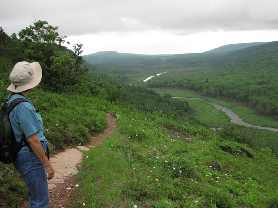
So we found the spur trail which would allow us to hike just a portion of the Escarpment trail. It was accessed off SR 107 about 4 miles from the visitors' center.
 This area looked familiar and I was sure it was near here I found some nice plants of the
Fragrant cliff fern (Dryopteris fragrans).
This area looked familiar and I was sure it was near here I found some nice plants of the
Fragrant cliff fern (Dryopteris fragrans).
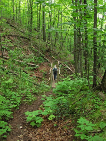
The trail immediately started with a stiff up hill climb and both of us did a little groaning.
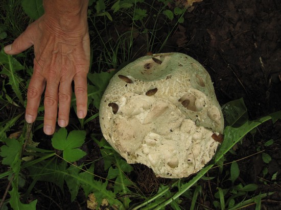
I had walked right by this big puffball and Betsy called my attention to it. Check out all the slugs feeding on it.
It was warm and muggy and I hated having to "suit up" in long pants and long sleeved shirt. But the price for not doing so would be to either be saturated in DEET or put up with lots of mosquito bites. No thanks.
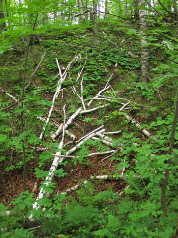
I thought this fallen Paper Birch made an interesting pattern.
We made our way slowly up the trail. Both of us were hot and sweaty.
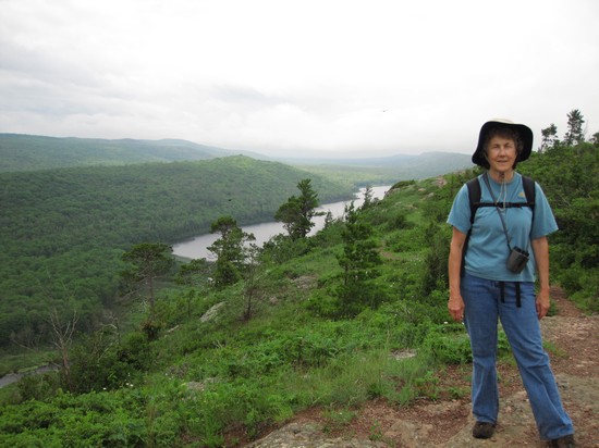
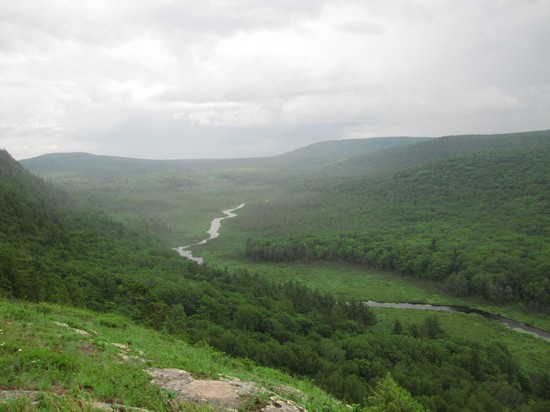
"Then we came out on the first escarpment.
Ah - the breeze - Ah - the view!" Betsy's journal.
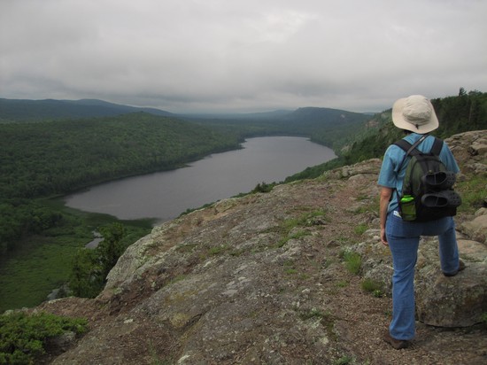
This is Lake of the Clouds and very appropriately named it is.
Once again I found myself wishing for a blue sky and those big puffy clouds.
Back in the 80s, when Betsy and I were a tad younger, we hiked down into this area. The forest was beautiful but the hordes of mosquitoes drove us out.
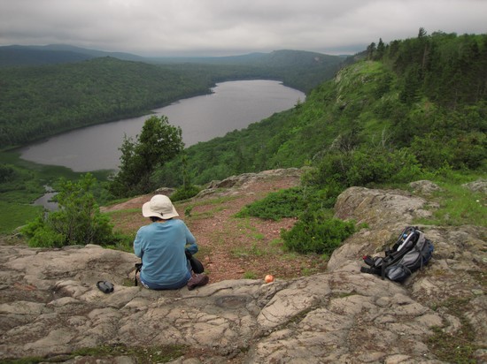
Another gorgeous lunch spot.
"This whole area of mountains, moraines and glacial lake plains westward to beyond the Black River, is a vast hardwood forest containing the most extensive primeval tracts remaining on the continent".
Deciduous Forests of Eastern North America ~Lucy Braun, Ph.D.
An amazing place, to say the least.
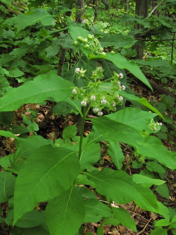
On our way back down the trail I took this blurry snapshot the Poke-leaved Milkweed (Asclepias exaltata).
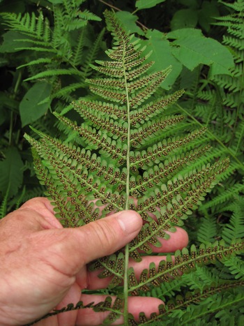
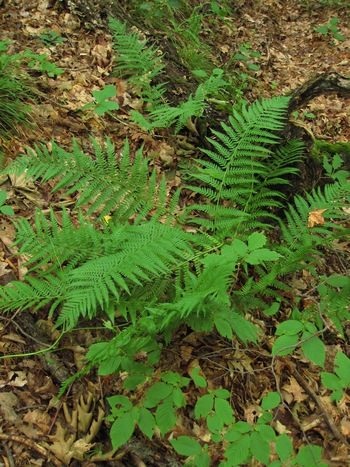
On yesterday's hike we had seen the Male Fern and I took a few snaps. Here are some better photos.
The male fern is one of the most powerful medications for tapeworm ever documented in the records of medicine. Normally this useful herb grows up to two to four feet in height and bears insipid green leaves also known as fronds. These fronds are narrow and tasseled and grow closely packed all the way up to the fleshy stem. On the underside of the fronds, there are two rows of dark brown spores. The rhizome or tuber of the male fern is reddish brown in color and is usually small, bulky and scaled.
Source: herbs2000.com
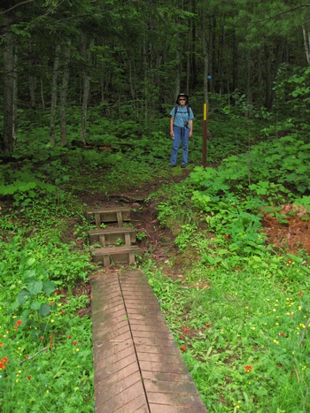
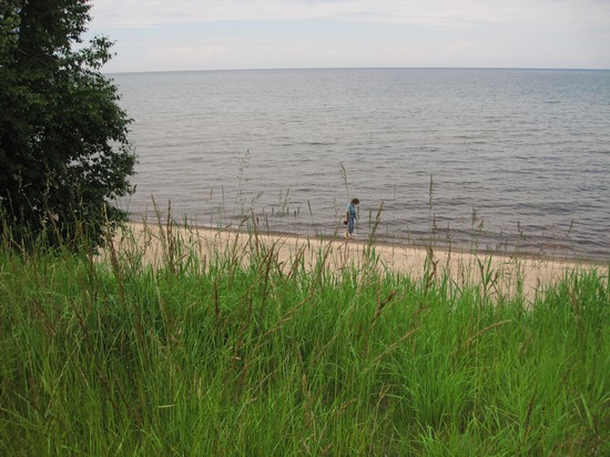
By the time we reached this bridge we were almost back to the car. Already, Betsy was thinking about the sandy beaches and cool waters of Lake Superior we had seen on the drive here to the hike.
As we descended down to lake level I watched the thermometer tick away the degrees: 75 - 74 - 73 - 72...
By the time we reached the beach it was a refreshing 63 degrees!
While Betsy walked the beach and collected touchstones I walked across the road for some non nature pictures.
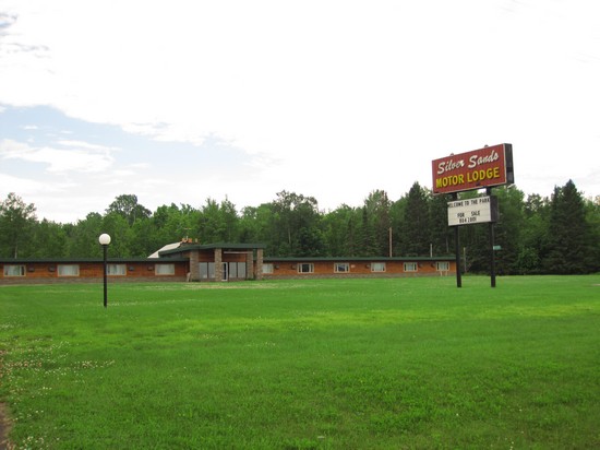
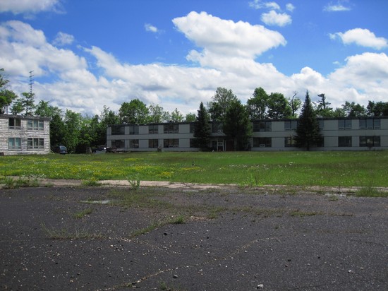
This nice motel, complete with resteraunt, gas station and convenience store was closed and up for sale.
The nearly perfect location, directly across from beach access and directly adjacent to one of the most popular spots in the UP makes one wonder about the state of tourism here.
It was now about 3:30 and we headed south towards camp and made a few stops along the way.
About 4:30 we started seeing some blue sky. Finally!
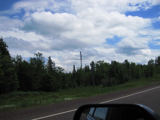
First stop was to be the now nearly defunct town of White Pine. Here you can see the stack from the White Pine Copper Refinery.
ONTONAGON -- The White Pine Copper Refinery in Ontonagon County will be closing down within one year. That announcement was made by the refinery's owner, HudBay Minerals.
It means that 65 employees of the refinery will lose their jobs, although the company says it will work with them to mitigate the impact of the closure.
The refinery was closed because the Flin Flon Smelter in Manitoba, which sends copper anodes to White Pine for refining, is also shutting down.
HudBay said the reasons for the closures are that today's business realities just make it impractical to keep them open. Posted: 06.19.2009 at 5:04 PM
See also:
"HudBay Minerals Announces Intention to Acquire White Pine Copper Refinery"
Business Wire, Oct 11, 2005
The White Pine Copper Refinery was originally built to process copper ore from the White Pine Mine which closed in 1995.
The White Pine mine that made all this possible differed dramatically from all the many other U.P. copper mines. Instead of deep shafts leading to many lateral excavations, the White Pine mine was one enormous cavity, growing to four square miles in size, sloping downward from 800 to 2,800 feet below ground.
The mine was closed after the Michigan United Conservation Club led a suit to upgrade the smelter, whose smoke plume contained toxic mercury. The mining operation left considerable environmental problems in its wake. The huge underground cavern has gradually been filling with brine, which eventually would severely pollute Lake Superior if left unchecked.
Prodded by Michigan's Department of Environmental Quality, the mine's owner has been filling the mine with Lake Superior water to suppress the brine water.Another severe problem has been the powdery tailings deposited northwest of the mine after copper extraction. Wind blew these tailings into the air, at some times engulfing White Pine itself.
To subdue this noxious phenomenon, the Mineral River was diverted to inundate the 6,000 acres of tailings deposits northeast of town. The giant pond is gradually being replaced by planted vegetation.
There is lots of info about the environmental damage and subsequent restoration at the Montana State University Bozeman's Ecosystem Restoration Website.
History of Site: The White Pine Mine is owned and operated by the Copper Range Company, a subsidiary of Inmet Mining Corporation. It is located in Ontanogan County, Michigan along the shores of Lake Superior in a region known as the Upper Peninsula of Michigan. The project was in operation for over 70 years and is currently in the process of site wide closure. The project consists of an underground copper mine, processing facilities, and approximately 2,630 ha (6,500 ac) of tailings.
The tailings are impounded in three separate facilities: the South Dam; North Pond 1; and North Pond 2. The South Dam was not filled to capacity, and was closed and stabilized by dozing the surrounding remaining embankment clays onto the tailings surface, and revegetating using standard agricultural means. The North Pond 1 and 2 tailings facilities, which total approximately 2,023 ha (5,000 ac), are being stabilized from wind and water erosion by direct revegetation of the tailings themselves.
Previous attempts to establish vegetation on the tailings were initially successful, but after two to three years a dieback of vegetation occurred, and ultimately failure. The sand blasting effect of the blown tailings, burial by the moving dunes of tailings, the physical nature of the tailings, and possibly chemical or nutrient imbalances, were all suspected of causing the failure. The tailings have remained relatively barren for over 20 years.
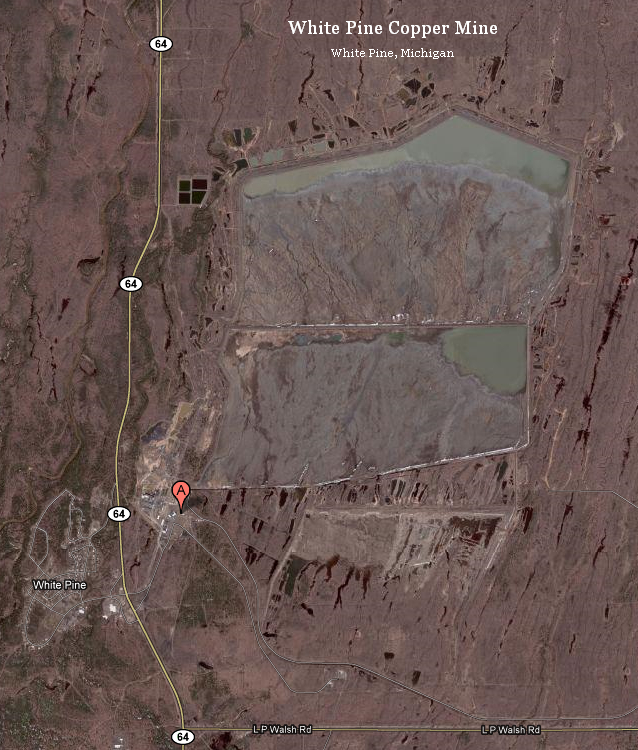
Source: © Google Maps

We drove around and looked at some of the ruins of White Pine.
I have no idea what this place was.

We came through White Pine on our 80s trip. We saw a sign on the road which pointed to "White Pine Mall. What we saw then was a large steel structure which had been partionioned into sales stalls.
One of the stalls was selling collectibles and I found the 8" plate above. I bought two of them for next to nothing.


Makers mark on back.
The same guy also had a bunch of old glass quart milk bottles with "Ontanogan Dairy" in raised letters. To this day I regret not buying any of them.
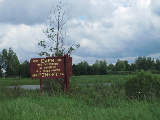
To get back to our campsite we had to go though the small town of Ewen.
Boom and bust in just 20 years.

Even though they cut down all the trees decades ago they still boast about the lumbering heritage.
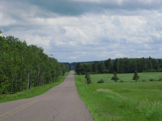
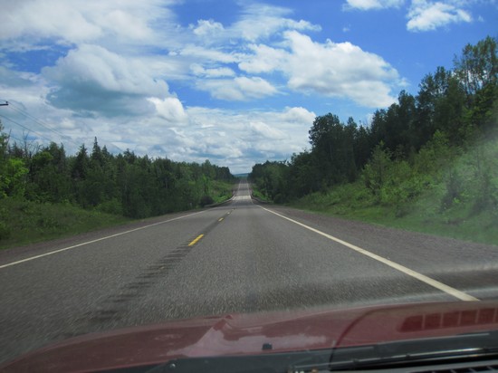
Here we are back on good old Choate Road. I could not resist taking some more snaps.
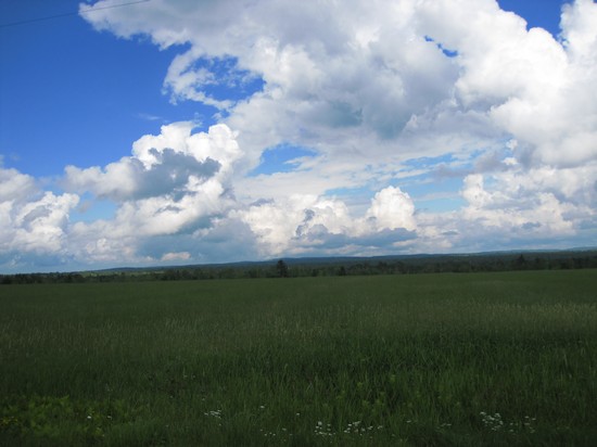
I sure wish the sky had looked like this up at Lake of the Clouds!

We stopped at the Bobolink locale from the previous day and they were still very active and vocal.
We also saw a Purple Martin near here which was a new bird for the trip.
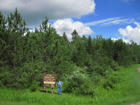
Sunny and warm equals a skinny-dip at Steusser Lake - our last one.
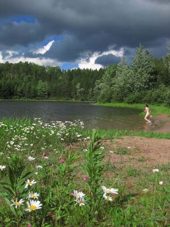
Ready, set, GO!
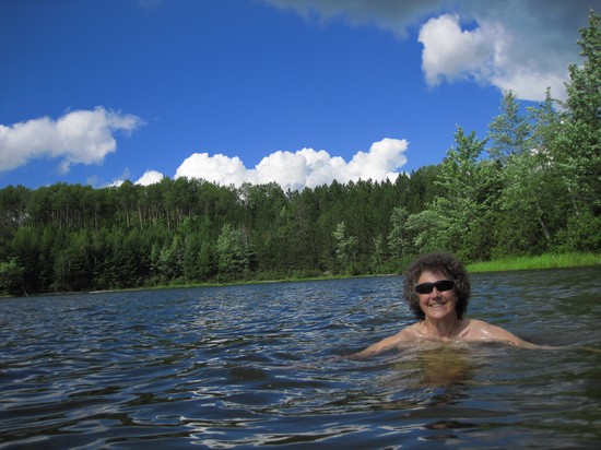
Ahhh... no more hot and sweaty now!
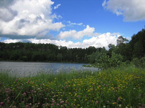
What a great spot and only minutes away from Robbins Pond Campground.

After our cool, refreshing dip we headed back to the campsite with a short detour down a road which looked like it might go to a river.
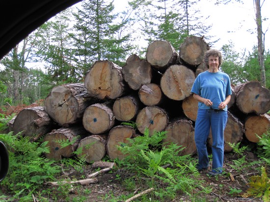
We drove until the road got narrow and soft and saw nothing but a timber operation.
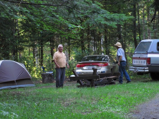
When we got back to the campground around 8:30 someone had moved into site No 3 and Keith, our neighbor in No 2 had just drug a picnic table over to site 3 using his pick up and a chain. I went over and helped them set it up right and move it into place.
I noticed the guy had two bumper stickers on his car. One read: "Veteran's for Bush". Fine.
The other one read "Drill here, Drill now, Pay LESS!". You have got to be kidding...
I also noticed he had his tent set up with all the screens wide open. I was going to say something to him about the skeeters. But, remembering the "Drill here..." bumper sticker I thought: "The hell with it, let the skeeters drill HIM!".
After that it was time for dinner. Betsy made here usual delicious salad and I started to boil water for the spaghetti.
Right in the middle of our dinner Keith came over and asked about out day and then launched into a multitude of stories about his 3 ex wives, travelling all over Europe, working in South America, and an incident with a cougar when he was a teenager. He was quite entertaining and a very interesting fellow who had obviously had an unconventional life.
By the time Keith wrapped things up our spaghetti was barely warm, but, no matter. It was still quite tasty.